Thickthorn Wood

Wood, Forest in Dorset

England

Thickthorn Wood

Track to Goldfield's Farm
Track to Goldfield's Farm Credit: Helen Steed

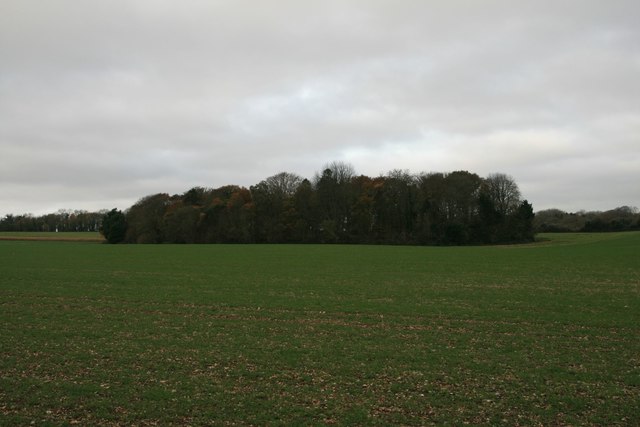
Thickthorn Wood is a picturesque forest located in the county of Dorset, England. It is situated in the southern part of the county, near the village of Thickthorn. Covering an area of approximately 100 hectares, this woodland is known for its natural beauty and diverse wildlife.

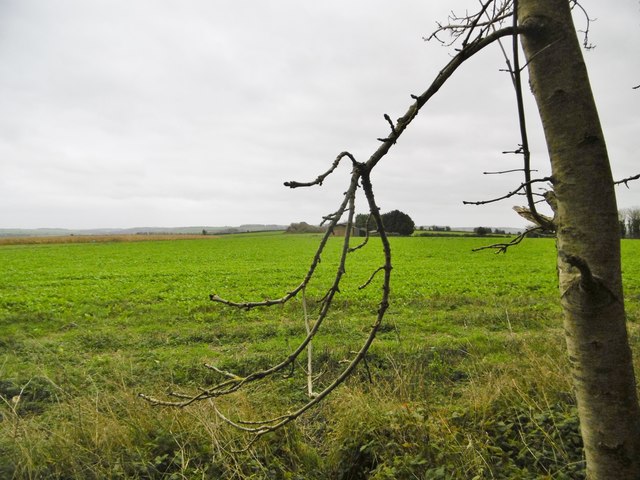
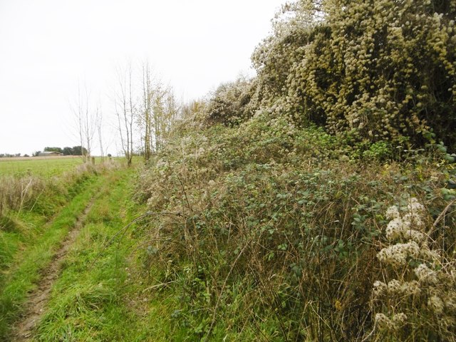
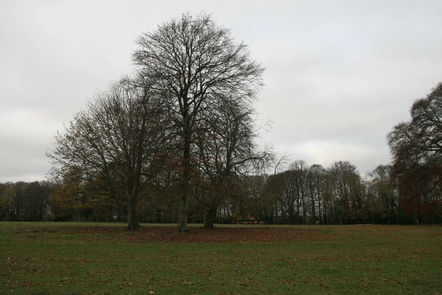
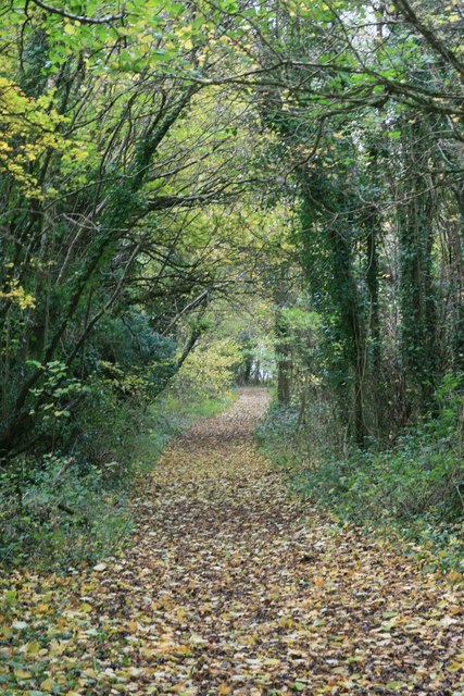
The wood is primarily composed of deciduous trees, including oak, beech, and ash. These trees provide a stunning display of foliage during the autumn season, attracting visitors from near and far. The forest floor is adorned with a carpet of wildflowers and ferns, creating a vibrant and enchanting atmosphere.

Thickthorn Wood is a haven for nature enthusiasts and wildlife lovers. It is home to a variety of animal species, including deer, badgers, foxes, and numerous bird species. Birdwatchers often visit the wood to catch a glimpse of the elusive nightingales and woodpeckers that inhabit the area.

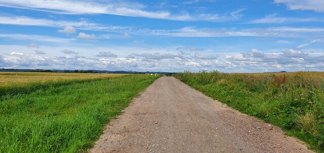
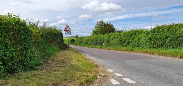
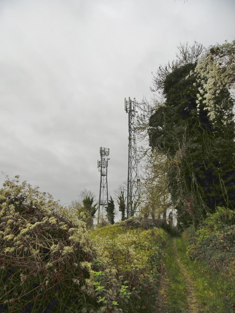
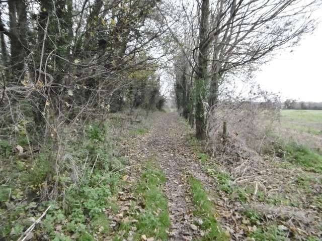
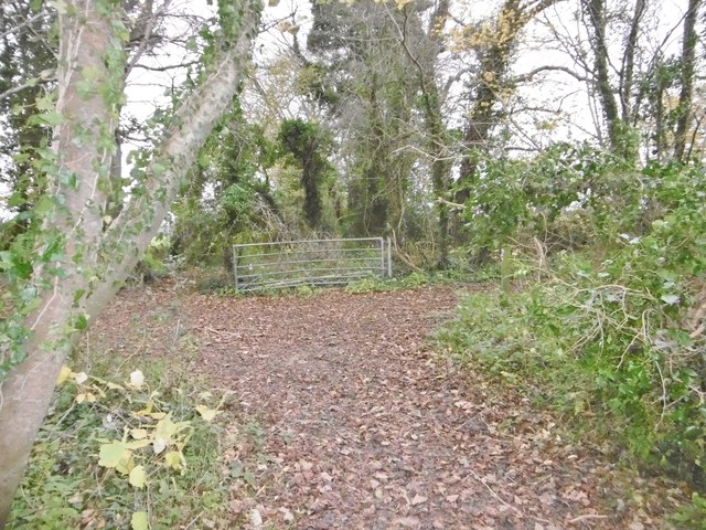
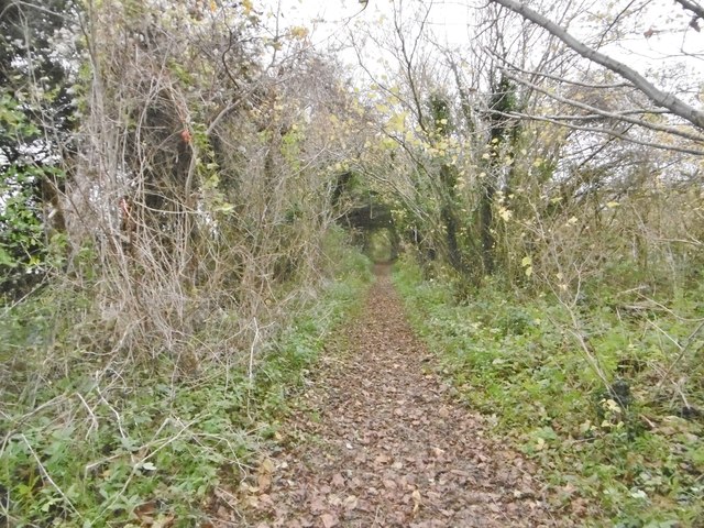
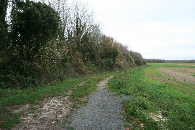
The wood offers a range of walking trails and paths, allowing visitors to explore its natural wonders at their own pace. Along these trails, there are several picnic spots and benches where visitors can rest and enjoy the tranquil surroundings. The forest also features a small stream that adds to its charm and provides a habitat for aquatic creatures.

Thickthorn Wood is not only a place of natural beauty but also holds historical significance. It is believed that the wood has been in existence for centuries and was once part of an ancient hunting ground. Today, it continues to be a cherished natural treasure, offering a peaceful retreat for all who venture into its leafy depths.

If you have any feedback on the listing, please let us know in the comments section below.

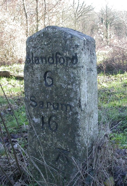
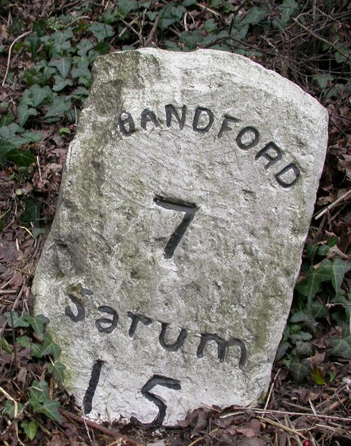
Thickthorn Wood Images

Images are sourced within 2km of 50.910485/-2.0592035 or Grid Reference ST9512. Thanks to Geograph Open Source API. All images are credited.

Track to Goldfield's Farm
Road junction on Miller's Lane
The lane to Chettle off the A354
Castleman Hotel, Chettle The Castleman Hotel was originally Chettle Lodge, the dower house for the surrounding estate. Since 1846 the estate has been owned by the Castleman-Bourke family.
Castleman Hotel, Chettle
The Castleman Hotel was originally Chettle Lodge, the dower house for the surrounding estate. Since 1846 the estate has been owned by the Castleman-Bourke family.
Tarrant Hinton, masts Seen from the byway from Little Wood. NGR refers to the nearer mast.
Tarrant Hinton, masts
Seen from the byway from Little Wood. NGR refers to the nearer mast.
Tarrant Hinton, brassicas Oil-seed rape (?).
Tarrant Hinton, brassicas
Oil-seed rape (?).
Tarrant Hinton, byway Open to all traffic; towards Little Wood.
Tarrant Hinton, byway
Open to all traffic; towards Little Wood.
Tarrant Hinton, seedheads Traveller's Joy seedheads (Clematis vitalba), sprawling over an ash tree and scrub, on the byway to the village.
Tarrant Hinton, seedheads
Traveller's Joy seedheads (Clematis vitalba), sprawling over an ash tree and scrub, on the byway to the village.
Tarrant Hinton, byway junction Coming from Tarrant Gunville; left, to Chettle; right, to Tarrant Hinton.
Tarrant Hinton, byway junction
Coming from Tarrant Gunville; left, to Chettle; right, to Tarrant Hinton.
Tarrant Gunville, bridleway From <a href="https://www.geograph.org.uk/photo/4758077">ST9412 : Tarrant Hinton, byway junction</a> to the village. The bridleway also forms part of the Jubilee Trail, and is on the boundary of Tarrant Gunville and Chettle Parishes.
Tarrant Gunville, bridleway
From ST9412 : Tarrant Hinton, byway junction to the village. The bridleway also forms part of the Jubilee Trail, and is on the boundary of Tarrant Gunville and Chettle Parishes.
The Park, Chettle
The Park, Chettle
Church of St Mary, Chettle
Byway through Little Wood, Chettle
Footpath at North Tarrant Hinton Down
Ninety-nine Plantation, near Pimperne
Old Milestone by the A354, north east of Tarrant Hinton Carved stone post by the A354, in parish of TARRANT HINTON (NORTH DORSET District), North East of Tarrant Hinton, 3m back from road near top of hill, on South side of road. Dorset 1 (limestone), erected by the Harnham, Blandford & Dorchester turnpike trust in the 19th century. 

Inscription reads:-
Blandford
5
Sarum
17  

Grade II Listed. List Entry Number:1118495
<span class="nowrap"><a title="https://historicengland.org.uk/listing/the-list/list-entry/1118495" rel="nofollow ugc noopener" href="https://historicengland.org.uk/listing/the-list/list-entry/1118495">Link</a><img style="margin-left:2px;" alt="External link" title="External link - shift click to open in new window" src="https://s1.geograph.org.uk/img/external.png" width="10" height="10"/></span>

Milestone Society National ID: DO_BFSA05
Old Milestone by the A354, north east of Tarrant Hinton
Carved stone post by the A354, in parish of TARRANT HINTON (NORTH DORSET District), North East of Tarrant Hinton, 3m back from road near top of hill, on South side of road. Dorset 1 (limestone), erected by the Harnham, Blandford & Dorchester turnpike trust in the 19th century. Inscription reads:- Blandford 5 Sarum 17 Grade II Listed. List Entry Number:1118495 LinkExternal link Milestone Society National ID: DO_BFSA05
Old Milestone by the A354, Plantation Farm Carved stone post by the A354, in parish of TARRANT HINTON (NORTH DORSET District), South East of Chettle on main road; opposite Plantation Farm, by the road, on South side of road. Dorset 1 (limestone), erected by the Harnham, Blandford & Dorchester turnpike trust in the 19th century. 

Inscription reads:-
Blandford
6
Sarum
16   
Carved benchmark bottom right of face.

Milestone Society National ID: DO_BFSA06
Old Milestone by the A354, Plantation Farm
Carved stone post by the A354, in parish of TARRANT HINTON (NORTH DORSET District), South East of Chettle on main road; opposite Plantation Farm, by the road, on South side of road. Dorset 1 (limestone), erected by the Harnham, Blandford & Dorchester turnpike trust in the 19th century. Inscription reads:- Blandford 6 Sarum 16 Carved benchmark bottom right of face. Milestone Society National ID: DO_BFSA06
Old Milestone, A354, South West of Cashmoor The milestone is located on the bank in a small wood, on the south side of road. Parish of Long Crichel (East Dorset District). Carved stone post, Dorset 1 (limestone) design, erected by the Harnham, Blandford & Dorchester turnpike trust in the 19th century. 

Inscription reads:-
BANDFORD (sic)
7
Sarum
15   

Grade II Listed. List Entry Number:1323487
<span class="nowrap"><a title="https://historicengland.org.uk/listing/the-list/list-entry/1323487" rel="nofollow ugc noopener" href="https://historicengland.org.uk/listing/the-list/list-entry/1323487">Link</a><img style="margin-left:2px;" alt="External link" title="External link - shift click to open in new window" src="https://s1.geograph.org.uk/img/external.png" width="10" height="10"/></span>

Milestone Society National ID: DO_BFSA07
Old Milestone, A354, South West of Cashmoor
The milestone is located on the bank in a small wood, on the south side of road. Parish of Long Crichel (East Dorset District). Carved stone post, Dorset 1 (limestone) design, erected by the Harnham, Blandford & Dorchester turnpike trust in the 19th century. Inscription reads:- BANDFORD (sic) 7 Sarum 15 Grade II Listed. List Entry Number:1323487 LinkExternal link Milestone Society National ID: DO_BFSA07
Show me another place!

Thickthorn Wood is located at Grid Ref: ST9512 (Lat: 50.910485, Lng: -2.0592035)

Unitary Authority: Dorset

Police Authority: Dorset

What 3 Words

///passenger.regard.detect. Near Pimperne, Dorset

Related Wikis

Chettle House

Chettle House is a Grade I listed country manor house with Queen Anne style architecture in Chettle, North Dorset, England, about 6 miles (10 km) northeast...

Thickthorn Down Long Barrows

The Thickthorn Down Long Barrows are two Neolithic long barrows, near the village of Gussage St Michael in Dorset, England. They are near the south-western...

Chettle

Chettle is a small village and civil parish in the county of Dorset in southern England. It lies 6 miles (10 kilometres) northeast of Blandford Forum....

Tarrant Hinton

Tarrant Hinton is a village and civil parish in the county of Dorset in southern England. It is situated in the Tarrant Valley, approximately five miles...

Eastbury Park

Eastbury Park was a country estate near Tarrant Gunville in Dorset, England. It contained a large mansion designed by Sir John Vanbrugh. The mansion has...

St Mary's Church, Long Crichel

St Mary's Church is in the village of Long Crichel, Dorset, England. It is a redundant Anglican parish church that has been under the care of the Friends...

Farnham, Dorset

Farnham is a village and civil parish in North Dorset, in the south of England, on Cranborne Chase, seven miles (eleven kilometres) northeast of Blandford...

Long Crichel

Long Crichel () is a small village and former civil parish, now in the parish of Crichel, in east Dorset, England, situated on Cranborne Chase five miles...

Nearby Amenities

Located within 500m of 50.910485,-2.0592035
Material: wood
Poles: bipole
Power: pole
Source: bing
Lat/Long: 50.9064588/-2.0561063
Material: wood
Poles: bipole
Power: pole
Source: bing
Lat/Long: 50.9082787/-2.0547035
Material: wood
Poles: bipole
Power: pole
Source: bing
Lat/Long: 50.9094101/-2.0538399
Material: wood
Poles: bipole
Power: pole
Source: bing
Lat/Long: 50.9107767/-2.0527724
The data included in this document is from www.openstreetmap.org. The data is made available under ODbL.

Have you been to Thickthorn Wood?

Leave your review of Thickthorn Wood below (or comments, questions and feedback).