May Plantation East

Wood, Forest in Northumberland

England

May Plantation East

Hope the picnic tables are alright The car park and picnic area at the entrance to Holystone Woods forest trails are unrecognisable.  This area contained some massive pines.  Storm Arwen flattened it despite its location down in the valley.
Hope the picnic tables are alright Credit: Leanmeanmo

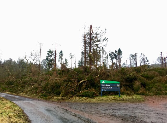
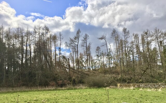
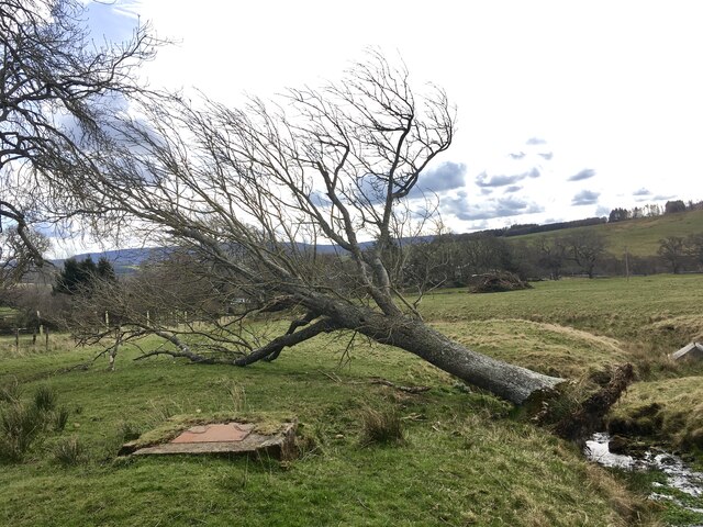
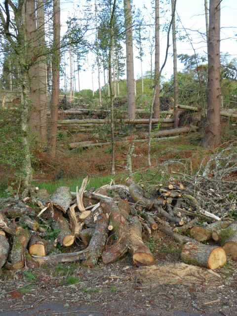
May Plantation East is a sprawling woodland located in the Northumberland region of England. Covering an extensive area, the plantation is situated in the eastern part of May, a small village known for its picturesque landscapes and natural beauty. The woodland is predominantly composed of dense, lush forests that are home to a diverse range of flora and fauna.

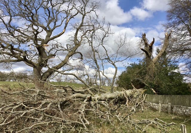
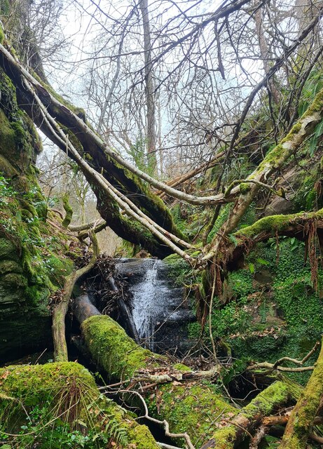
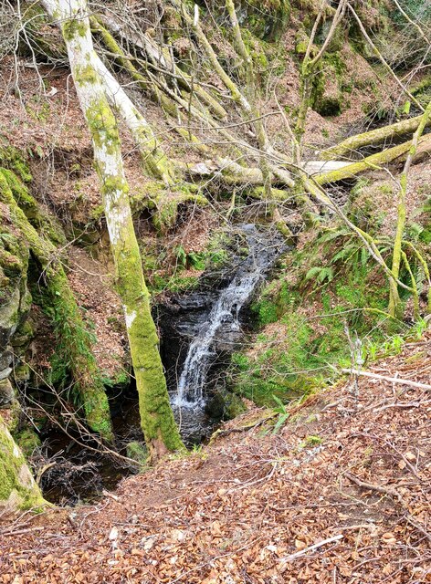
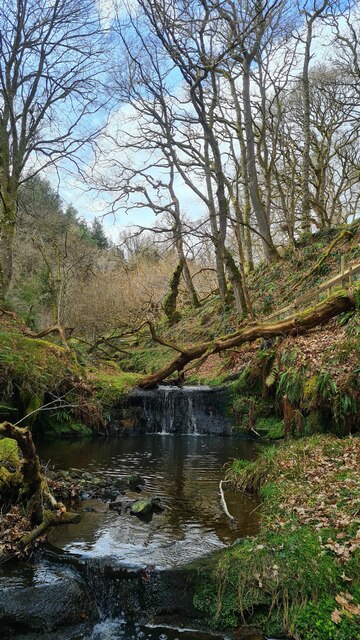
The plantation is characterized by its tall, mature trees, including oak, beech, and pine, which provide a dense canopy and create a serene and tranquil environment. The forest floor is covered in a thick layer of moss and fallen leaves, adding to the enchanting atmosphere of the woodland.

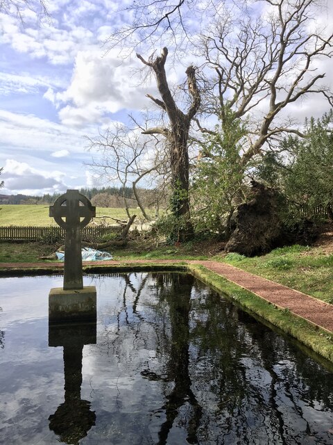
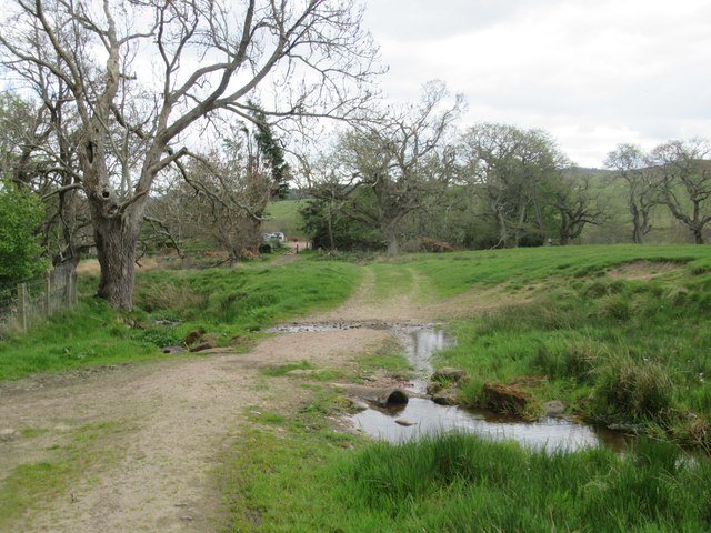
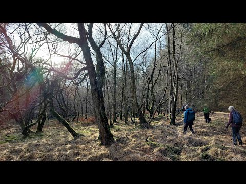
Walking trails crisscross through the plantation, allowing visitors to explore its natural wonders. These paths lead to hidden clearings, babbling brooks, and small ponds, providing ample opportunities for nature enthusiasts to observe and appreciate the local wildlife, such as deer, squirrels, and a variety of bird species.

May Plantation East is not only a haven for nature lovers but also serves as an important ecological habitat. The diverse range of trees and plants supports a rich biodiversity, providing a home for numerous species of insects, animals, and birds. The woodland is also managed sustainably, with periodic tree thinning and replanting efforts to maintain the health and vitality of the forest ecosystem.

Overall, May Plantation East is a captivating woodland that offers visitors a chance to immerse themselves in the beauty of nature. Whether it is a leisurely stroll or an adventurous hike, this woodland provides a serene escape from the hustle and bustle of everyday life, allowing visitors to connect with the natural world.

If you have any feedback on the listing, please let us know in the comments section below.

May Plantation East Images

Images are sourced within 2km of 55.305974/-2.066399 or Grid Reference NT9501. Thanks to Geograph Open Source API. All images are credited.

Hope the picnic tables are alright The car park and picnic area at the entrance to Holystone Woods forest trails are unrecognisable.  This area contained some massive pines.  Storm Arwen flattened it despite its location down in the valley.
Hope the picnic tables are alright
The car park and picnic area at the entrance to Holystone Woods forest trails are unrecognisable. This area contained some massive pines. Storm Arwen flattened it despite its location down in the valley.
Storm Arwen near Holystone Everywhere one goes in mid and north Northumberland one sees the consequences of Storm Arwen's ferocity in swathes of fallen trees. On November 26th 2021 the storm is estimated to have damaged 16 million trees: the Great Storm of 1987 destroyed 15 million trees.
Storm Arwen near Holystone
Everywhere one goes in mid and north Northumberland one sees the consequences of Storm Arwen's ferocity in swathes of fallen trees. On November 26th 2021 the storm is estimated to have damaged 16 million trees: the Great Storm of 1987 destroyed 15 million trees.
Storm Arwen damage at the Lady's Well Fortunately this huge tree fell out of the enclosure rather than into it.
Storm Arwen damage at the Lady's Well
Fortunately this huge tree fell out of the enclosure rather than into it.
Storm Arwen damage at the Lady's Well Fortunately this huge tree fell out of the enclosure rather than into it.
Storm Arwen damage at the Lady's Well
Fortunately this huge tree fell out of the enclosure rather than into it.
Storm Arwen damage near the Lady's Well Everywhere one goes in mid and north Northumberland one sees the consequences of Storm Arwen's ferocity in swathes of fallen trees. On November 26th 2021 the storm is estimated to have damaged 16 million trees: the Great Storm of 1987 destroyed 15 million trees.
Storm Arwen damage near the Lady's Well
Everywhere one goes in mid and north Northumberland one sees the consequences of Storm Arwen's ferocity in swathes of fallen trees. On November 26th 2021 the storm is estimated to have damaged 16 million trees: the Great Storm of 1987 destroyed 15 million trees.
Waterfall at Rob Roy's Cave The cave is immediately to the left of this photo. The Dovecrag Burn boasts a number of small waterfalls though, as here, it rarely carries much water. The deep, narrow gorge is littered with fallen and decayed tree limbs which have become permanently trapped, rendering access difficult.
Waterfall at Rob Roy's Cave
The cave is immediately to the left of this photo. The Dovecrag Burn boasts a number of small waterfalls though, as here, it rarely carries much water. The deep, narrow gorge is littered with fallen and decayed tree limbs which have become permanently trapped, rendering access difficult.
Cascade on the Dovecrag Burn The Dovecrag Burn boasts a number of small waterfalls though, as here, it rarely carries much water. The deep, narrow gorge is littered with fallen and decayed tree limbs which have become permanently trapped, rendering access difficult.
Cascade on the Dovecrag Burn
The Dovecrag Burn boasts a number of small waterfalls though, as here, it rarely carries much water. The deep, narrow gorge is littered with fallen and decayed tree limbs which have become permanently trapped, rendering access difficult.
Waterfalls on the Dovecrag Burn Just upstream of Rob Roy's Cave. The Dovecrag Burn boasts a number of small waterfalls though, as here, it rarely carries much water.
Waterfalls on the Dovecrag Burn
Just upstream of Rob Roy's Cave. The Dovecrag Burn boasts a number of small waterfalls though, as here, it rarely carries much water.
Storm Arwen brought down many trees  Some of the trees are being 'recycled' as firewood!
Storm Arwen brought down many trees
Some of the trees are being 'recycled' as firewood!
Another Storm Arwen ravaged copse of trees Like its near neighbour this small walled enclosure is probably of military origin since it boasts gun loops.  Although it's well outside the boundary of the Otterburn Ranges, it too is still used by troops in training, evidenced by the odd cartridge case lying around.  See

<a href="https://www.geograph.org.uk/photo/7441540">NT9300 : Small copse of Scots Pine in walled enclosure</a>
Another Storm Arwen ravaged copse of trees
Like its near neighbour this small walled enclosure is probably of military origin since it boasts gun loops. Although it's well outside the boundary of the Otterburn Ranges, it too is still used by troops in training, evidenced by the odd cartridge case lying around. See NT9300 : Small copse of Scots Pine in walled enclosure
Firing loops One of a number of groups of gun loops set into the wall enclosing a small copse of Scots Pine.  See

<a href="https://www.geograph.org.uk/photo/7441544">NT9400 : Another Storm Arwen ravaged copse of trees</a>
Firing loops
One of a number of groups of gun loops set into the wall enclosing a small copse of Scots Pine. See NT9400 : Another Storm Arwen ravaged copse of trees
Dues Hill round cairn Archaeological site.  Scheduled Monument, see

<span class="nowrap"><a title="https://historicengland.org.uk/listing/the-list/list-entry/1021032" rel="nofollow ugc noopener" href="https://historicengland.org.uk/listing/the-list/list-entry/1021032">Link</a><img style="margin-left:2px;" alt="External link" title="External link - shift click to open in new window" src="https://s1.geograph.org.uk/img/external.png" width="10" height="10"/></span>
Dues Hill round cairn
Archaeological site. Scheduled Monument, see LinkExternal link
Woodhouses Bastle This bastle, located south-west of Holystone Grange, was built in the early 17th century. It is built of coarse stonework and measures 11.5m long by 7.5m wide. Inside is a vaulted basement, the entrance to which is carved with the date 1602. The basement was used to keep animals, but upstairs is the first floor living area. Here, there are a few small windows and two stone wall cupboards, a stone sink, and traces of an original fireplace. The bastle was increased in height in the 18th century when an attic was added and was restored and reroofed in 1904. This is a Scheduled Monument and Grade II* Listed Building protected by law.
<span class="nowrap"><a title="https://keystothepast.info/search-records/results-of-search/results-of-search-2/site-details/?PRN=N1192" rel="nofollow ugc noopener" href="https://keystothepast.info/search-records/results-of-search/results-of-search-2/site-details/?PRN=N1192">Link</a><img style="margin-left:2px;" alt="External link" title="External link - shift click to open in new window" src="https://s1.geograph.org.uk/img/external.png" width="10" height="10"/></span>
Woodhouses Bastle
This bastle, located south-west of Holystone Grange, was built in the early 17th century. It is built of coarse stonework and measures 11.5m long by 7.5m wide. Inside is a vaulted basement, the entrance to which is carved with the date 1602. The basement was used to keep animals, but upstairs is the first floor living area. Here, there are a few small windows and two stone wall cupboards, a stone sink, and traces of an original fireplace. The bastle was increased in height in the 18th century when an attic was added and was restored and reroofed in 1904. This is a Scheduled Monument and Grade II* Listed Building protected by law. LinkExternal link
Storm Arwen Damage at Dry Burn Wood
Salmon House once The Salmon Inn Sadly like many country pubs and the disease is spreading urban areas with so many watering holes closing.
Salmon House once The Salmon Inn
Sadly like many country pubs and the disease is spreading urban areas with so many watering holes closing.
Ford through Unnamed Burn I think this might be a drainage ditch rather than a burn.
Ford through Unnamed Burn
I think this might be a drainage ditch rather than a burn.
Lady's Well, Holystone Lady's Well is a stone water tank of possible Roman date, fed by a natural spring. The well is alongside the Roman road between High Rochester and the River Aln. The stone tank has been completely rebuilt at least once since the Roman period. The well has been a Christian holy site since the medieval period, and may have been the site of early Christian rituals. An alternative name for the well is 'Ninian's Well'. Ninian was the Bishop of Whithorn, in south-west Scotland, from AD500-550. It is possible that Ninian visited Holystone, although we have no evidence for such a visit. There is a legend that Paulinus, an early Christian missionary from Italy, converted 3000 people at the well during Easter AD627. In the medieval period, there was an Augustinian convent at Holystone, which may be where the name 'Lady's Well' comes from. In addition to the tank, a 15th century statue, said to be of Paulinus, was brought to the site from Alnwick in 1780. The statue was moved from the centre of the tank in the 19th century and replaced with a wheel cross. Local tradition says an altar-shaped stone near the well is the 'holy' stone, which gives the local village its name. The Lady's Well is a Scheduled Monument and Grade I Listed Building protected by law.
<span class="nowrap"><a title="https://keystothepast.info/search-records/results-of-search/results-of-search-2/site-details/?PRN=N1209" rel="nofollow ugc noopener" href="https://keystothepast.info/search-records/results-of-search/results-of-search-2/site-details/?PRN=N1209">Link</a><img style="margin-left:2px;" alt="External link" title="External link - shift click to open in new window" src="https://s1.geograph.org.uk/img/external.png" width="10" height="10"/></span>
Lady's Well, Holystone
Lady's Well is a stone water tank of possible Roman date, fed by a natural spring. The well is alongside the Roman road between High Rochester and the River Aln. The stone tank has been completely rebuilt at least once since the Roman period. The well has been a Christian holy site since the medieval period, and may have been the site of early Christian rituals. An alternative name for the well is 'Ninian's Well'. Ninian was the Bishop of Whithorn, in south-west Scotland, from AD500-550. It is possible that Ninian visited Holystone, although we have no evidence for such a visit. There is a legend that Paulinus, an early Christian missionary from Italy, converted 3000 people at the well during Easter AD627. In the medieval period, there was an Augustinian convent at Holystone, which may be where the name 'Lady's Well' comes from. In addition to the tank, a 15th century statue, said to be of Paulinus, was brought to the site from Alnwick in 1780. The statue was moved from the centre of the tank in the 19th century and replaced with a wheel cross. Local tradition says an altar-shaped stone near the well is the 'holy' stone, which gives the local village its name. The Lady's Well is a Scheduled Monument and Grade I Listed Building protected by law. LinkExternal link
Show me another place!

May Plantation East is located at Grid Ref: NT9501 (Lat: 55.305974, Lng: -2.066399)

Unitary Authority: Northumberland

Police Authority: Northumbria

What 3 Words

///chucked.texted.golf. Near Rothbury, Northumberland

Related Wikis

Holystone, Northumberland

Holystone is a small village and former civil parish, now in the parish of Harbottle, in Northumberland, England. It lies on the edge of (and just within...

Sharperton

Sharperton is a small settlement and former civil parish, now in the parish of Harbottle, in Northumberland, England. Sharperton is the site of a deserted...

Hepple

Hepple is a small village and parish in rural Northumberland, 4 miles (6.4 km) west of Rothbury, which provides most of its local services. It is on the...

High Cove

High Cove is a major slip feature to the west of Grasslees Burn in the Simonside Hills, Northumberland, England. It contains several small rifts and caves...

Reivers Way

The Reivers Way is a long-distance footpath in Northumberland, passing through the Northumberland National Park and the Cheviot Hills. Totalling 242 kilometres...

Harbottle

Harbottle is a village and civil parish in Northumberland, England about 10 miles (16 km) south-east of the Scottish border, in the southeastern part of...

Harbottle Castle

Harbottle Castle is a ruined medieval castle situated at the west end of the village of Harbottle, Northumberland, England, 9 miles (14 km) west-north...

Billsmoor Park and Grasslees Wood

Billsmoor Park and Grasslees Wood is the name given to a Site of Special Scientific Interest (SSSI) in Northumberland, North East England, designated in...

Related Videos

Holystone, Lady's Well and Dove Crag with Interesting Walks NE (7.8 miles)

Beautiful walk around Holystone with a bait stop at Dove Crag. I was absolutely worn-out after this one - the combination of blown ...

Walking the Beacon Trig Point on Dues Hill (301m)

Winter hike - trips and tumbles around Holystone Common and up to the Beacon trig point on Dues Hill. When you can't ...

Holystone TRIP

Tumble around Holystone Common to the Beacon.

Nearby Amenities

Located within 500m of 55.305974,-2.066399
The data included in this document is from www.openstreetmap.org. The data is made available under ODbL.

Have you been to May Plantation East?

Leave your review of May Plantation East below (or comments, questions and feedback).