Thickthorn Coppice

Wood, Forest in Dorset

England

Thickthorn Coppice

The lane to Chettle off the A354
The lane to Chettle off the A354 Credit: Paul Barnett

Thickthorn Coppice is a picturesque woodland located in the county of Dorset, England. Covering an area of approximately 50 acres, it is a relatively small but diverse forest that offers a tranquil escape from the hustle and bustle of daily life. Situated near the village of Thickthorn, the coppice is easily accessible from the nearby town of Wareham.

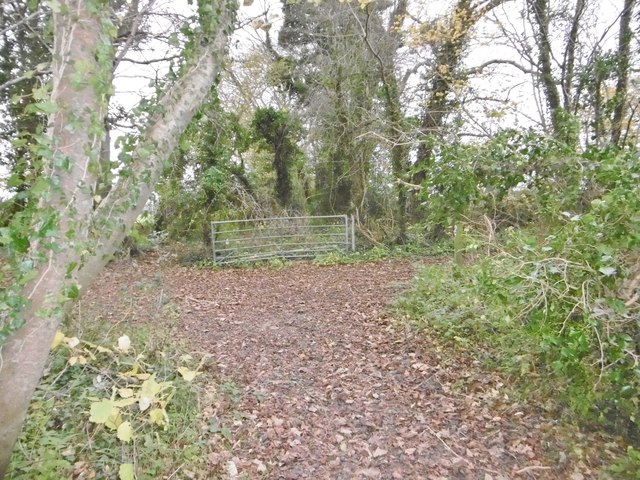
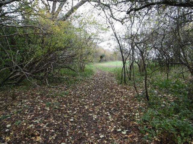
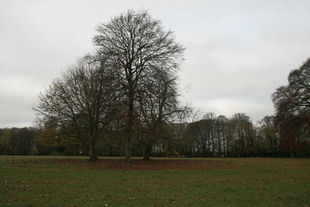
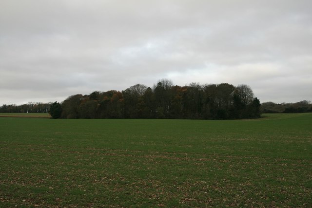
The woodland is characterized by its dense canopy of mature trees, predominantly consisting of oak, beech, and ash. These towering giants provide a rich habitat for a variety of wildlife, including deer, badgers, and a wide range of bird species. The forest floor is carpeted with a diverse array of flora, such as bluebells, wild garlic, and wood anemones, creating a vibrant and colorful display during the spring and summer months.

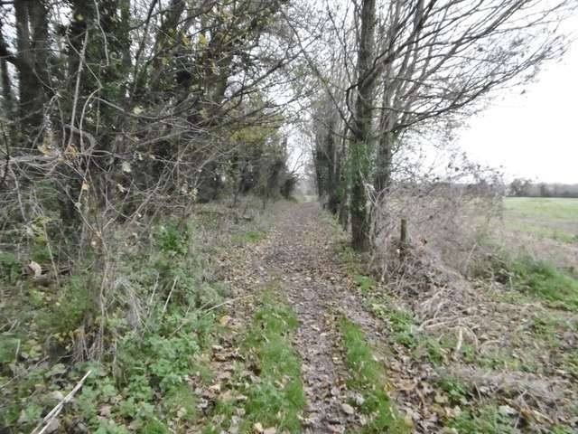
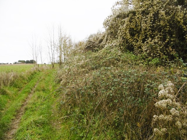
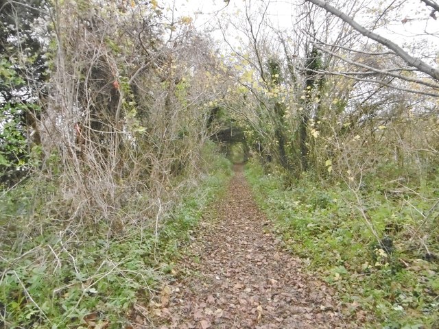
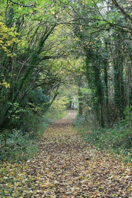
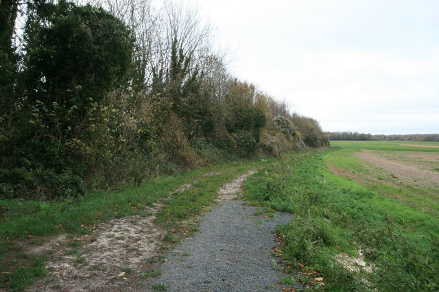
Thickthorn Coppice is traversed by a network of well-maintained footpaths and bridleways, making it popular among walkers, joggers, and horse riders. The paths wind their way through the woodland, offering visitors the opportunity to explore its hidden corners and discover its hidden treasures. There are also several picnic areas scattered throughout the forest, providing the perfect spot for a leisurely lunch surrounded by nature.

Managed by the local forestry commission, Thickthorn Coppice is carefully maintained to ensure the preservation of its natural beauty and biodiversity. Regular conservation efforts, including tree planting and controlled burning, help to maintain a healthy ecosystem within the woodland.

Overall, Thickthorn Coppice is a delightful woodland retreat that offers visitors the chance to immerse themselves in nature and enjoy the peaceful surroundings. Whether it's a tranquil walk, a picnic with loved ones, or simply a moment of solitude, this enchanting forest provides a haven for all who visit.

If you have any feedback on the listing, please let us know in the comments section below.

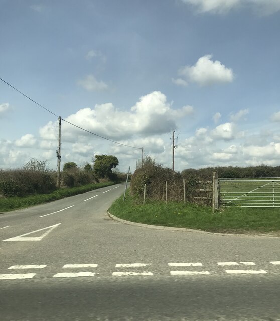
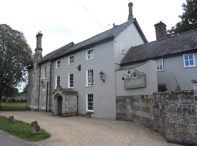
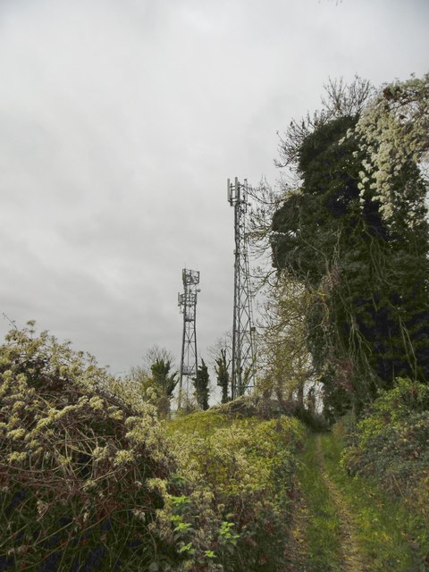
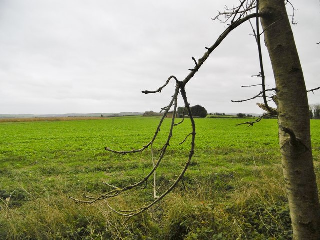
Thickthorn Coppice Images

Images are sourced within 2km of 50.912534/-2.0622216 or Grid Reference ST9512. Thanks to Geograph Open Source API. All images are credited.

The lane to Chettle off the A354
Castleman Hotel, Chettle The Castleman Hotel was originally Chettle Lodge, the dower house for the surrounding estate. Since 1846 the estate has been owned by the Castleman-Bourke family.
Castleman Hotel, Chettle
The Castleman Hotel was originally Chettle Lodge, the dower house for the surrounding estate. Since 1846 the estate has been owned by the Castleman-Bourke family.
Tarrant Hinton, masts Seen from the byway from Little Wood. NGR refers to the nearer mast.
Tarrant Hinton, masts
Seen from the byway from Little Wood. NGR refers to the nearer mast.
Tarrant Hinton, brassicas Oil-seed rape (?).
Tarrant Hinton, brassicas
Oil-seed rape (?).
Tarrant Hinton, byway Open to all traffic; towards Little Wood.
Tarrant Hinton, byway
Open to all traffic; towards Little Wood.
Tarrant Hinton, seedheads Traveller's Joy seedheads (Clematis vitalba), sprawling over an ash tree and scrub, on the byway to the village.
Tarrant Hinton, seedheads
Traveller's Joy seedheads (Clematis vitalba), sprawling over an ash tree and scrub, on the byway to the village.
Tarrant Hinton, byway junction Coming from Tarrant Gunville; left, to Chettle; right, to Tarrant Hinton.
Tarrant Hinton, byway junction
Coming from Tarrant Gunville; left, to Chettle; right, to Tarrant Hinton.
Tarrant Gunville, bridleway From <a href="https://www.geograph.org.uk/photo/4758077">ST9412 : Tarrant Hinton, byway junction</a> to the village. The bridleway also forms part of the Jubilee Trail, and is on the boundary of Tarrant Gunville and Chettle Parishes.
Tarrant Gunville, bridleway
From ST9412 : Tarrant Hinton, byway junction to the village. The bridleway also forms part of the Jubilee Trail, and is on the boundary of Tarrant Gunville and Chettle Parishes.
Chettle, gate The entrance to Little Wood.
Chettle, gate
The entrance to Little Wood.
Chettle, bridleway Leaving woodland for open farmland, on the way around Eastbury Park. This section forms part of Jubilee Trail. <span class="nowrap"><a title="https://www.ldwa.org.uk/ldp/members/show_path.php?path_name=Jubilee+Trail+(Dorset)" rel="nofollow ugc noopener" href="https://www.ldwa.org.uk/ldp/members/show_path.php?path_name=Jubilee+Trail+(Dorset)">Link</a><img style="margin-left:2px;" alt="External link" title="External link - shift click to open in new window" src="https://s1.geograph.org.uk/img/external.png" width="10" height="10"/></span>
Chettle, bridleway
Leaving woodland for open farmland, on the way around Eastbury Park. This section forms part of Jubilee Trail. LinkExternal link
The Park, Chettle
The Park, Chettle
Church of St Mary, Chettle
Byway through Little Wood, Chettle
Footpath at North Tarrant Hinton Down
Ninety-nine Plantation, near Pimperne
Old Milestone by the A354, north east of Tarrant Hinton Carved stone post by the A354, in parish of TARRANT HINTON (NORTH DORSET District), North East of Tarrant Hinton, 3m back from road near top of hill, on South side of road. Dorset 1 (limestone), erected by the Harnham, Blandford & Dorchester turnpike trust in the 19th century. 

Inscription reads:-
Blandford
5
Sarum
17  

Grade II Listed. List Entry Number:1118495
<span class="nowrap"><a title="https://historicengland.org.uk/listing/the-list/list-entry/1118495" rel="nofollow ugc noopener" href="https://historicengland.org.uk/listing/the-list/list-entry/1118495">Link</a><img style="margin-left:2px;" alt="External link" title="External link - shift click to open in new window" src="https://s1.geograph.org.uk/img/external.png" width="10" height="10"/></span>

Milestone Society National ID: DO_BFSA05
Old Milestone by the A354, north east of Tarrant Hinton
Carved stone post by the A354, in parish of TARRANT HINTON (NORTH DORSET District), North East of Tarrant Hinton, 3m back from road near top of hill, on South side of road. Dorset 1 (limestone), erected by the Harnham, Blandford & Dorchester turnpike trust in the 19th century. Inscription reads:- Blandford 5 Sarum 17 Grade II Listed. List Entry Number:1118495 LinkExternal link Milestone Society National ID: DO_BFSA05
Old Milestone by the A354, Plantation Farm Carved stone post by the A354, in parish of TARRANT HINTON (NORTH DORSET District), South East of Chettle on main road; opposite Plantation Farm, by the road, on South side of road. Dorset 1 (limestone), erected by the Harnham, Blandford & Dorchester turnpike trust in the 19th century. 

Inscription reads:-
Blandford
6
Sarum
16   
Carved benchmark bottom right of face.

Milestone Society National ID: DO_BFSA06
Old Milestone by the A354, Plantation Farm
Carved stone post by the A354, in parish of TARRANT HINTON (NORTH DORSET District), South East of Chettle on main road; opposite Plantation Farm, by the road, on South side of road. Dorset 1 (limestone), erected by the Harnham, Blandford & Dorchester turnpike trust in the 19th century. Inscription reads:- Blandford 6 Sarum 16 Carved benchmark bottom right of face. Milestone Society National ID: DO_BFSA06
Old Milestone, A354, South West of Cashmoor The milestone is located on the bank in a small wood, on the south side of road. Parish of Long Crichel (East Dorset District). Carved stone post, Dorset 1 (limestone) design, erected by the Harnham, Blandford & Dorchester turnpike trust in the 19th century. 

Inscription reads:-
BANDFORD (sic)
7
Sarum
15   

Grade II Listed. List Entry Number:1323487
<span class="nowrap"><a title="https://historicengland.org.uk/listing/the-list/list-entry/1323487" rel="nofollow ugc noopener" href="https://historicengland.org.uk/listing/the-list/list-entry/1323487">Link</a><img style="margin-left:2px;" alt="External link" title="External link - shift click to open in new window" src="https://s1.geograph.org.uk/img/external.png" width="10" height="10"/></span>

Milestone Society National ID: DO_BFSA07
Old Milestone, A354, South West of Cashmoor
The milestone is located on the bank in a small wood, on the south side of road. Parish of Long Crichel (East Dorset District). Carved stone post, Dorset 1 (limestone) design, erected by the Harnham, Blandford & Dorchester turnpike trust in the 19th century. Inscription reads:- BANDFORD (sic) 7 Sarum 15 Grade II Listed. List Entry Number:1323487 LinkExternal link Milestone Society National ID: DO_BFSA07
Show me another place!

Thickthorn Coppice is located at Grid Ref: ST9512 (Lat: 50.912534, Lng: -2.0622216)

Unitary Authority: Dorset

Police Authority: Dorset

What 3 Words

///super.commutes.player. Near Pimperne, Dorset

Related Wikis

Chettle House

Chettle House is a Grade I listed country manor house with Queen Anne style architecture in Chettle, North Dorset, England, about 6 miles (10 km) northeast...

Chettle

Chettle is a small village and civil parish in the county of Dorset in southern England. It lies 6 miles (10 kilometres) northeast of Blandford Forum....

Thickthorn Down Long Barrows

The Thickthorn Down Long Barrows are two Neolithic long barrows, near the village of Gussage St Michael in Dorset, England. They are near the south-western...

Tarrant Hinton

Tarrant Hinton is a village and civil parish in the county of Dorset in southern England. It is situated in the Tarrant Valley, approximately five miles...

Have you been to Thickthorn Coppice?

Leave your review of Thickthorn Coppice below (or comments, questions and feedback).