Briery Coppice

Wood, Forest in Staffordshire

England

Briery Coppice

St John The Baptist, Parish church of Halesowen Halesowen Parish Church is a Town Centre Church in the fast-changing town of Halesowen with a 1,000 year history as a Grade 1 listed building.
The second most important historical building in Dudley Metropolitan Borough it was opened in 1083, and had been in central use ever since
St John The Baptist, Parish church of Halesowen Credit: Stephen Rogerson

Briery Coppice is a picturesque woodland located in Staffordshire, England. Covering an area of approximately 50 acres, it is a popular destination for nature enthusiasts and those seeking a peaceful retreat.

The coppice is primarily composed of broadleaf trees, including oak, beech, and birch. These trees create a dense canopy, providing shade and shelter for a variety of flora and fauna. The forest floor is covered in a lush carpet of ferns, bluebells, and wildflowers, adding to its natural beauty.

The woodland is crisscrossed with a network of well-maintained footpaths, making it easily accessible to visitors of all ages and abilities. These paths wind through the trees, offering glimpses of the surrounding countryside and providing an opportunity to spot wildlife such as deer, squirrels, and a wide range of bird species.

Briery Coppice is a haven for outdoor activities, with designated areas for picnicking and camping. Fishing is also a popular pastime, as the coppice is home to several small ponds and streams teeming with fish.

Throughout the year, the woodland is host to various events and workshops, including guided nature walks, photography classes, and forest bathing sessions. These activities allow visitors to immerse themselves in the tranquility of the forest and learn more about its ecology.

Overall, Briery Coppice is a cherished natural gem in Staffordshire, offering a serene escape from the hustle and bustle of daily life. Its diverse ecosystem and range of recreational opportunities make it a must-visit destination for nature lovers and outdoor enthusiasts alike.

If you have any feedback on the listing, please let us know in the comments section below.

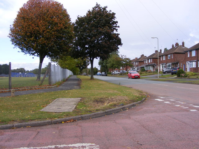
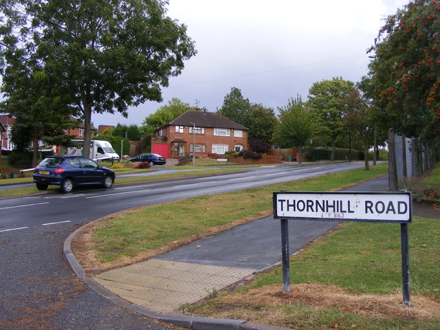
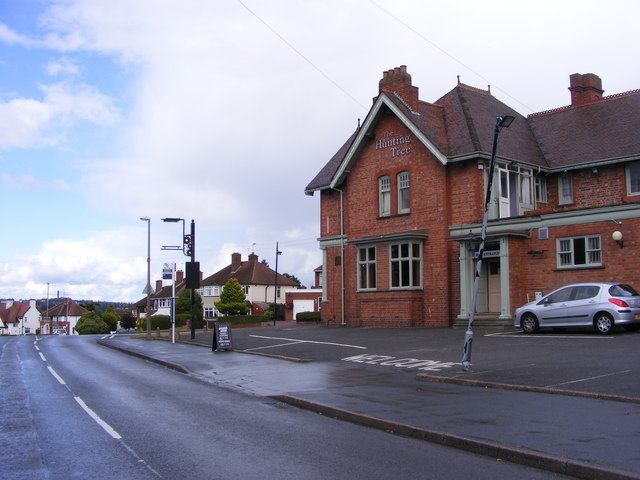
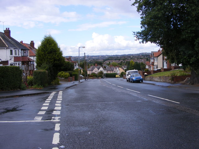
Briery Coppice Images

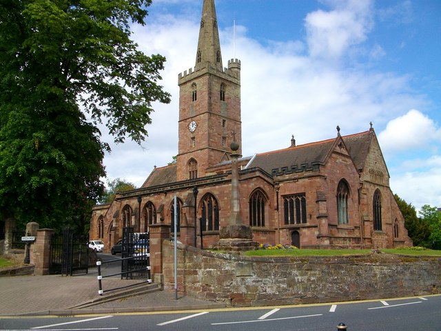
Images are sourced within 2km of 52.462531/-2.0645252 or Grid Reference SO9584. Thanks to Geograph Open Source API. All images are credited.

St John The Baptist, Parish church of Halesowen Halesowen Parish Church is a Town Centre Church in the fast-changing town of Halesowen with a 1,000 year history as a Grade 1 listed building.
The second most important historical building in Dudley Metropolitan Borough it was opened in 1083, and had been in central use ever since
St John The Baptist, Parish church of Halesowen
Halesowen Parish Church is a Town Centre Church in the fast-changing town of Halesowen with a 1,000 year history as a Grade 1 listed building. The second most important historical building in Dudley Metropolitan Borough it was opened in 1083, and had been in central use ever since
Mucklow Hill View The view up the A458 in Halesowen.
Mucklow Hill View
The view up the A458 in Halesowen.
New Gateway The Gate on Belle Vale road alongside the River Stour in the Congreaves Nature Reserve. The Gateway is being renovated. Old Gateway <a href="https://www.geograph.org.uk/photo/1537783">SO9584 : Old Gateway</a>
New Gateway
The Gate on Belle Vale road alongside the River Stour in the Congreaves Nature Reserve. The Gateway is being renovated. Old Gateway SO9584 : Old Gateway
Huntingtree Park The park off Huntingtree Road Hasbury near Halesowen.
Huntingtree Park
The park off Huntingtree Road Hasbury near Halesowen.
Thornhill Road Shops The parade of shops in Hasbury, near Halesowen.
Thornhill Road Shops
The parade of shops in Hasbury, near Halesowen.
Thornhill Road View The view down Bassnage Road Hasbury near Halesowen.
Thornhill Road View
The view down Bassnage Road Hasbury near Halesowen.
Thornhill Road Junction The view down Huntingtree Road near Halesowen.
Thornhill Road Junction
The view down Huntingtree Road near Halesowen.
The Hunting Tree A Pub on Alexandra Road Hasbury near Halesowen.
The Hunting Tree
A Pub on Alexandra Road Hasbury near Halesowen.
Alexandra Road View
Alexandra Road View
Olde queens Head
Olde queens Head
Benjamins Restaurant & Bar in Halesowen town centre.
Benjamins
Restaurant & Bar in Halesowen town centre.
The Whitley (1), 211 Stourbridge Road, Halesowen At one time this was known as the Whitley Hotel. After a period of closure, it re-opened as a real ale pub in March 2011. It was bought by Black Country brewers Real Ale Taverns, and extensively refurbished. It still has a very traditional feel and decor inside, and is popular with local people. The road on the left leads to the pub's rear car park.

<a href="https://www.geograph.org.uk/photo/2692606">SO9583 : The Whitley (2) - sign, 211 Stourbridge Road, Halesowen</a>.
The Whitley (1), 211 Stourbridge Road, Halesowen
At one time this was known as the Whitley Hotel. After a period of closure, it re-opened as a real ale pub in March 2011. It was bought by Black Country brewers Real Ale Taverns, and extensively refurbished. It still has a very traditional feel and decor inside, and is popular with local people. The road on the left leads to the pub's rear car park. SO9583 : The Whitley (2) - sign, 211 Stourbridge Road, Halesowen.
The Whitley (2) - sign, 211 Stourbridge Road, Halesowen The new sign at the recently re-opened Whitley pub.

<a href="https://www.geograph.org.uk/photo/2692597">SO9583 : The Whitley (1), 211 Stourbridge Road, Halesowen</a>.
The Whitley (2) - sign, 211 Stourbridge Road, Halesowen
The new sign at the recently re-opened Whitley pub. SO9583 : The Whitley (1), 211 Stourbridge Road, Halesowen.
Traffic island by the Hunting Tree PH
Gosty Hill Tunnel, south-east end, 1987 The Dudley Canal passes through the closed Coombeswood tube works. Above is a  footbridge and a travelling crane bridge beyond. The tunnel looks an insignificant rat hole from this end, and indeed for most of its length the cross-section is rather small.
Gosty Hill Tunnel, south-east end, 1987
The Dudley Canal passes through the closed Coombeswood tube works. Above is a footbridge and a travelling crane bridge beyond. The tunnel looks an insignificant rat hole from this end, and indeed for most of its length the cross-section is rather small.
Halesowen Church in the Snow 1990
Mary Macarthur Monument The view of the sculptures unveiled Saturday 9th June in Mary Macarthur Park, Cradley Heath. The 10ft steel artwork was created by sculptor Luke Perry from Stourbridge. The artwork commemorates the 1910 female chainmakers' dispute in which 800 women went on strike for a national minimum wage.
Mary Macarthur Monument
The view of the sculptures unveiled Saturday 9th June in Mary Macarthur Park, Cradley Heath. The 10ft steel artwork was created by sculptor Luke Perry from Stourbridge. The artwork commemorates the 1910 female chainmakers' dispute in which 800 women went on strike for a national minimum wage.
Mary Macarthur Detail The view of the sculpture unveiled Saturday 9th June in Mary Macarthur Park, Cradley Heath. The 10ft steel artwork was created by sculptor Luke Perry from Stourbridge. The artwork commemorates the 1910 female chainmakers' dispute in which 800 women went on strike for a national minimum wage.
Mary Macarthur Detail
The view of the sculpture unveiled Saturday 9th June in Mary Macarthur Park, Cradley Heath. The 10ft steel artwork was created by sculptor Luke Perry from Stourbridge. The artwork commemorates the 1910 female chainmakers' dispute in which 800 women went on strike for a national minimum wage.
Show me another place!

Briery Coppice is located at Grid Ref: SO9584 (Lat: 52.462531, Lng: -2.0645252)

Unitary Authority: Sandwell

Police Authority: West Midlands

What 3 Words

///moods.vines.gosh. Near Cradley Heath, West Midlands

Nearby Locations

Belle Vale Briery Coppice

Related Wikis

Hawne

Hawne is a residential area approximately one mile from Halesowen town centre in the county of West Midlands, England. It includes Newfield Park Primary...

Haden Hill Park

Haden Hill Park is at Haden Hill, between Halesowen and Old Hill in the West Midlands, England, on the southern edge of the Black Country. Within its grounds...

Haden Hill

Haden Hill is a residential area in the West Midlands of England, straddling the border of Halesowen and Cradley Heath townships and the modern boroughs...

Coombes Holloway Halt railway station

Coombes Holloway Halt railway station was a railway station in Halesowen, England, on the Great Western Railway & Midland Railway's Joint Halesowen Railway...

Causeway United F.C.

Causeway United Football Club was a football club based in Halesowen, England, but originally from Oldbury. == History == Causeway United FC was formed...

Halesowen Town F.C.

Halesowen Town Football Club is a football club based in Halesowen, West Midlands, England. They are currently members of the Southern League Premier Division...

Old Hill railway station

Old Hill railway station is in Old Hill, West Midlands, England, on the Birmingham-Stourbridge line. It is managed by West Midlands Trains, who provide...

Halesowen College of Further Education

Halesowen College is a further and higher education college in Whittingham Road, Halesowen, West Midlands. It was established in 1982 as a tertiary college...

Related Videos

Halesowen Town Centre Walking Tour - Feb 2024 [4k]

A walking tour of Halesowen Town Centre. Welcome to another virtual walking tour of another English town that's forgotten.

Cornbow Shopping Centre | Walking Tour | Feb 2024 [4k]

Halesowen is another forgotten town. It has a small centre called Cornbow shopping centre. This is another English town that has ...

Walking to heal

Me and my dog mish walking to heal.

Walking to The Lady Pool ...Leasows...Mucklow Hill...

The Lady Pool ... Did a Lady drown in the Lady Pool? The story in the 70s was that she did...and she was never found...is this ...

Nearby Amenities

Located within 500m of 52.462531,-2.0645252
Bus Stop
Fairmile Rd / Blagdon Road
Bus: yes
Naptan AtcoCode: 43000818401
Naptan Bearing: NE
Naptan BusStopType: MKD
Naptan CommonName: Blagdon Road
Naptan Indicator: opp
Naptan NaptanCode: nwmtdgjp
Naptan PlusbusZoneRef: BHAMNWS
Naptan Status: ACT
Naptan StopType: BCT
Naptan Street: FAIRMILE RD
Naptan Towards: Old Hill
Naptan Verified: no
Public Transport: platform
Route Ref: 244
Source: WMCA
Lat/Long: 52.4598203/-2.0587201
Bus Stop
Fairmile Rd / Blagdon Road
Bus: yes
Naptan AtcoCode: 43000818402
Naptan Bearing: SW
Naptan BusStopType: MKD
Naptan CommonName: Blagdon Road
Naptan Indicator: adj
Naptan NaptanCode: nwmtdgjt
Naptan PlusbusZoneRef: BHAMNWS
Naptan Status: ACT
Naptan StopType: BCT
Naptan Street: FAIRMILE RD
Naptan Towards: Halesowen
Naptan Verified: no
Public Transport: platform
Route Ref: 244
Source: WMCA
Lat/Long: 52.4596728/-2.0589009
Bus Stop
Fairmile Rd / Hawne Lane
Bus: yes
Naptan AtcoCode: 43008210201
Naptan Bearing: SW
Naptan BusStopType: MKD
Naptan CommonName: Hawne Lane
Naptan Indicator: before
Naptan NaptanCode: nwmtjpja
Naptan PlusbusZoneRef: BHAMNWS
Naptan Status: ACT
Naptan StopType: BCT
Naptan Street: FAIRMILE RD
Naptan Towards: Halesowen
Public Transport: platform
Route Ref: 244
Shelter: no
Source: WMCA
Lat/Long: 52.4591019/-2.0627715
Bus Stop
Fairmile Rd / Hawne Lane
Bus: yes
Naptan AtcoCode: 43008210202
Naptan Bearing: NE
Naptan BusStopType: MKD
Naptan CommonName: Hawne Lane
Naptan Indicator: after
Naptan NaptanCode: nwmtjpjd
Naptan PlusbusZoneRef: BHAMNWS
Naptan Status: ACT
Naptan StopType: BCT
Naptan Street: FAIRMILE RD
Naptan Towards: Old Hill
Public Transport: platform
Route Ref: 244
Shelter: no
Source: WMCA
Lat/Long: 52.459122/-2.0633897
Bus Stop
Valley Rd / Mill Rd
Bus: yes
Naptan AtcoCode: 43000903101
Naptan Bearing: S
Naptan BusStopType: MKD
Naptan CommonName: Mill Rd
Naptan Indicator: adj
Naptan NaptanCode: nwmpatap
Naptan PlusbusZoneRef: BHAMNWS
Naptan Status: ACT
Naptan StopType: BCT
Naptan Street: VALLEY RD
Naptan Towards: Merry Hill
Naptan Verified: no
Public Transport: platform
Route Ref: 17;243
Shelter: no
Source: WMCA
Towards: Halesowen
Lat/Long: 52.4635432/-2.0697116
Bus Stop
Valley Rd / Mill Rd
Bus: yes
Naptan AtcoCode: 43000903102
Naptan Bearing: N
Naptan BusStopType: MKD
Naptan CommonName: Mill Rd
Naptan Indicator: opp
Naptan NaptanCode: nwmpatat
Naptan PlusbusZoneRef: BHAMNWS
Naptan Status: ACT
Naptan StopType: BCT
Naptan Street: VALLEY RD
Naptan Towards: Cradley Heath
Public Transport: platform
Route Ref: 17;243
Shelter: no
Source: WMCA
Towards: Cradley Heath
Lat/Long: 52.4637074/-2.0699827
Greener Fuels
Man Made: works
Lat/Long: 52.4610268/-2.0600196
Aalco
Man Made: works
Source: survey
Website: https://www.aalco.co.uk/
Lat/Long: 52.4609955/-2.0608662
Bearings Direct
Man Made: works
Lat/Long: 52.4614279/-2.0599701
Silverline Industries
Man Made: works
Lat/Long: 52.4614225/-2.0600588
Star Fleet Taxis
Note: Taxi company depot/office
Lat/Long: 52.4614693/-2.0589949
TRAC Ltd
Man Made: works
Note: Air conditioning company
Website: https://www.trac-aircon.co.uk/
Lat/Long: 52.4614603/-2.0592833
Husbands Lift Solutions
Man Made: works
Website: https://www.husbands.co.uk/
Lat/Long: 52.4614513/-2.0595531
Diamond Coatings Ltd
Man Made: works
Lat/Long: 52.4614279/-2.0598903
Hayley (site 2)
Man Made: works
Source: survey
Website: https://www.hayley-group.co.uk/
Lat/Long: 52.4612084/-2.0574995
Hayley (site 3)
Man Made: works
Source: survey
Website: https://www.hayley-group.co.uk/
Lat/Long: 52.4611821/-2.0581531
Mark One Automotive Ltd
Shop: car_repair
Lat/Long: 52.4615098/-2.0584478
Barrier: cycle_barrier
Source: survey
Lat/Long: 52.4588148/-2.0668792
Addr Country: GB
Addr Housenumber: 94
Addr Postcode: B63 3RP
Addr Street: Carol Crescent
Source: survey
Lat/Long: 52.4584594/-2.0640703
Addr Housename: Rosemary Lodge
Source: survey
Lat/Long: 52.4592257/-2.0645205
Beaver Park Industrial Estate
Source: survey
Lat/Long: 52.459515/-2.0631416
Sharper Design and Marketing
Source: survey
Website: www.sharpermove.com
Lat/Long: 52.4598783/-2.0620369
Solutions Acrylic and Display Ltd
Man Made: works
Phone: +44121 550 5088
Source: survey
Website: http://www.solutions-display.co.uk/
Lat/Long: 52.4597121/-2.0623945
Burton Motors
Shop: car_repair
Source: survey
Lat/Long: 52.4613953/-2.0605447
Barrier: bollard
Source: survey
Lat/Long: 52.4620406/-2.0645849
Barrier: bollard
Source: survey
Lat/Long: 52.4617044/-2.0654628
Barrier: bollard
Source: survey
Lat/Long: 52.4644953/-2.0623414
Turning Circle
Source: bing
Lat/Long: 52.4644945/-2.0662171
Turning Circle
Source: survey
Lat/Long: 52.4655598/-2.0686841
Brand: National Grid
Brand Wikidata: Q1465461
Operator: National Grid Electricity Distribution Plc
Operator Old: Western Power Distribution
Operator Wikidata: Q7988183
Owner: National Grid Electricity Distribution (West Midlands) Plc
Owner Wikidata: Q114397791
Power: substation
Ref: 582
Source: survey
Lat/Long: 52.4627591/-2.0603526
Barrier: cycle_barrier
Source: survey
Lat/Long: 52.4611788/-2.0706558
Post Box
Ref: B64 1127
Source: GPS Survey
Lat/Long: 52.4642937/-2.0673
Brand: National Grid
Brand Wikidata: Q1465461
Operator: National Grid Electricity Distribution Plc
Operator Old: Western Power Distribution
Operator Wikidata: Q7988183
Owner: National Grid Electricity Distribution (West Midlands) Plc
Owner Wikidata: Q114397791
Power: substation
Ref: 6412
Source: survey
Lat/Long: 52.4667466/-2.0643708
Barrier: cycle_barrier
Source: survey
Lat/Long: 52.4627112/-2.059861
Barrier: bollard
Source: survey
Lat/Long: 52.4628195/-2.0580163
Brand: National Grid
Brand Wikidata: Q1465461
Operator: National Grid Electricity Distribution Plc
Operator Old: Western Power Distribution
Operator Wikidata: Q7988183
Owner: National Grid Electricity Distribution (West Midlands) Plc
Owner Wikidata: Q114397791
Power: substation
Ref: 6223
Source: survey
Lat/Long: 52.464956/-2.0594524
Turning Circle
Source: bing
Lat/Long: 52.4586631/-2.0620439
Grit Bin
Source: survey
Lat/Long: 52.460471/-2.0687864
Post Box
Ref: B63 168
Source: GPS Survey
Lat/Long: 52.4603597/-2.0688544
Generator Method: photovoltaic
Generator Output Electricity: yes
Generator Source: solar
Generator Type: solar_photovoltaic_panel
Location: roof
Power: generator
Lat/Long: 52.4590788/-2.0609343
Generator Method: photovoltaic
Generator Output Electricity: yes
Generator Source: solar
Generator Type: solar_photovoltaic_panel
Location: roof
Power: generator
Lat/Long: 52.459051/-2.060422
Generator Method: photovoltaic
Generator Output Electricity: yes
Generator Source: solar
Generator Type: solar_photovoltaic_panel
Location: roof
Power: generator
Lat/Long: 52.4591/-2.0616719
Generator Method: photovoltaic
Generator Output Electricity: yes
Generator Source: solar
Generator Type: solar_photovoltaic_panel
Location: roof
Power: generator
Lat/Long: 52.4645551/-2.0582762
Generator Method: photovoltaic
Generator Output Electricity: yes
Generator Source: solar
Generator Type: solar_photovoltaic_panel
Location: roof
Power: generator
Lat/Long: 52.4640142/-2.0588878
Generator Method: photovoltaic
Generator Output Electricity: yes
Generator Source: solar
Generator Type: solar_photovoltaic_panel
Location: roof
Power: generator
Lat/Long: 52.4648419/-2.0693994
Generator Method: photovoltaic
Generator Output Electricity: yes
Generator Source: solar
Generator Type: solar_photovoltaic_panel
Location: roof
Power: generator
Lat/Long: 52.4645968/-2.0697239
Generator Method: photovoltaic
Generator Output Electricity: yes
Generator Source: solar
Generator Type: solar_photovoltaic_panel
Location: roof
Power: generator
Lat/Long: 52.4646189/-2.0696649
Generator Method: photovoltaic
Generator Output Electricity: yes
Generator Source: solar
Generator Type: solar_photovoltaic_panel
Location: roof
Power: generator
Lat/Long: 52.4644596/-2.0701705
Generator Method: photovoltaic
Generator Output Electricity: yes
Generator Source: solar
Generator Type: solar_photovoltaic_panel
Location: roof
Power: generator
Lat/Long: 52.4644816/-2.0701168
Generator Method: photovoltaic
Generator Output Electricity: yes
Generator Source: solar
Generator Type: solar_photovoltaic_panel
Location: roof
Power: generator
Lat/Long: 52.458479/-2.066815
The data included in this document is from www.openstreetmap.org. The data is made available under ODbL.

Have you been to Briery Coppice?

Leave your review of Briery Coppice below (or comments, questions and feedback).