Uffmoor Wood

Wood, Forest in Worcestershire Bromsgrove

England

Uffmoor Wood

Path towards the Nimmings Plantation
Path towards the Nimmings Plantation Credit: Mat Fascione

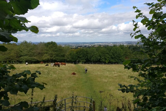
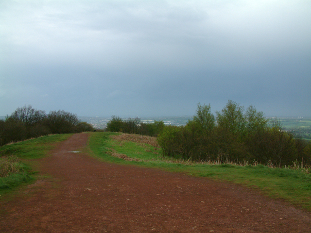
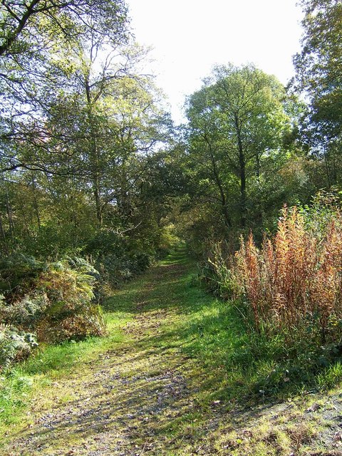
Uffmoor Wood is a picturesque woodland located in Worcestershire, England. Covering an area of approximately 100 hectares, it is a designated Site of Special Scientific Interest (SSSI) due to its abundance of diverse plant and animal species. The wood is situated on the northern slopes of the Clent Hills, offering stunning views of the surrounding countryside.

The wood itself is predominantly made up of broadleaf trees, such as oak, ash, and beech, which provide a rich and varied habitat for wildlife. Bluebells carpet the forest floor in spring, creating a breathtaking display of color. Uffmoor Wood is also home to a variety of bird species, including woodpeckers, nuthatches, and tawny owls, making it a popular spot for birdwatching enthusiasts.

The wood is crisscrossed with a network of well-maintained footpaths, allowing visitors to explore its natural beauty at their own pace. There are also several picnic areas dotted throughout the woodland, providing a tranquil spot for visitors to relax and enjoy a packed lunch.

Uffmoor Wood is managed by the Worcestershire Wildlife Trust, which works to protect and enhance the natural habitats within the wood. The trust also organizes guided walks and educational events, offering visitors the opportunity to learn more about the flora and fauna that call Uffmoor Wood home.

Overall, Uffmoor Wood is a haven for nature lovers, providing a peaceful retreat to escape the hustle and bustle of everyday life and immerse oneself in the beauty of the natural world.

If you have any feedback on the listing, please let us know in the comments section below.
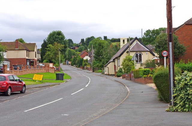
Uffmoor Wood Images

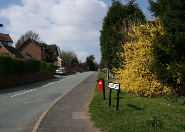
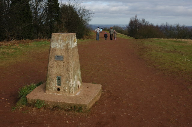
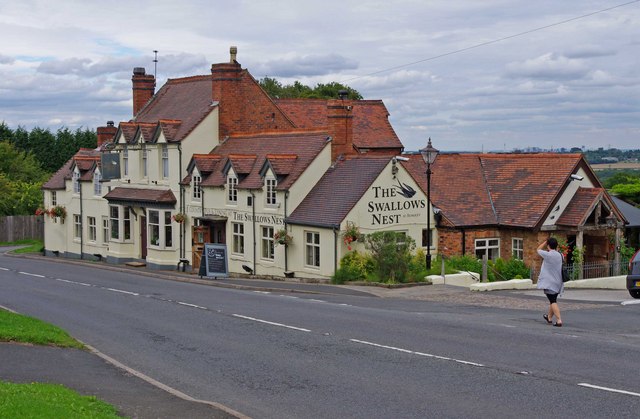
Images are sourced within 2km of 52.429184/-2.0705945 or Grid Reference SO9581. Thanks to Geograph Open Source API. All images are credited.

Path towards the Nimmings Plantation
Walton Hill Path along the summit ridge of Walton Hill, highest (315 metres above sea level) of the Clent Hills.
Walton Hill
Path along the summit ridge of Walton Hill, highest (315 metres above sea level) of the Clent Hills.
Swallow's Nest Pub, Romsley
St Kenelm's Road Romsley Junction with Dark Lane
St Kenelm's Road Romsley
Junction with Dark Lane
Poplar Lane, Romsley
Trig point on Walton Hill The trig point on Walton Hill is 315m above sea level.
Trig point on Walton Hill
The trig point on Walton Hill is 315m above sea level.
The Swallows Nest (formerly The Fighting Cocks), 40 Bromsgrove Road There used to be a lot of pubs in Romsley, but most closed long ago. The Fighting Cocks was one of the few survivors, and some years ago was renamed The Swallows Nest. The building was originally a row of labourers' cottages, belonging to a long gone farm opposite. The cottages were knocked into one, to make the pub, and this was licensed in 1825. It seems however that there was a Fighting Cocks inn or pub in Romsley from at least the 16th century, but that presumably was on a different site. The present pub's cellar is said to be haunted by a former landlady.

<a href="https://www.geograph.org.uk/photo/2026705">SO9679 : The Swallows Nest (pub sign), 40 Bromsgrove Road</a>.
The Swallows Nest (formerly The Fighting Cocks), 40 Bromsgrove Road
There used to be a lot of pubs in Romsley, but most closed long ago. The Fighting Cocks was one of the few survivors, and some years ago was renamed The Swallows Nest. The building was originally a row of labourers' cottages, belonging to a long gone farm opposite. The cottages were knocked into one, to make the pub, and this was licensed in 1825. It seems however that there was a Fighting Cocks inn or pub in Romsley from at least the 16th century, but that presumably was on a different site. The present pub's cellar is said to be haunted by a former landlady. SO9679 : The Swallows Nest (pub sign), 40 Bromsgrove Road.
The Swallows Nest (pub sign), 40 Bromsgrove Road The Swallows Nest is one of the pubs run by Vintage Inns. The previous sign has been replaced by this rather insipid design.

<a href="https://www.geograph.org.uk/photo/2026693">SO9679 : The Swallows Nest (formerly The Fighting Cocks), 40 Bromsgrove Road</a>.
The Swallows Nest (pub sign), 40 Bromsgrove Road
The Swallows Nest is one of the pubs run by Vintage Inns. The previous sign has been replaced by this rather insipid design. SO9679 : The Swallows Nest (formerly The Fighting Cocks), 40 Bromsgrove Road.
Romsley Methodist Church, Bromsgrove Road The church building dates from 1930. The red and white decor seems recent. On the Blackheath & Halesowen Circuit website, the photograph shows the building with dark blue and white paintwork.

<a href="https://www.geograph.org.uk/photo/2027999">SO9679 : Romsley Methodist Church - detail, Bromsgrove Road</a>.
Romsley Methodist Church, Bromsgrove Road
The church building dates from 1930. The red and white decor seems recent. On the Blackheath & Halesowen Circuit website, the photograph shows the building with dark blue and white paintwork. SO9679 : Romsley Methodist Church - detail, Bromsgrove Road.
Romsley Methodist Church - detail, Bromsgrove Road Above the door is a representation of a dove and the word "Peace". Above that is a stone, inscribed with the words "Methodist Church 1930".

<a href="https://www.geograph.org.uk/photo/2027991">SO9679 : Romsley Methodist Church, Bromsgrove Road</a>.
Romsley Methodist Church - detail, Bromsgrove Road
Above the door is a representation of a dove and the word "Peace". Above that is a stone, inscribed with the words "Methodist Church 1930". SO9679 : Romsley Methodist Church, Bromsgrove Road.
St. Kenelm's Church Hall, Bromsgrove Road The church itself is not in the village, but one and a quarter miles away, in rural countryside. It seems there used to be a settlement around it long ago, called Kenelmstowe, but that has disappeared, apart from a farmhouse. In the modern village of Romsley, the church has this hall, which is used for various functions both by the church, and other organisations. What is particularly interesting about the building, is that it started life as a National School in the middle of the 19th century. In 1925/26 it was remodelled as a mission room, but later became the church hall.
St. Kenelm's Church Hall, Bromsgrove Road
The church itself is not in the village, but one and a quarter miles away, in rural countryside. It seems there used to be a settlement around it long ago, called Kenelmstowe, but that has disappeared, apart from a farmhouse. In the modern village of Romsley, the church has this hall, which is used for various functions both by the church, and other organisations. What is particularly interesting about the building, is that it started life as a National School in the middle of the 19th century. In 1925/26 it was remodelled as a mission room, but later became the church hall.
St. Kenelm's Church of England Primary School, Bromsgrove Road A Church of England primary school, taking pupils in the age range 5 to 11 years old.
St. Kenelm's Church of England Primary School, Bromsgrove Road
A Church of England primary school, taking pupils in the age range 5 to 11 years old.
Junction of St. Kenelm's Road with Dark Lane Dark Lane is coming in on the left. Most of the built-up area of the village of Romsley is contained within a triangle, formed by these two roads and Bromsgrover Road (the B4551).
Junction of St. Kenelm's Road with Dark Lane
Dark Lane is coming in on the left. Most of the built-up area of the village of Romsley is contained within a triangle, formed by these two roads and Bromsgrover Road (the B4551).
Hillside Road One of the village's main residential roads, here seen from its junction with Dark Lane. There is some very nice housing in the village, and being so near to Birmingham, it is likely that most residents of working age commute to work in the Birmingham area.
Hillside Road
One of the village's main residential roads, here seen from its junction with Dark Lane. There is some very nice housing in the village, and being so near to Birmingham, it is likely that most residents of working age commute to work in the Birmingham area.
Bromsgrove Road (the B4551) The main road through the village, and which forms one of the three sides of the triangle, within which most of the village is contained. The other two are St. Kenelm's Road and Dark Lane. The cream coloured building on the right is St. Kenelm's Church Hall. The building started life as a national school, although it has been altered since then. The yellow sign on the left of the road, is to warn motorists of school crossing patrols in the area.

<a href="https://www.geograph.org.uk/photo/2028017">SO9679 : St. Kenelm's Church Hall, Bromsgrove Road</a>.
Bromsgrove Road (the B4551)
The main road through the village, and which forms one of the three sides of the triangle, within which most of the village is contained. The other two are St. Kenelm's Road and Dark Lane. The cream coloured building on the right is St. Kenelm's Church Hall. The building started life as a national school, although it has been altered since then. The yellow sign on the left of the road, is to warn motorists of school crossing patrols in the area. SO9679 : St. Kenelm's Church Hall, Bromsgrove Road.
BT Premises, Bromsgrove Road These premises belong to BT, the telecoms company. The back end of one of their vans can be seen on the left. On the right of the property is St. Kenelm's Church Hall.
BT Premises, Bromsgrove Road
These premises belong to BT, the telecoms company. The back end of one of their vans can be seen on the left. On the right of the property is St. Kenelm's Church Hall.
Shops, Kenelm Buildings, Bromsgrove Road On the left is Lana's Nails & Beauty, in the middle is Snippet One Hair Studio and on the right is Romsley Village Stores, which is also the Post Office. Its postal address is 99 Bromsgrove Road. Around the corner, facing St. Kenelm's Road, is David Withers, Butcher. It tells you a lot about a place this size, that it can support a butcher's shop. Most villages long ago lost theirs.

<a href="https://www.geograph.org.uk/photo/2045141">SO9679 : Shops, Kenelm Buildings, St Kenelm's Road</a>.
Shops, Kenelm Buildings, Bromsgrove Road
On the left is Lana's Nails & Beauty, in the middle is Snippet One Hair Studio and on the right is Romsley Village Stores, which is also the Post Office. Its postal address is 99 Bromsgrove Road. Around the corner, facing St. Kenelm's Road, is David Withers, Butcher. It tells you a lot about a place this size, that it can support a butcher's shop. Most villages long ago lost theirs. SO9679 : Shops, Kenelm Buildings, St Kenelm's Road.
Woodgate Christadelphians notice board, St. Kenelm's Road The Christadelphians are quite a small Christian sect, with perhaps 18,000 members in the UK, and maybe up to 60,000 worldwide. They don't have any premises in Romsley themselves, but the Woodgate Christadelphians do use the local Scout Centre for many of their activities. This notice board was on a gate near the local playing field/recreation area. Apparently the Christadelphians use the word devil as a reference to sin and human opposition to God. Their beliefs differ quite widely in some areas from the larger established churches.
Woodgate Christadelphians notice board, St. Kenelm's Road
The Christadelphians are quite a small Christian sect, with perhaps 18,000 members in the UK, and maybe up to 60,000 worldwide. They don't have any premises in Romsley themselves, but the Woodgate Christadelphians do use the local Scout Centre for many of their activities. This notice board was on a gate near the local playing field/recreation area. Apparently the Christadelphians use the word devil as a reference to sin and human opposition to God. Their beliefs differ quite widely in some areas from the larger established churches.
Show me another place!

Uffmoor Wood is located at Grid Ref: SO9581 (Lat: 52.429184, Lng: -2.0705945)

Administrative County: Worcestershire

District: Bromsgrove

Police Authority: West Mercia

What 3 Words

///twice.aside.ranks. Near Romsley, Worcestershire

Nearby Locations

Uffmoor Wood Breach Dingle

Related Wikis

Uffmoor Wood

Uffmoor Wood is a semi-natural woodland in Worcestershire, in the English Midlands. It is one of over a thousand woods cared for by the Woodland Trust...

Hunnington

Hunnington is a village and civil parish in the Bromsgrove District of Worcestershire, England, close to the border with West Midlands, and just south...

Hayley Green, West Midlands

Hayley Green is a suburb of Halesowen in the Metropolitan Borough of Dudley, West Midlands, England, located to the south-west of Halesowen town centre...

Hasbury

Hasbury is a suburb of Halesowen in the Metropolitan Borough of Dudley in West Midlands, England. Its main focal point is the small shopping centre at...

Hunnington railway station

Hunnington railway station was a railway station in the village of Hunnington, near Halesowen, England, on the Great Western Railway & Midland Railway...

Romsley, Worcestershire

Romsley is a village and civil parish in the Bromsgrove District of Worcestershire, England, on the east side of the Clent Hills about 4 miles south of...

Clent Hills

The Clent Hills lie 10 miles (16 km) south-west of Birmingham city centre in Clent, Worcestershire, England. The closest towns are Stourbridge and Halesowen...

Walton Hill

At 316 metres (1,037 ft) above sea level, Walton Hill is the highest point in the range of hills in northern Worcestershire known as the Clent Hills. It...

Nearby Amenities

Located within 500m of 52.429184,-2.0705945
Barrier: kissing_gate
Lat/Long: 52.4277182/-2.0637847
The data included in this document is from www.openstreetmap.org. The data is made available under ODbL.

Have you been to Uffmoor Wood?

Leave your review of Uffmoor Wood below (or comments, questions and feedback).