Feeder Plantation

Wood, Forest in Yorkshire Craven

England

Feeder Plantation

Flasby As seen from the footpath alongside Flasby Beck.
Flasby Credit: Bill Boaden

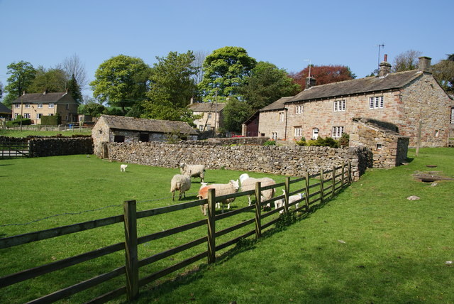
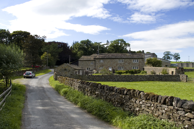
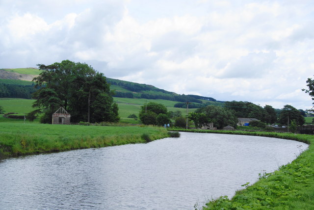
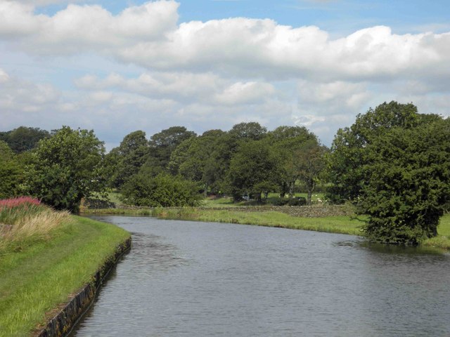
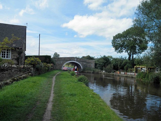
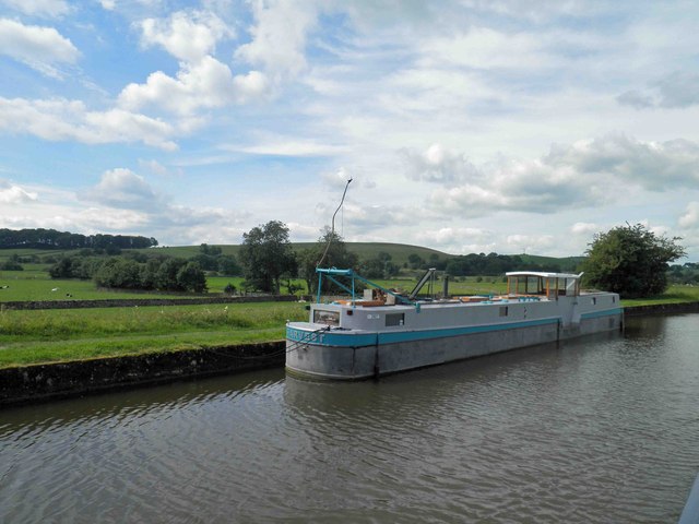
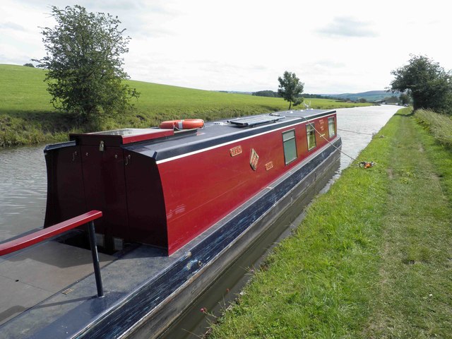
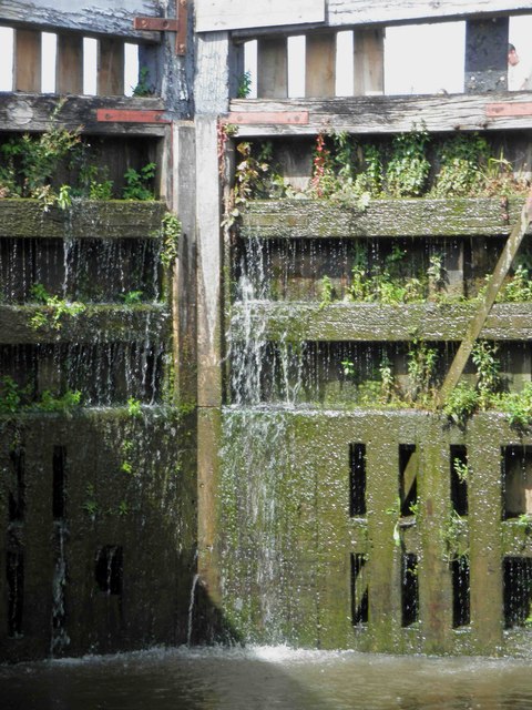
Feeder Plantation, located in Yorkshire, England, is a picturesque woodland area known for its dense vegetation and natural beauty. Covering a vast expanse of land, it is one of the largest plantations in the region, attracting nature enthusiasts, hikers, and birdwatchers alike.

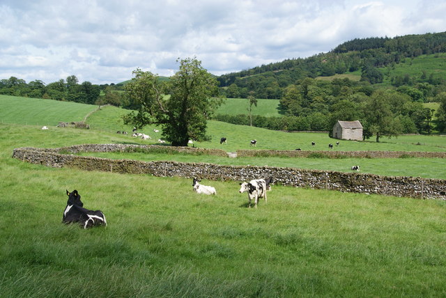
The plantation is primarily composed of various species of trees, with oak, beech, and birch being the most prevalent. The dense canopy created by these trees provides a sheltered environment for a diverse range of wildlife, including deer, foxes, and numerous bird species. This makes it an ideal destination for those interested in observing and studying the local fauna.

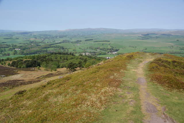
Traversing the plantation is made easy by a network of well-maintained footpaths, which allow visitors to explore the area at their own pace. The paths wind through the woodland, offering breathtaking views of the lush greenery and occasional glimpses of the wildlife that call this place their home.

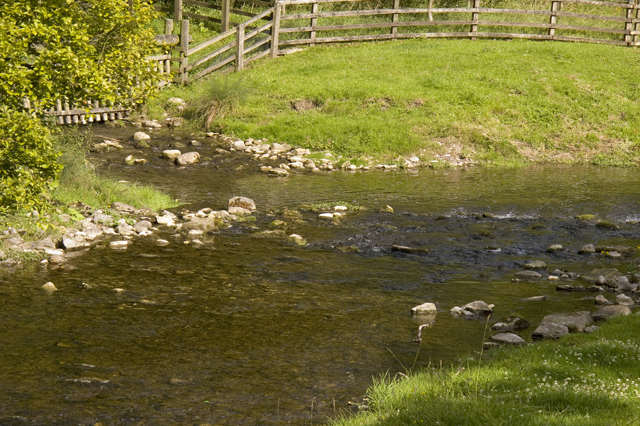
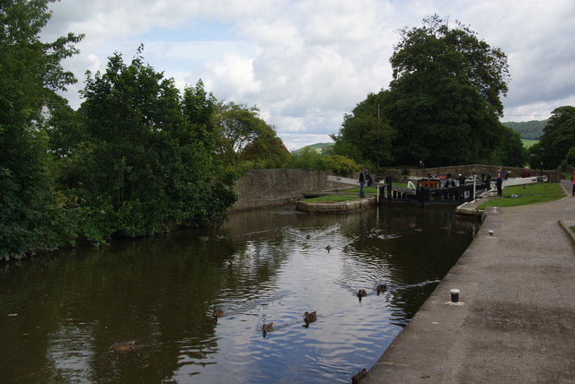
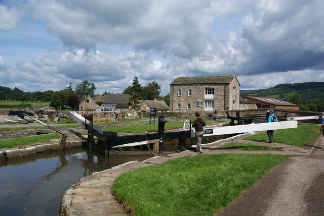
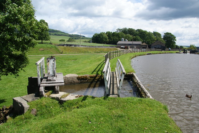
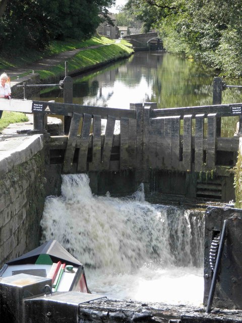
Furthermore, Feeder Plantation is also home to a small lake, which adds to the overall charm of the area. The tranquil waters attract various waterfowl, including ducks and swans, creating a serene atmosphere for visitors to enjoy.

In addition to its natural beauty, the plantation offers recreational activities such as picnicking and camping. The well-equipped picnic areas provide a great spot for families and friends to relax and enjoy a meal amidst the stunning surroundings. Camping facilities are also available for those who wish to spend the night, allowing them to fully immerse themselves in the tranquility of the woodland.

Overall, Feeder Plantation in Yorkshire is a haven for nature lovers, offering a combination of scenic beauty, diverse wildlife, and recreational activities for all to enjoy.

If you have any feedback on the listing, please let us know in the comments section below.

Feeder Plantation Images

Images are sourced within 2km of 53.989338/-2.0904957 or Grid Reference SD9454. Thanks to Geograph Open Source API. All images are credited.

Flasby As seen from the footpath alongside Flasby Beck.
Flasby
As seen from the footpath alongside Flasby Beck.
The north end of Sharp Haw hilltop This is taken from the trig point.
The north end of Sharp Haw hilltop
This is taken from the trig point.
Trig point on Sharp Haw It wasn't possible to view this without people. In the distance is Pendle, and to the right of it Longridge Fell.
Trig point on Sharp Haw
It wasn't possible to view this without people. In the distance is Pendle, and to the right of it Longridge Fell.
Confluence of Eshton Beck and Flasby Beck Flasby beck is joining up here with the larger Eshton Beck
Confluence of Eshton Beck and Flasby Beck
Flasby beck is joining up here with the larger Eshton Beck
Ducks by Lock 32 of the Leeds and Liverpool Canal The lock can accommodate two barges, and two are just about to emerge from the lock.
Ducks by Lock 32 of the Leeds and Liverpool Canal
The lock can accommodate two barges, and two are just about to emerge from the lock.
Lock 31 on the Leeds and Liverpool Canal This is by the Eshton Road bridge on the north side of Gargrave.
Lock 31 on the Leeds and Liverpool Canal
This is by the Eshton Road bridge on the north side of Gargrave.
A crop between the A65 and the Leeds and Liverpool Canal I didn't work out what was growing here. The road bridge crosses Eshton Brook which will join the River Aire shortly.
A crop between the A65 and the Leeds and Liverpool Canal
I didn't work out what was growing here. The road bridge crosses Eshton Brook which will join the River Aire shortly.
Sluice on the Leeds and Liverpool Canal This allows surplus water to flow into Eshton Brook.
Sluice on the Leeds and Liverpool Canal
This allows surplus water to flow into Eshton Brook.
A bend in the Leeds and Liverpool Canal This stretch  east of Gragrave seems wider than normal.
A bend in the Leeds and Liverpool Canal
This stretch east of Gragrave seems wider than normal.
Turning point (winding?) on the Leeds Liverpool canal One of two such points before the first lock at Gargrave.
Turning point (winding?) on the Leeds Liverpool canal
One of two such points before the first lock at Gargrave.
Filling lock 31 on the Leeds and Liverpool canal Gargrave
Bridge 172 Ray Bridge on the Leeds Liverpool canal near Gargrave
The vessel Harvest on the Leeds Liverpool canal
Bridge 173 Highgate bridge on the Leeds Liverpool canal
Silsden boats Gwen's Drum moored near a winding point on the Leeds Liverpool canal.
Lock gate 30 on the Leeds Liverpool canal Gargrave Complete with a substantial amount of greenery.
Lock gate 30 on the Leeds Liverpool canal Gargrave
Complete with a substantial amount of greenery.
Crumacre Laithe In the valley of Eshton Brook.
Crumacre Laithe
In the valley of Eshton Brook.
Show me another place!

Feeder Plantation is located at Grid Ref: SD9454 (Lat: 53.989338, Lng: -2.0904957)

Division: West Riding

Administrative County: North Yorkshire

District: Craven

Police Authority: North Yorkshire

What 3 Words

///durations.routines.nozzles. Near Gargrave, North Yorkshire

Related Wikis

Related Videos

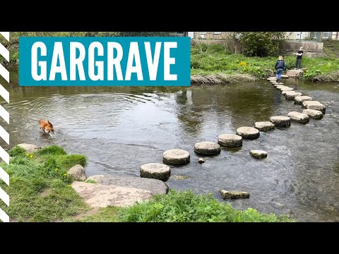
GARGRAVE VILLAGE near Skipton in THE YORKSHIRE DALES | Leeds Liverpool Canal Walks | The Pennine Way

We visit the beautiful English village of Gargrave in the Yorkshire Dales exploring things to do and checking whether it is worth ...

Walking the Leeds Liverpool canal

Checking a section of canal for a days Paddleboarding.

Walking With Sarcoma: Sharp Haw & Rough Haw pt2

Part 2 of my last walk before having my tumour removed. #sarcoma #synovialsarcoma #cancer #vlog #walkingwithsarcoma #blog ...

Top of Sharp Haw, nr Skipton

A short walk to the top of Sharp Haw. A location that gives wonderful views across the Yorkshire Dales. With just a short climb, the ...

Nearby Amenities

Located within 500m of 53.989338,-2.0904957
Parking
Lat/Long: 53.9861596/-2.0926688
Parking
Capacity: 4
Fee: no
Lat/Long: 53.9857755/-2.0933505
Robin Hill
Natural: peak
Source: OS 1:25k
Lat/Long: 53.9895632/-2.0847234
Ray Bridge Hill
Natural: peak
Source: OS 1:25k
Lat/Long: 53.9909887/-2.0938214
Seamark Type: gate
Waterway: lock_gate
Lat/Long: 53.9864389/-2.0875309
Seamark Type: gate
Waterway: lock_gate
Lat/Long: 53.9862744/-2.0873425
Phone
Emergency: phone
Note: Original by Pobice 2009. remapped top avoid JohnSmith tainting.aaed to remove non-OB
Lat/Long: 53.9857016/-2.093507
Phone
Emergency: phone
Note: Original by Pobice 2009. remapped top avoid JohnSmith tainting.aaed to remove non-OB
Lat/Long: 53.986175/-2.0925282
Waterway: turning_point
Lat/Long: 53.9877479/-2.095412
Power: pole
Lat/Long: 53.987124/-2.0902535
Barrier: stile
Source: GPS Survey
Lat/Long: 53.9877043/-2.095056
Historic: milestone
Source: GPS Survey
Lat/Long: 53.9874662/-2.0965058
Power: pole
Lat/Long: 53.9852173/-2.090621
Power: pole
Lat/Long: 53.9861052/-2.0906559
Power: pole
Lat/Long: 53.9870357/-2.0907202
Power: pole
Lat/Long: 53.9876476/-2.0902374
Power: pole
Lat/Long: 53.9881601/-2.0898646
Power: pole
Lat/Long: 53.9888571/-2.0893443
Power: pole
Lat/Long: 53.9893696/-2.0889714
Power: pole
Lat/Long: 53.990155/-2.0883492
Power: pole
Lat/Long: 53.9909308/-2.0877108
Power: pole
Lat/Long: 53.9918375/-2.0869437
Power: pole
Lat/Long: 53.9925108/-2.0863831
Barrier: stile
Lat/Long: 53.9927372/-2.0917434
The data included in this document is from www.openstreetmap.org. The data is made available under ODbL.

Have you been to Feeder Plantation?

Leave your review of Feeder Plantation below (or comments, questions and feedback).