Kidland Forest

Wood, Forest in Northumberland

England

Kidland Forest

The Yoke Burn in Kidland Forest Labelled as a ford on the 1:25k map, the Yoke Burn is now conveyed under the forestry track in a culvert.

This photograph was taken during the Coronavirus (COVID-19) pandemic of 2020/21/22.
The Yoke Burn in Kidland Forest Credit: James T M Towill

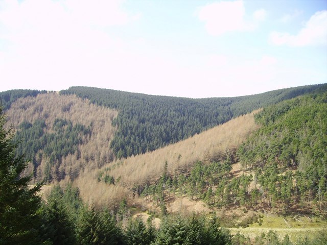
Kidland Forest is a majestic woodland located in the county of Northumberland, England. Covering an expansive area, this enchanting forest is a haven for nature lovers and outdoor enthusiasts alike. It lies within the North Pennines Area of Outstanding Natural Beauty, creating a picturesque setting that attracts visitors from far and wide.

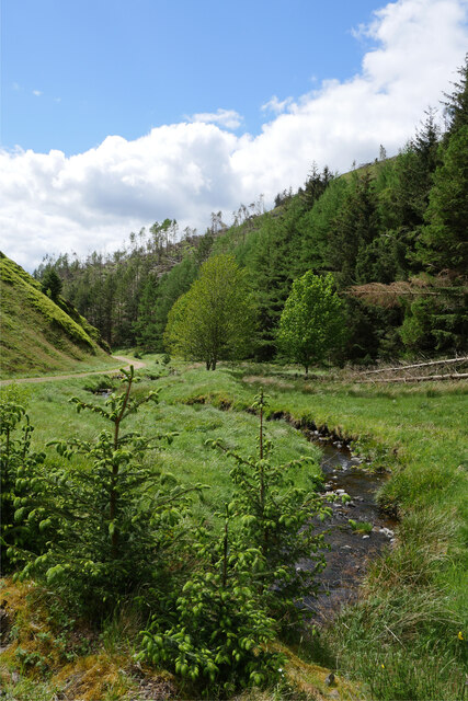
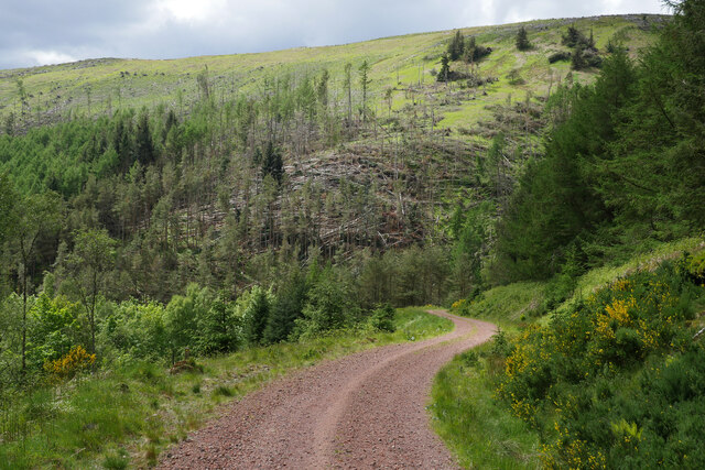
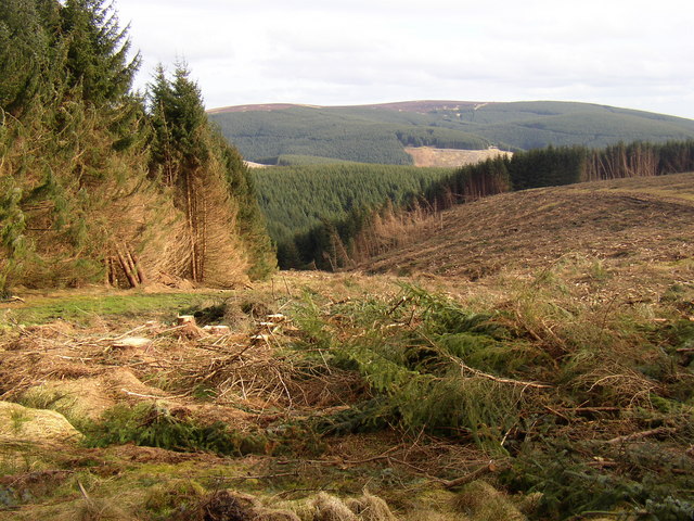
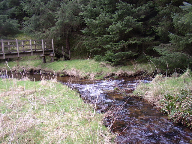
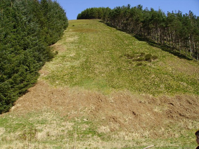
The forest is primarily composed of a variety of native trees, including oak, birch, and pine, which form a dense canopy overhead. This creates a serene atmosphere and provides ample shade for those exploring the woodland on hot summer days. The forest floor is covered in a rich carpet of moss, ferns, and wildflowers, adding to the beauty of the surroundings.

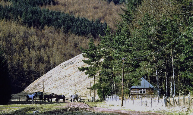
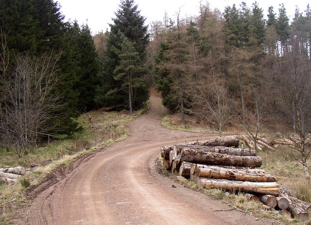
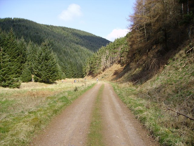
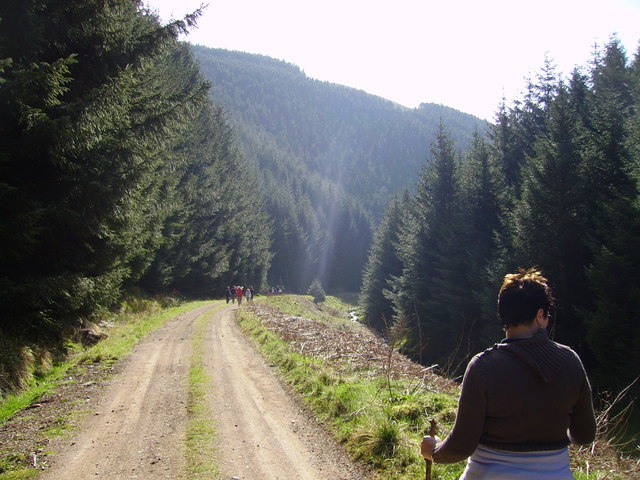
Kidland Forest offers a multitude of walking trails, ranging from leisurely strolls to more challenging hikes. These well-maintained paths wind through the forest, offering glimpses of breathtaking vistas and wildlife along the way. Visitors may spot roe deer, red squirrels, and a wide array of bird species, creating a captivating experience for nature enthusiasts.

For those seeking a more immersive experience, camping is permitted in designated areas within the forest. This allows visitors to fully embrace the tranquility of their surroundings and spend the night under the starry sky. Additionally, there are picnic areas scattered throughout the forest, providing the perfect opportunity to relax and enjoy a meal amidst nature's beauty.

Kidland Forest truly embodies the essence of Northumberland's natural beauty. With its diverse flora and fauna, well-maintained trails, and peaceful ambiance, it is a must-visit destination for anyone looking to reconnect with nature in this stunning region of England.

If you have any feedback on the listing, please let us know in the comments section below.

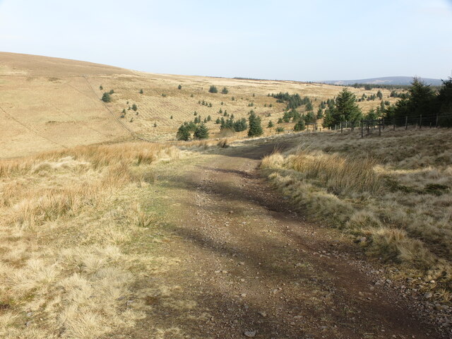
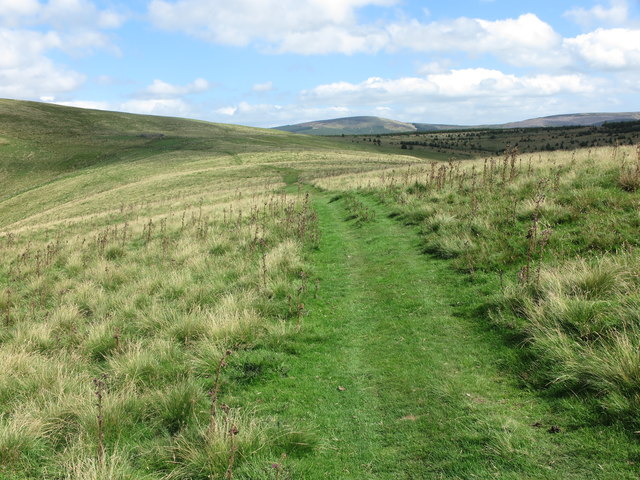
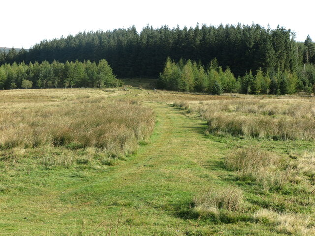
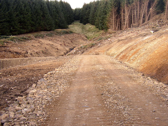
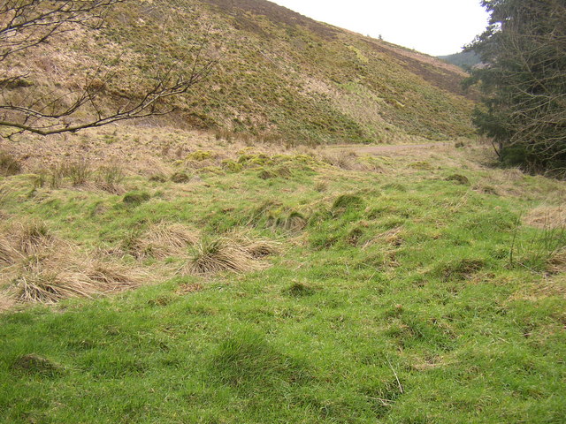
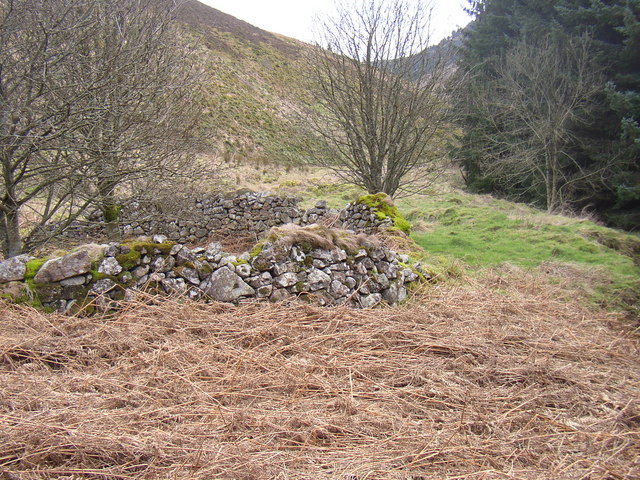
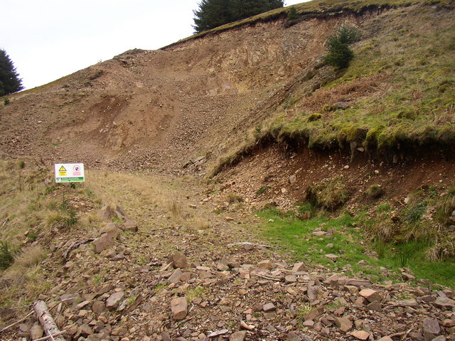
Kidland Forest Images

Images are sourced within 2km of 55.396412/-2.1505763 or Grid Reference NT9011. Thanks to Geograph Open Source API. All images are credited.

The Yoke Burn in Kidland Forest Labelled as a ford on the 1:25k map, the Yoke Burn is now conveyed under the forestry track in a culvert.

This photograph was taken during the Coronavirus (COVID-19) pandemic of 2020/21/22.
The Yoke Burn in Kidland Forest
Labelled as a ford on the 1:25k map, the Yoke Burn is now conveyed under the forestry track in a culvert. This photograph was taken during the Coronavirus (COVID-19) pandemic of 2020/21/22.
A track between Meadow Sike and Milkhope Heading back down to the valley floor track after a cycle to Sting Head.  Storm Arwen (26/27 November 2021) has resulted in destruction of numerous areas within Kidland Forest as seen on the hillside in the background.

This photograph was taken during the Coronavirus (COVID-19) pandemic of 2020/21/22.
A track between Meadow Sike and Milkhope
Heading back down to the valley floor track after a cycle to Sting Head. Storm Arwen (26/27 November 2021) has resulted in destruction of numerous areas within Kidland Forest as seen on the hillside in the background. This photograph was taken during the Coronavirus (COVID-19) pandemic of 2020/21/22.
Hut and ponies beside bridleway This is in the valley of the Yoke Beck in the Kidland Forest as the sign close to the animals tells. The image was made in 1995 and the building, may no longer be there.
Geoff Holland has a more recent image taken from a little further north and so probably beyond the hut's location - <a title="https://www.geograph.org.uk/photo/6856451" href="https://www.geograph.org.uk/photo/6856451">Link</a> .
Hut and ponies beside bridleway
This is in the valley of the Yoke Beck in the Kidland Forest as the sign close to the animals tells. The image was made in 1995 and the building, may no longer be there. Geoff Holland has a more recent image taken from a little further north and so probably beyond the hut's location - Link .
JCB Mini Digger above the Wholehope Burn This digger, which was lying idle when I passed by, had been used for digging drainage ditches alongside the track referred to at <a title="https://www.geograph.org.uk/photo/7126230" href="https://www.geograph.org.uk/photo/7126230">Link</a>. The hill in the middle distance is Inner Hill on Shillhope Law. For a selection of detailed free to download walking routes in the area visit <span class="nowrap"><a title="www.cheviotwalks.co.uk" rel="nofollow ugc noopener" href="http://www.cheviotwalks.co.uk">Link</a><img style="margin-left:2px;" alt="External link" title="External link - shift click to open in new window" src="https://s1.geograph.org.uk/img/external.png" width="10" height="10"/></span>
JCB Mini Digger above the Wholehope Burn
This digger, which was lying idle when I passed by, had been used for digging drainage ditches alongside the track referred to at Link. The hill in the middle distance is Inner Hill on Shillhope Law. For a selection of detailed free to download walking routes in the area visit LinkExternal link
Track near Wholehope Knowe This track, which was originally constructed by the MoD, runs from Shillmoor in Upper Coquetdale to the edge of the Kidland Forest on Wholehope Knowe. Along the way it winds around the head of the beautiful Wholehope Burn. For a selection of detailed free to download walking routes in the area visit <span class="nowrap"><a title="www.cheviotwalks.co.uk" rel="nofollow ugc noopener" href="http://www.cheviotwalks.co.uk">Link</a><img style="margin-left:2px;" alt="External link" title="External link - shift click to open in new window" src="https://s1.geograph.org.uk/img/external.png" width="10" height="10"/></span>
Track near Wholehope Knowe
This track, which was originally constructed by the MoD, runs from Shillmoor in Upper Coquetdale to the edge of the Kidland Forest on Wholehope Knowe. Along the way it winds around the head of the beautiful Wholehope Burn. For a selection of detailed free to download walking routes in the area visit LinkExternal link
Public Footpath near Saughy Hill This public footpath links Shillmoor in Upper Coquetdale with Clennell Street just beyond Saughy Hill. Along the way the path crosses Copper Snout. For a selection of detailed free to download walking routes in the area visit <span class="nowrap"><a title="www.cheviotwalks.co.uk" rel="nofollow ugc noopener" href="http://www.cheviotwalks.co.uk">Link</a><img style="margin-left:2px;" alt="External link" title="External link - shift click to open in new window" src="https://s1.geograph.org.uk/img/external.png" width="10" height="10"/></span>
Public Footpath near Saughy Hill
This public footpath links Shillmoor in Upper Coquetdale with Clennell Street just beyond Saughy Hill. Along the way the path crosses Copper Snout. For a selection of detailed free to download walking routes in the area visit LinkExternal link
Track, Wholehope Knowe This track appears to be an extension of the track shown a short distance to the north east which ultimately crosses the head of the Wholehope Burn to join the track over Copper Snout on Saugh Rigg. I believe that this track was originally constructed by the MoD as part of the Otterburn Dry Training Area. The track also leads through the trees in the background to join the cross-border track of Clennell Street. For a selection of detailed free to download walking routes in the area visit <span class="nowrap"><a title="www.cheviotwalks.co.uk" rel="nofollow ugc noopener" href="http://www.cheviotwalks.co.uk">Link</a><img style="margin-left:2px;" alt="External link" title="External link - shift click to open in new window" src="https://s1.geograph.org.uk/img/external.png" width="10" height="10"/></span>
Track, Wholehope Knowe
This track appears to be an extension of the track shown a short distance to the north east which ultimately crosses the head of the Wholehope Burn to join the track over Copper Snout on Saugh Rigg. I believe that this track was originally constructed by the MoD as part of the Otterburn Dry Training Area. The track also leads through the trees in the background to join the cross-border track of Clennell Street. For a selection of detailed free to download walking routes in the area visit LinkExternal link
New road at Lindhope Linn, Kidland Forest. The trees in Kidland Forest have reached maturity. This road has been constructed to give access to this remote area of the forest for the harvesting of trees.
New road at Lindhope Linn, Kidland Forest.
The trees in Kidland Forest have reached maturity. This road has been constructed to give access to this remote area of the forest for the harvesting of trees.
Memmer Kirk (remains of) Believed to be the site of a Medieval Chapel
Memmer Kirk (remains of)
Believed to be the site of a Medieval Chapel
Stell next to the site of Memmer Kirk
Quarry in Yoke Burn area of Kidland Forest A new Forestry access road is under construction in this area of the forest and stone from this quarry is being used in that process.
Quarry in Yoke Burn area of Kidland Forest
A new Forestry access road is under construction in this area of the forest and stone from this quarry is being used in that process.
Bridleway to Heigh leaves the forest road in Kidland
Tree felling in Kidland Forest
The Yoke Burn and White Burn join to form the River Alwin
Looking up slope from valley floor Looking up the Slope (ski run?) near to Wether Hill from close to Whiteburnshank
Looking up slope from valley floor
Looking up the Slope (ski run?) near to Wether Hill from close to Whiteburnshank
Looking along valley Looking along valley near Sneer Hill (right of picture)
Looking along valley
Looking along valley near Sneer Hill (right of picture)
Looking across valley View of valley much better than my pic can show worth the walk up to it.
Looking across valley
View of valley much better than my pic can show worth the walk up to it.
Looking along valley floor Valley floor down from Whiteburnshank
Looking along valley floor
Valley floor down from Whiteburnshank
Show me another place!

Kidland Forest is located at Grid Ref: NT9011 (Lat: 55.396412, Lng: -2.1505763)

Unitary Authority: Northumberland

Police Authority: Northumbria

What 3 Words

///melon.steams.divorcing. Near Rochester, Northumberland

Related Wikis

Kidland

Kidland is a former civil parish, now in the parish of Alwinton in Northumberland, England, about 2 miles (3 km) northwest of Alwinton village. In 1951...

Shillhope Law

Shillhope Law is a hill in the southern Cheviots, a range of hills in Northumberland, England. Shillhope Law is a relatively unremarkable member of this...

Barrow Burn Meadows

Barrow Burn Meadows is a Site of Special Scientific Interest (SSSI) in north Northumberland, England. The site is a species-rich hay meadow of a sort now...

Barrow Burn

Barrowburn is a hamlet in Upper Coquetdale in the county of Northumberland, England. It comprises a working farm with associated buildings and two holiday...

Nearby Amenities

Located within 500m of 55.396412,-2.1505763
Sneer Hill
Created By: Potlatch 0.10f
Place: locality
Lat/Long: 55.3988891/-2.1492468
Ford: yes
Lat/Long: 55.3923533/-2.1480575
The data included in this document is from www.openstreetmap.org. The data is made available under ODbL.

Have you been to Kidland Forest?

Leave your review of Kidland Forest below (or comments, questions and feedback).