Church Plantation

Wood, Forest in Wiltshire

England

Church Plantation

Clanger Wood, Wiltshire Farmland adjacent to the western perimeter of Clanger Wood.
Clanger Wood, Wiltshire Credit: Rebecca A Wills

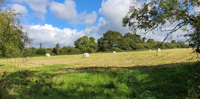
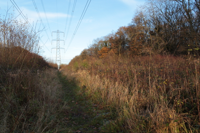
Church Plantation is a small woodland area located in the county of Wiltshire, England. Situated near the village of Wood, this forested region spans approximately 50 acres of land. The plantation is named after the nearby Church of St. Mary, which dates back to the 12th century and stands as a historical landmark in the area.

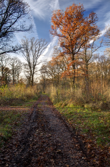
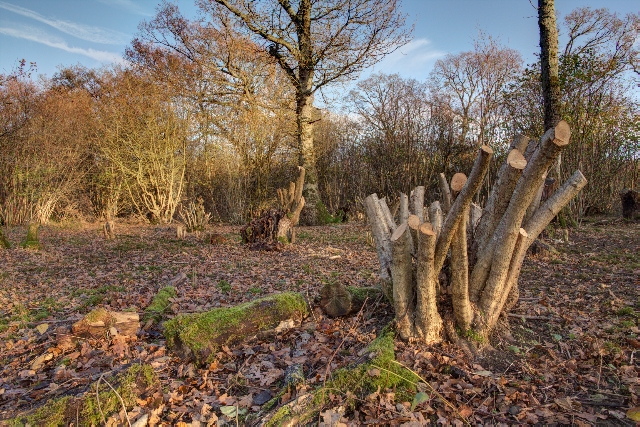
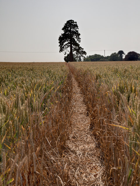
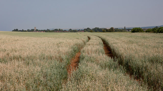
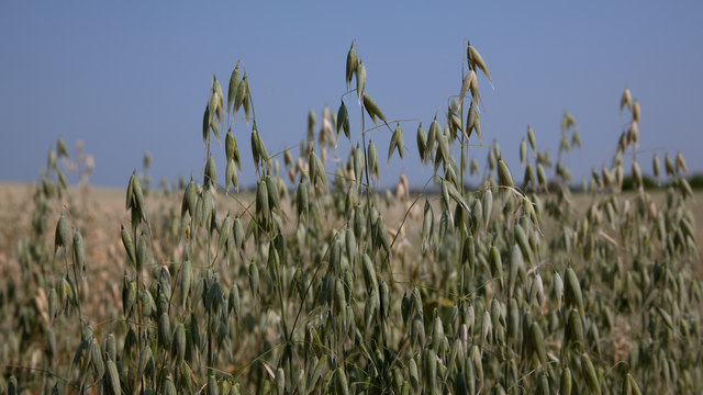
The woodland of Church Plantation is characterized by a diverse range of trees, including oak, beech, and ash, which provide a rich habitat for various wildlife species. The forest floor is covered in a thick carpet of moss and ferns, adding to the area's natural beauty.

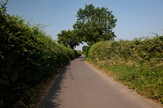
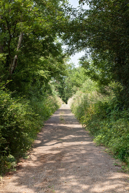
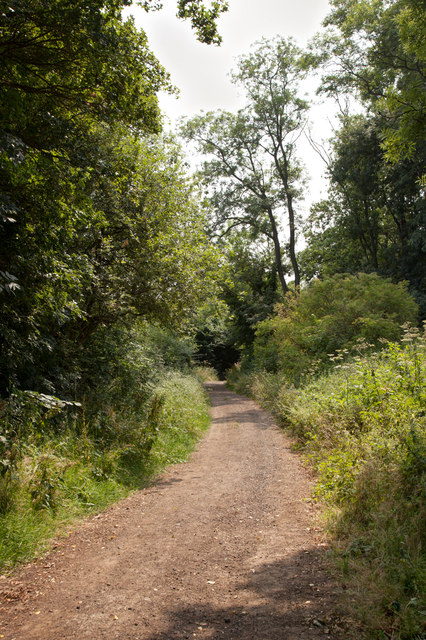
The woodland is intersected by a network of footpaths, allowing visitors to explore the area and enjoy its tranquil ambiance. These paths wind through the forest, providing opportunities for hiking, nature walks, and birdwatching. The plantation is a popular destination for outdoor enthusiasts and nature lovers, offering a peaceful retreat from the surrounding urban areas.

Church Plantation also holds cultural significance, as it is believed to have been a source of timber for the construction of the nearby church centuries ago. The woodland continues to be managed sustainably, ensuring its longevity and preserving its ecological importance.

Overall, Church Plantation in Wiltshire offers a picturesque and serene natural environment, providing visitors with a chance to immerse themselves in the beauty of the English countryside.

If you have any feedback on the listing, please let us know in the comments section below.

Church Plantation Images

Images are sourced within 2km of 51.304548/-2.1736958 or Grid Reference ST8756. Thanks to Geograph Open Source API. All images are credited.

Clanger Wood, Wiltshire Farmland adjacent to the western perimeter of Clanger Wood.
Clanger Wood, Wiltshire
Farmland adjacent to the western perimeter of Clanger Wood.
Old Milestone by the A350, Westbury Road, Yarnbrook Metal plate attached to stone post by the A350, in parish of North Bradley (West Wiltshire District), Westbury Road, Yarnbrook, in front of service road near No. 46 on verge, on East side of road. Westbury plate, erected by the Westbury turnpike trust in the 19th century.

Inscription reads:-
99
LONDON
{line}
TROWBRIDGE 3
{arrow}
WESTBURY 2
{arrow}

Milestone Society National ID: WI_WYMK02
Old Milestone by the A350, Westbury Road, Yarnbrook
Metal plate attached to stone post by the A350, in parish of North Bradley (West Wiltshire District), Westbury Road, Yarnbrook, in front of service road near No. 46 on verge, on East side of road. Westbury plate, erected by the Westbury turnpike trust in the 19th century. Inscription reads:- 99 LONDON {line} TROWBRIDGE 3 {arrow} WESTBURY 2 {arrow} Milestone Society National ID: WI_WYMK02
Old Milestone by the A350, Yarnbrook Road, West Ashton Stone post (plate lost) by the A350, in parish of WEST ASHTON (WEST WILTSHIRE District), Yarnbrook Road; West Ashton; 200m South of crossroads/traffic lights, on the verge, on East side of road. Westbury plate, erected by the Westbury turnpike trust in the 19th century. 

Inscription once read:-
(Westbury)
(3)
(Melksham)
(5½)
Carved benchmark right middle. 

Milestone Society National ID: WI_WYMK03.
Old Milestone by the A350, Yarnbrook Road, West Ashton
Stone post (plate lost) by the A350, in parish of WEST ASHTON (WEST WILTSHIRE District), Yarnbrook Road; West Ashton; 200m South of crossroads/traffic lights, on the verge, on East side of road. Westbury plate, erected by the Westbury turnpike trust in the 19th century. Inscription once read:- (Westbury) (3) (Melksham) (5½) Carved benchmark right middle. Milestone Society National ID: WI_WYMK03.
Passenger Train at Yarnbrook Passenger train passing the lake near Yarnbrook.
Passenger Train at Yarnbrook
Passenger train passing the lake near Yarnbrook.
Entrance to North Bradley
Path in Green Lane Wood Green Lane Wood is owned and managed by the Wiltshire Wildlife Trust.  This is the main track into the wood from the car park on the A350.
Path in Green Lane Wood
Green Lane Wood is owned and managed by the Wiltshire Wildlife Trust. This is the main track into the wood from the car park on the A350.
Recently Coppiced Trees in Green Lane Wood Green Lane Wood is owned and managed by the Wiltshire Wildlife Trust.  Coppicing is carried out each winter by volunteers.
Recently Coppiced Trees in Green Lane Wood
Green Lane Wood is owned and managed by the Wiltshire Wildlife Trust. Coppicing is carried out each winter by volunteers.
Electricity Pylon in Green Lane Wood A footpath runs underneath the line of the pylons which pass through the centre of the wood.
Electricity Pylon in Green Lane Wood
A footpath runs underneath the line of the pylons which pass through the centre of the wood.
Clearing for Pylons Through Green Lane Wood There is a clearing through the centre of Green Lane Wood for a line of electricity pylons.  A footpath runs underneath the pylons through the centre of this clearing.
Clearing for Pylons Through Green Lane Wood
There is a clearing through the centre of Green Lane Wood for a line of electricity pylons. A footpath runs underneath the pylons through the centre of this clearing.
A350 approaching Yarnbrook
Westbury Road Yarnbrook
Wind Pump at East Town Farm Seven years on from <a href="https://www.geograph.org.uk/photo/716683">ST8955 : 2008 : Wind Pump at East Town Farm</a> and the wind pump is still maintained.

In the distance through the gap in the trees you can see the church of St. Mary in Steeple Ashton
Wind Pump at East Town Farm
Seven years on from ST8955 : 2008 : Wind Pump at East Town Farm and the wind pump is still maintained. In the distance through the gap in the trees you can see the church of St. Mary in Steeple Ashton
Footpath through the wheat
West Ditch Lane
West Ditch Lane
North along Mudmead Lane Mudmead Lane is a restricted byway
North along Mudmead Lane
Mudmead Lane is a restricted byway
South along Mudmead Lane Mudmead Lane is a restricted byway
South along Mudmead Lane
Mudmead Lane is a restricted byway
View towards Steeple Ashton The field is planted with a crop of oats
View towards Steeple Ashton
The field is planted with a crop of oats
Field of oats This is a view of the oats shown in <a href="https://www.geograph.org.uk/photo/3565478">ST8957 : View towards Steeple Ashton</a>
Field of oats
This is a view of the oats shown in ST8957 : View towards Steeple Ashton
Show me another place!

Church Plantation is located at Grid Ref: ST8756 (Lat: 51.304548, Lng: -2.1736958)

Unitary Authority: Wiltshire

Police Authority: Wiltshire

What 3 Words

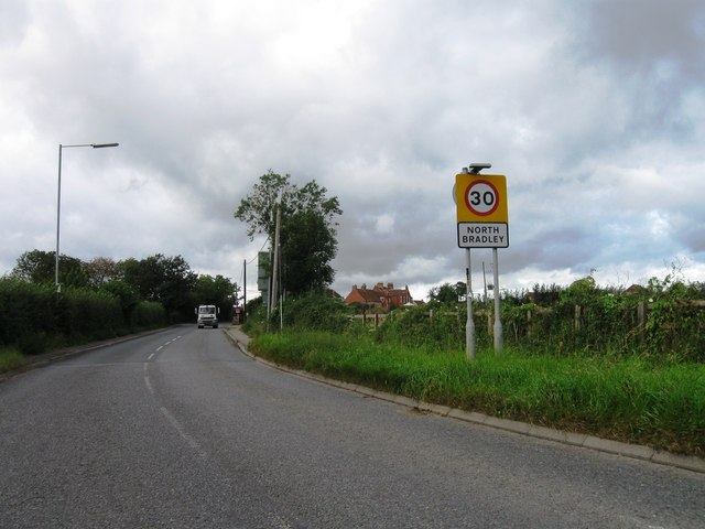
///choppers.drilling.eyeliner. Near North Bradley, Wiltshire

Related Wikis

West Ashton

West Ashton is a village and civil parish in Wiltshire, England. It is about 2 miles (3.2 km) southeast of Trowbridge, near the A350 between Melksham and...

Rood Ashton House

Rood Ashton House was a country house in Wiltshire, England, standing in parkland 0.5 miles (0.80 km) northeast of the village of West Ashton, near Trowbridge...

Yarnbrook

Yarnbrook is a large hamlet in Wiltshire, England, between the towns of Westbury and Trowbridge. Most of the settlement lies in the civil parish of North...

Picket and Clanger Wood

Picket and Clanger Wood (grid reference ST875543) is a 66.4 hectare biological Site of Special Scientific Interest in Wiltshire, England, and lies off...

North Bradley

North Bradley is a village and civil parish in Wiltshire, England, between Trowbridge and Westbury. The village is about 1.75 miles (2.8 km) south of Trowbridge...

Trowbridge Town F.C.

Trowbridge Town Football Club is a football club based in Trowbridge, Wiltshire, England. They are currently champions of the Wiltshire League Premier...

Heywood, Wiltshire

Heywood is a civil parish and small village in the county of Wiltshire in southwestern England. The village is approximately 1.5 miles (2.4 km) north of...

Ashton Common

Ashton Common is a hamlet in Wiltshire, England, to the east of Trowbridge. The hamlet lies on Common Hill, a little south of the A350 road, within the...

Nearby Amenities

Located within 500m of 51.304548,-2.1736958
Traffic Signals
Lat/Long: 51.3013967/-2.1776678
Traffic Signals
Lat/Long: 51.3013766/-2.1779714
Traffic Signals
Lat/Long: 51.3010817/-2.1780355
Traffic Signals
Lat/Long: 51.3012166/-2.1775388
Barrier: stile
Lat/Long: 51.3087163/-2.1732164
Post Box
Mapillary: 275607287634293
Operator: Royal Mail
Operator Wikidata: Q638098
Post Box Mounting: pier
Post Box Type: lamp
Lat/Long: 51.3005053/-2.1759088
The data included in this document is from www.openstreetmap.org. The data is made available under ODbL.

Have you been to Church Plantation?

Leave your review of Church Plantation below (or comments, questions and feedback).