Swallowcroft Wood

Wood, Forest in Staffordshire Newcastle-under-Lyme

England

Swallowcroft Wood

Clock House Drive, Keele Hall This Used to be the old entrance drive to Keele Hall
Clock House Drive, Keele Hall Credit: Brian Deegan

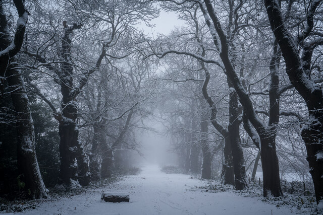
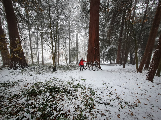
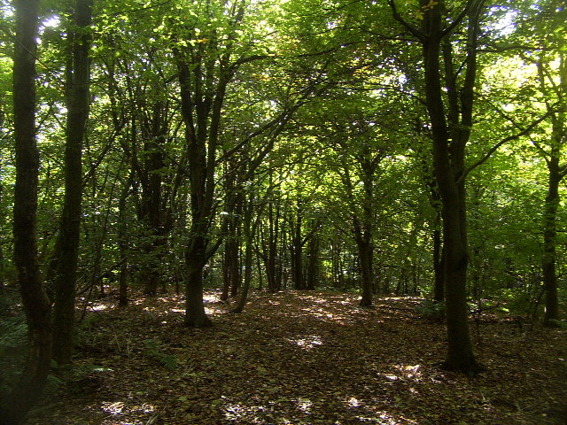
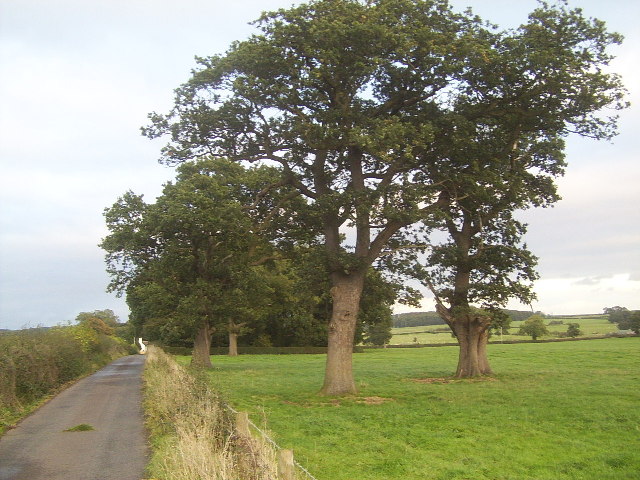
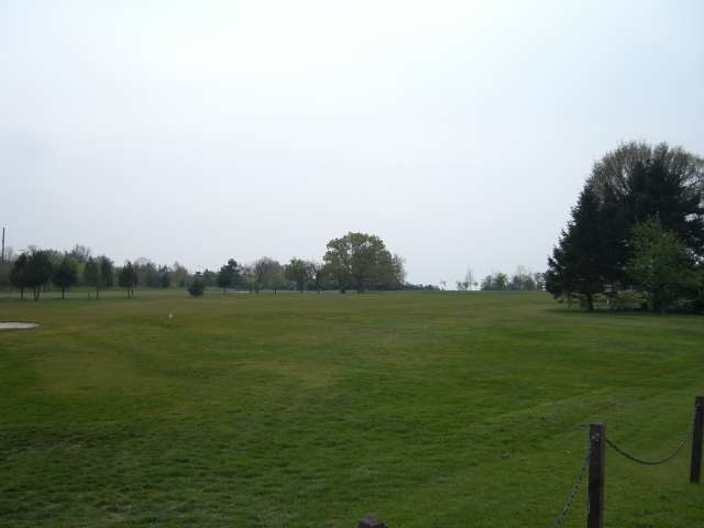
Swallowcroft Wood is a picturesque woodland located in Staffordshire, England. Covering an area of approximately 50 acres, it is a popular destination for nature lovers and outdoor enthusiasts. The woodland is characterized by its diverse range of trees, including oak, beech, and ash, which provide a stunning canopy of greenery throughout the year.

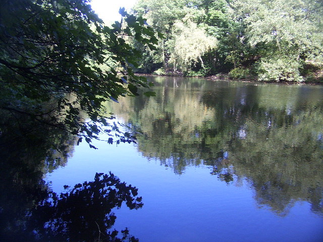
One of the notable features of Swallowcroft Wood is its rich biodiversity. The forest is home to a variety of wildlife species, such as deer, foxes, badgers, and numerous bird species. This makes it an ideal spot for birdwatching and wildlife observation. The serene and tranquil atmosphere of the wood also attracts visitors who seek a peaceful retreat from the hustle and bustle of urban life.

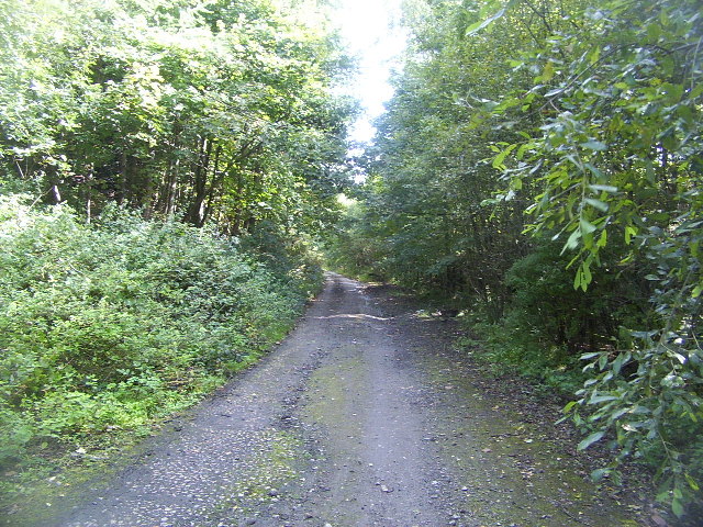
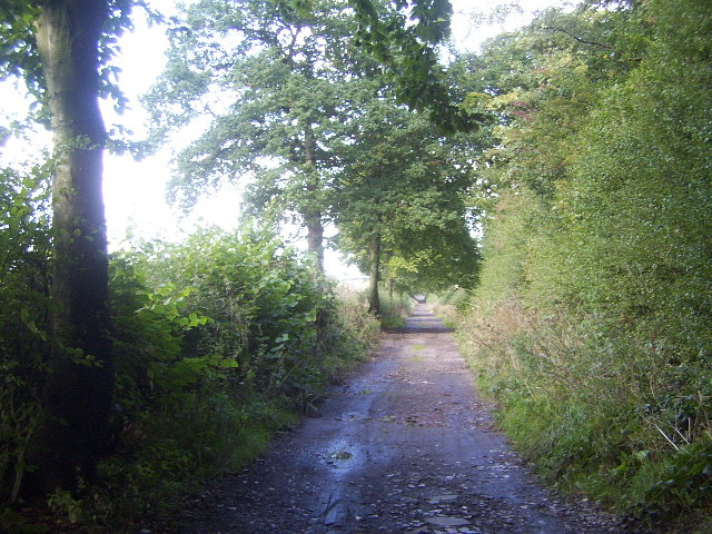
The woodland offers several walking trails, providing visitors with the opportunity to explore its beauty at their own pace. These trails are well-maintained and allow visitors to immerse themselves in the natural surroundings. Additionally, there are picnic areas scattered throughout the woodland, allowing visitors to enjoy a meal amidst nature.

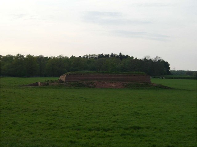
Swallowcroft Wood is also steeped in history, with evidence of human habitation dating back to the Bronze Age. Archaeological remains, including burial mounds and ancient structures, have been discovered within the woodland, adding to its historical significance.

Overall, Swallowcroft Wood is a captivating destination that offers a blend of natural beauty, wildlife, and historical interest. Whether it is for a leisurely walk, wildlife spotting, or exploration of its historical past, this woodland provides a delightful experience for visitors of all ages.

If you have any feedback on the listing, please let us know in the comments section below.

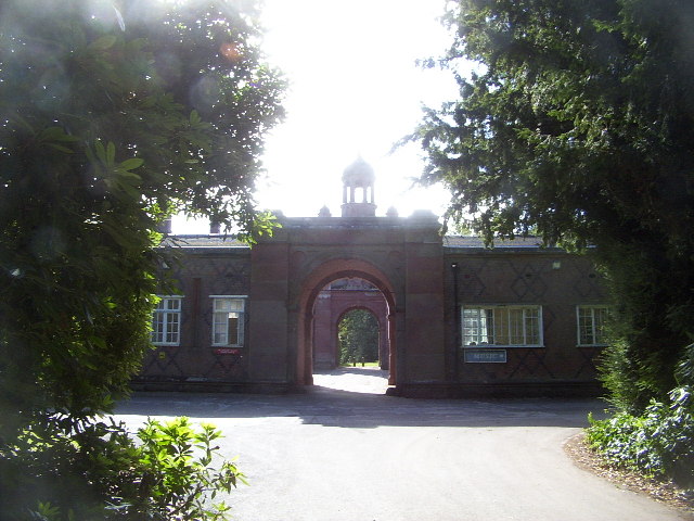
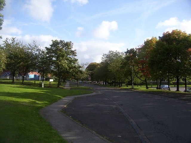
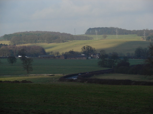
Swallowcroft Wood Images

Images are sourced within 2km of 52.990417/-2.2691345 or Grid Reference SJ8243. Thanks to Geograph Open Source API. All images are credited.

Clock House Drive, Keele Hall This Used to be the old entrance drive to Keele Hall
Clock House Drive, Keele Hall
This Used to be the old entrance drive to Keele Hall
Keele Redwoods in the Snow
Keele Hall in the Snow Built 1851 on the site of an earlier Hall . Now Keele University campus. 

<span class="nowrap"><a title="https://en.wikipedia.org/wiki/Keele_Hall" rel="nofollow ugc noopener" href="https://en.wikipedia.org/wiki/Keele_Hall">Link</a><img style="margin-left:2px;" alt="External link" title="External link - shift click to open in new window" src="https://s1.geograph.org.uk/img/external.png" width="10" height="10"/></span>
Keele Hall in the Snow
Built 1851 on the site of an earlier Hall . Now Keele University campus. LinkExternal link
Keele Hall, Keele This historic house now forms part of the campus of the University of Keele. Some of the grounds of the house still also survive.
Keele Hall, Keele
This historic house now forms part of the campus of the University of Keele. Some of the grounds of the house still also survive.
Keele Service Station The service station on the M6 very early in the morning.
Keele Service Station
The service station on the M6 very early in the morning.
Freeze-Frame Managed to make these fast-moving cars on the M6 southbound by Keele services look stationary using 1/500th sec. exposure.
Freeze-Frame
Managed to make these fast-moving cars on the M6 southbound by Keele services look stationary using 1/500th sec. exposure.
Keele University Observatory The University observatory houses a 60cm telescope. Here a mount for another telescope can be seen in the foreground.
Keele University Observatory
The University observatory houses a 60cm telescope. Here a mount for another telescope can be seen in the foreground.
Woods near Keele University An early autumn day in the woods near Keele University. A lot of this square is open woodland that used to form the grounds of Keele Hall. Since the University took over the Hall and its 617 acre grounds, this area is now public access, with many footpaths among the trees and ponds.
Woods near Keele University
An early autumn day in the woods near Keele University. A lot of this square is open woodland that used to form the grounds of Keele Hall. Since the University took over the Hall and its 617 acre grounds, this area is now public access, with many footpaths among the trees and ponds.
Pool near Keele Hall This is the lowermost of the ponds that extend south-east from Keele Hall <a href="https://www.geograph.org.uk/photo/14295">SJ8144 : Keele Hall, Keele</a> towards Springpool Wood. There are many possible walks around the area.
Pool near Keele Hall
This is the lowermost of the ponds that extend south-east from Keele Hall SJ8144 : Keele Hall, Keele towards Springpool Wood. There are many possible walks around the area.
The Lymes Road According to the 1940s map, this was originally a B-road, leading down to The Lymes, also in this square. Now it is only a loose-cobbled track running between Keele village and The Lymes. It also serves as a bridleway. Here is it seen just before it passes underneath the M6, which it now runs next to.
The Lymes Road
According to the 1940s map, this was originally a B-road, leading down to The Lymes, also in this square. Now it is only a loose-cobbled track running between Keele village and The Lymes. It also serves as a bridleway. Here is it seen just before it passes underneath the M6, which it now runs next to.
The Lymes Road More of The Lymes Road (see <a href="https://www.geograph.org.uk/gridref/SJ8243">SJ8243</a>), which runs between Keele village and The Lymes farm.
The Lymes Road
More of The Lymes Road (see SJ8243), which runs between Keele village and The Lymes farm.
The Clock House The Clock House, part of Keele University. It also houses the Music Department and has an attractive rock-cutting entrance.
The Clock House
The Clock House, part of Keele University. It also houses the Music Department and has an attractive rock-cutting entrance.
Keele University Campus Part of Keele University Campus, near Barnes Hall. This is effectively the "main street" of Keele Campus, which continues east into the next square.
Keele University Campus
Part of Keele University Campus, near Barnes Hall. This is effectively the "main street" of Keele Campus, which continues east into the next square.
Oak Trees in a Field Just to prove there's something going on in this square other than the motorway services (better shown in <a href="https://www.geograph.org.uk/gridref/SJ8044">SJ8044</a>), here's a nice view of some oak trees in a field.
Oak Trees in a Field
Just to prove there's something going on in this square other than the motorway services (better shown in SJ8044), here's a nice view of some oak trees in a field.
Green Fields near The Lymes Looking down over some very "English" green fields over the A53 towards The Lymes farm from the road up to Shutlanehead. For anyone wishing to travel along the track from Shutlanehead to The Pleck, be warned that there's not really a track and it's pretty inaccessible at the best of times.
Green Fields near The Lymes
Looking down over some very "English" green fields over the A53 towards The Lymes farm from the road up to Shutlanehead. For anyone wishing to travel along the track from Shutlanehead to The Pleck, be warned that there's not really a track and it's pretty inaccessible at the best of times.
Newcastle Golf Club View across the golf course from just in front of the clubhouse.
Newcastle Golf Club
View across the golf course from just in front of the clubhouse.
Footbridge over the M6
Reservoir This small reservoir is in a field alongside the A534. The small wood behind it is the entertainingly named "Pie Rough".
Reservoir
This small reservoir is in a field alongside the A534. The small wood behind it is the entertainingly named "Pie Rough".
Show me another place!

Swallowcroft Wood is located at Grid Ref: SJ8243 (Lat: 52.990417, Lng: -2.2691345)

Administrative County: Staffordshire

District: Newcastle-under-Lyme

Police Authority: Staffordshire

What 3 Words

///tend.dozen.tune. Near Keele, Staffordshire

Related Wikis

Keele (ward)

Keele Ward is a local council ward in the borough of Newcastle-under-Lyme. It covers the village of Keele and the neighbouring University of Keele's campus...
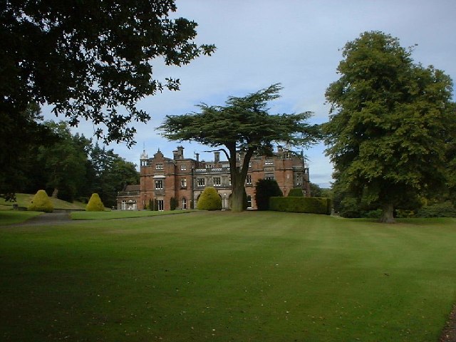
Keele Hall

Keele Hall is a 19th-century mansion house at Keele, Staffordshire, England, now standing on the campus of Keele University and serving as the university...

Loggerheads and Whitmore (ward)

Loggerheads and Whitmore ward was a ward in the Borough of Newcastle-under-Lyme, in the county of Staffordshire, England. It covered, amongst others, the...

Keele University Science & Business Park

Keele University Science and Innovation Park is a science and business development facility located on the campus of Keele University in North Staffordshire...

Keele University

Keele University, officially known as the University of Keele, is a public research university in Keele, approximately three miles (five kilometres) from...

Keele services

Keele services is a motorway service station, between junctions 15 and 16 of the M6 motorway near Keele in England. Operated by Welcome Break, it was built...

Seabridge

Seabridge is a suburb of Newcastle-under-Lyme in Staffordshire, England. The origin of the name "Seabridge" is unknown as it is situated in the midlands...

Keele University School of Medicine

Keele University School of Medicine is a medical school located in Newcastle-under-Lyme and Shrewsbury. The first two years of the school's MBChB degree...

Nearby Amenities

Located within 500m of 52.990417,-2.2691345
Man Made: surveillance
Source: survey
Surveillance: public
Lat/Long: 52.9909052/-2.2685792
Material: wood
Power: pole
Lat/Long: 52.9897299/-2.2653098
Material: wood
Power: pole
Lat/Long: 52.9895184/-2.2641551
Barrier: stile
Lat/Long: 52.9905292/-2.2657873
Material: wood
Power: pole
Lat/Long: 52.9892939/-2.262901
Material: wood
Power: pole
Lat/Long: 52.9895417/-2.2664737
Man Made: tower
Tower Construction: lattice
Tower Type: communication
Lat/Long: 52.9907117/-2.276096
Water Wheel
Building: yes
Historic: building
Lat/Long: 52.9913838/-2.2681654
The data included in this document is from www.openstreetmap.org. The data is made available under ODbL.

Have you been to Swallowcroft Wood?

Leave your review of Swallowcroft Wood below (or comments, questions and feedback).