Miry Paddock

Wood, Forest in Yorkshire South Lakeland

England

Miry Paddock

Rash Mill and chapel A grade II listed 18th century water-powered corn mill (left) with at right a Methodist chapel. See <a href="https://www.geograph.org.uk/photo/4500266">SD6589 : Rash Bridge</a> for a closer view of the mill.   The chapel was closed, and from the amount of cobweb across the door I expect it had not been opened since the start of the Covid-19 pandemic some 17 months earlier.
Rash Mill and chapel Credit: Stephen Craven

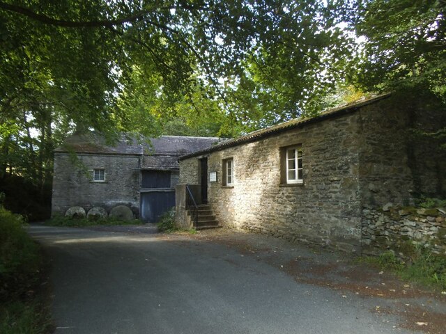
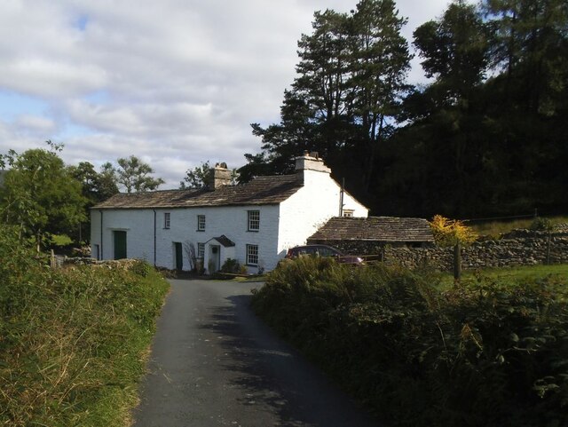
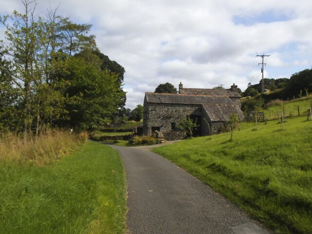
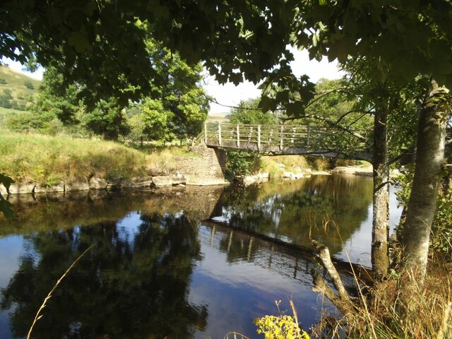
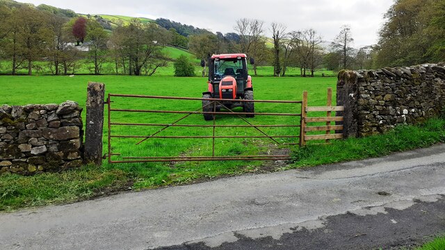
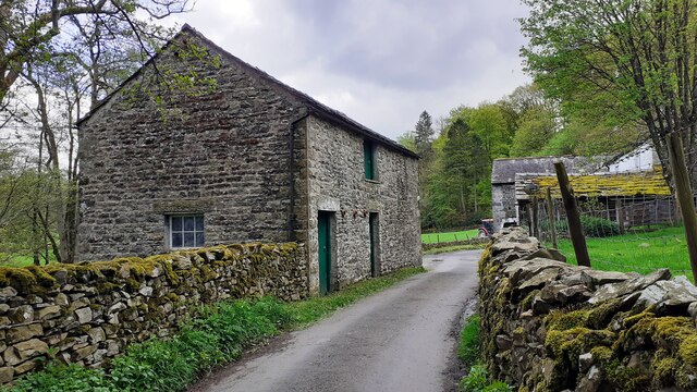
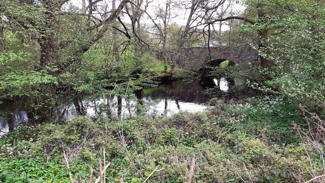
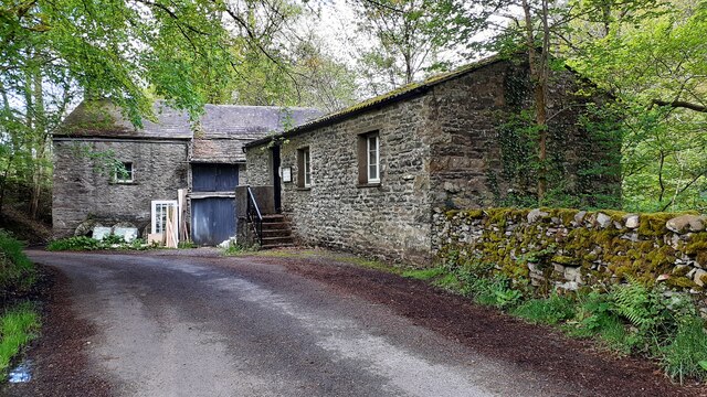
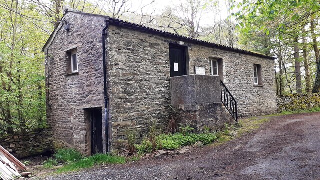
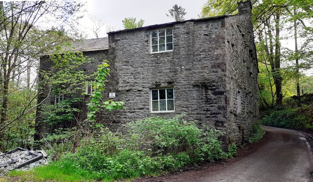
Miry Paddock, located in Yorkshire, is a picturesque woodland area known for its dense forest and natural beauty. Situated in the heart of the county, this enchanting wood is a haven for nature lovers and outdoor enthusiasts.

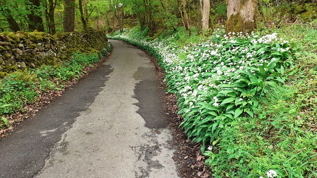
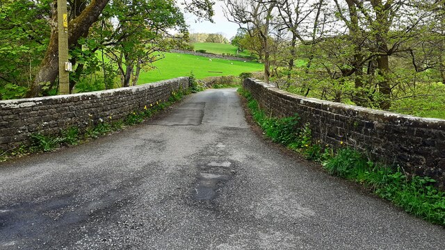
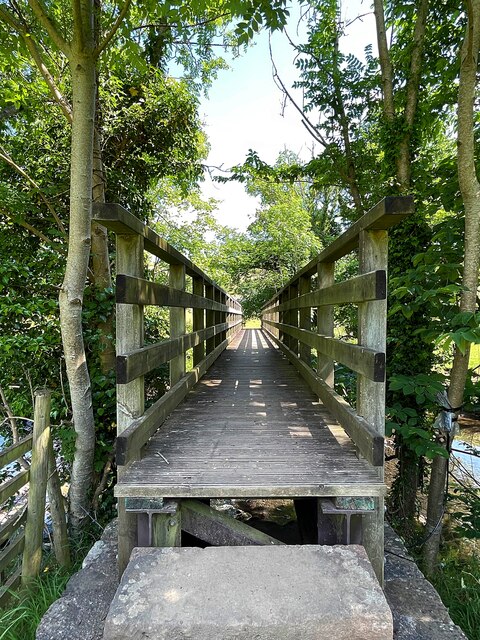
Covering an extensive area, Miry Paddock is characterized by its lush greenery, towering trees, and diverse wildlife. The forest boasts a variety of tree species, including oak, beech, and birch, which create a breathtaking canopy overhead. The forest floor is adorned with vibrant wildflowers, ferns, and moss, adding to the area's charm and tranquility.

Visitors to Miry Paddock can enjoy a range of activities, such as hiking, birdwatching, and photography. The well-maintained trails meander through the woods, offering breathtaking views and opportunities to spot local wildlife, including deer, foxes, and a plethora of bird species.

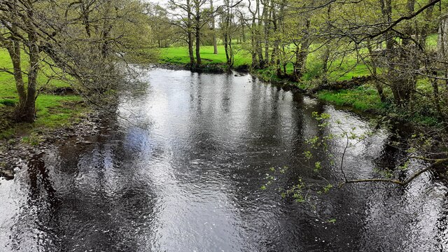
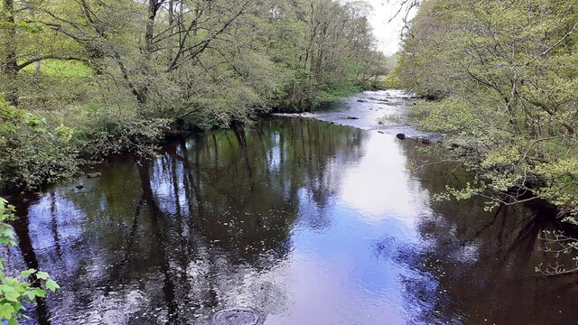
The forest also contains a small pond, providing a peaceful retreat for visitors to sit and observe the serene surroundings. The sound of birds chirping and leaves rustling in the breeze creates a soothing ambiance, making Miry Paddock an ideal spot for relaxation and contemplation.

Additionally, the woodland is home to several picnic areas, where families and friends can gather to enjoy a meal amidst nature. These designated spots offer a chance to unwind and appreciate the beauty of the forest while indulging in a leisurely picnic.

Miry Paddock truly encapsulates the essence of Yorkshire's natural splendor. Its dense forest, diverse flora and fauna, and tranquil ambiance make it a must-visit destination for those seeking a serene and immersive experience in nature.

If you have any feedback on the listing, please let us know in the comments section below.

Miry Paddock Images

Images are sourced within 2km of 54.30437/-2.5145489 or Grid Reference SD6689. Thanks to Geograph Open Source API. All images are credited.

Rash Mill and chapel A grade II listed 18th century water-powered corn mill (left) with at right a Methodist chapel. See <a href="https://www.geograph.org.uk/photo/4500266">SD6589 : Rash Bridge</a> for a closer view of the mill.   The chapel was closed, and from the amount of cobweb across the door I expect it had not been opened since the start of the Covid-19 pandemic some 17 months earlier.
Rash Mill and chapel
A grade II listed 18th century water-powered corn mill (left) with at right a Methodist chapel. See SD6589 : Rash Bridge for a closer view of the mill. The chapel was closed, and from the amount of cobweb across the door I expect it had not been opened since the start of the Covid-19 pandemic some 17 months earlier.
Brackensgill farm A grade II listed farmhouse with attached barn, "perhaps C17, remodelled and enlarged in C18 and C19" (list entry 1383931).
Brackensgill farm
A grade II listed farmhouse with attached barn, "perhaps C17, remodelled and enlarged in C18 and C19" (list entry 1383931).
Ellers barn A grade II listed barn (list entry 1383860).  The farmhouse beyond <a href="https://www.geograph.org.uk/photo/3629842">SD6788 : The farm at Ellers</a>, not clearly visible in this photo, is also listed (1383859).
Ellers barn
A grade II listed barn (list entry 1383860). The farmhouse beyond SD6788 : The farm at Ellers, not clearly visible in this photo, is also listed (1383859).
Footbridge over the river Dee at Ellers This is the small river Dee in Cumbria, not the better known larger rivers of that name in Cheshire or Aberdeen. The bridge is close to Ellers Farm <a href="https://www.geograph.org.uk/photo/2674190">SD6788 : Ellers, lower Dentdale</a>, so I presume it was intended primarily for their use, but it is on a public footpath.   Quite a long single span (c.15m) for a straight (not arched) wooden footbridge.
Footbridge over the river Dee at Ellers
This is the small river Dee in Cumbria, not the better known larger rivers of that name in Cheshire or Aberdeen. The bridge is close to Ellers Farm SD6788 : Ellers, lower Dentdale, so I presume it was intended primarily for their use, but it is on a public footpath. Quite a long single span (c.15m) for a straight (not arched) wooden footbridge.
Tractor in field at Rash
Rural road SE of Rash entering Scar wood Wild garlic adorns the right hand verge
Rural road SE of Rash entering Scar wood
Wild garlic adorns the right hand verge
Rash Mill Cottage and outbuildings
Farm building SE of Rash Bridge
Farm buildings beside road SE of Rash Bridge
Bridge taking Mill Lane over River Dee
Rash Mill Cottage and outbuildings
Looking southeast along River Dee from Rash Bridge
Looking northwest along River Dee from Rash Bridge
View to Rash Bridge from road on SW side of River Dee
Dent Foot Methodist Chapel and Rash Mill
Dent Foot Methodist Chapel The notice on the door reports 'chapel now closed'
Dent Foot Methodist Chapel
The notice on the door reports 'chapel now closed'
Northwest face of Rash Mill
Footbringe over the River Dee
Show me another place!

Miry Paddock is located at Grid Ref: SD6689 (Lat: 54.30437, Lng: -2.5145489)

Division: West Riding

Administrative County: Cumbria

District: South Lakeland

Police Authority: Cumbria

What 3 Words

///destroyer.stirs.suave. Near Sedbergh, Cumbria

Related Wikis

Millthrop

Millthrop is a hamlet in the South Lakeland district of Cumbria, Northern England and the Yorkshire Dales. Millthrop lies on the south bank of the River...

Sedbergh School Chapel

Sedbergh School Chapel is located to the southeast of Sedbergh School, Sedbergh, Cumbria, England. It is considered to be of architectural importance...

Settlebeck School

Settlebeck School is a small coeducational secondary school with academy status. It is located in Sedbergh in the English county of Cumbria, drawing pupils...

Sedbergh

Sedbergh ( SED-bər or locally SEB-ər) is a town and civil parish in the ceremonial county of Cumbria. It falls within the historic boundaries of the West...

Nearby Amenities

Located within 500m of 54.30437,-2.5145489
Rash House (E bound)
Local Ref: AT
Naptan AtcoCode: 090079181423
Naptan Bearing: E
Naptan BusStopType: CUS
Naptan CommonName: Rash House (E bound)
Naptan Indicator: at
Naptan Landmark: Rash House
Naptan NaptanCode: cumdgwgj
Naptan Street: No name
Naptan Verified: no
Source: naptan_import
Lat/Long: 54.3039682/-2.5215223
Rash House (W bound)
Naptan AtcoCode: 090079183316
Naptan Bearing: W
Naptan BusStopType: CUS
Naptan CommonName: Rash House (W bound)
Naptan Indicator: opp
Naptan Landmark: Rash House
Naptan NaptanCode: cumdgwjd
Naptan Street: No name
Naptan Verified: no
Source: naptan_import
Lat/Long: 54.3038641/-2.5217682
Post Box
Operator: Royal Mail
Post Box Type: wall
Ref: LA10 76
Royal Cypher: EVIIR
Royal Cypher Wikidata: Q33102324
Source: survey
Lat/Long: 54.3012865/-2.5118151
Barrier: stile
Material: stone
Source: survey;gps
Stile: stepover
Lat/Long: 54.3042122/-2.5118499
Barrier: stile
Material: stone
Source: survey;gps
Stile: stepover
Lat/Long: 54.3039022/-2.5100212
Barrier: stile
Source: survey;gps
Lat/Long: 54.3043513/-2.512434
Barrier: stile
Material: wood
Source: survey;gps
Stile: ladder
Lat/Long: 54.3058734/-2.5157834
Barrier: stile
Material: wood
Source: survey;gps
Stile: ladder
Lat/Long: 54.305984/-2.520032
Hiking: yes
Information: guidepost
Source: GPS survey
Tourism: information
Lat/Long: 54.3047397/-2.5131159
Hiking: yes
Information: guidepost
Source: GPS survey
Tourism: information
Lat/Long: 54.304341/-2.5124647
Hiking: yes
Information: guidepost
Source: GPS survey
Tourism: information
Lat/Long: 54.3029892/-2.5113349
Hiking: yes
Information: guidepost
Source: GPS survey
Tourism: information
Lat/Long: 54.3011267/-2.5115615
Power: pole
Lat/Long: 54.3020229/-2.5079961
Power: pole
Lat/Long: 54.3025167/-2.5093498
Power: pole
Lat/Long: 54.3029199/-2.5104714
Power: pole
Lat/Long: 54.3035535/-2.5122177
Power: pole
Lat/Long: 54.3037543/-2.513579
Power: pole
Lat/Long: 54.3040028/-2.5151902
Power: pole
Lat/Long: 54.3041946/-2.5164878
Power: pole
Lat/Long: 54.3044148/-2.517923
Power: pole
Lat/Long: 54.304803/-2.519524
Power: pole
Lat/Long: 54.3052567/-2.5214003
Power: pole
Lat/Long: 54.3012731/-2.5108666
Power: pole
Lat/Long: 54.3021285/-2.5106448
Power: pole
Lat/Long: 54.3040176/-2.5101732
Power: pole
Lat/Long: 54.3041827/-2.5108742
Power: pole
Lat/Long: 54.3044014/-2.5118277
Power: pole
Lat/Long: 54.3046067/-2.5126409
Power: pole
Lat/Long: 54.3023393/-2.5213809
Power: pole
Lat/Long: 54.3016474/-2.5201568
Power: pole
Lat/Long: 54.3037008/-2.5219846
Power: pole
Lat/Long: 54.3005431/-2.5168127
Power: pole
Lat/Long: 54.2999588/-2.515773
The data included in this document is from www.openstreetmap.org. The data is made available under ODbL.

Have you been to Miry Paddock?

Leave your review of Miry Paddock below (or comments, questions and feedback).