Gore Wood

Wood, Forest in Dorset

England

Gore Wood

Benchmark on Remedy House, near Hermitage Ordnance Survey benchmark, described on database at <span class="nowrap"><a title="http://www.bench-marks.org.uk/bm71318" rel="nofollow ugc noopener" href="http://www.bench-marks.org.uk/bm71318">Link</a><img style="margin-left:2px;" alt="External link" title="External link - shift click to open in new window" src="https://s1.geograph.org.uk/img/external.png" width="10" height="10"/></span>. See also <a href="https://www.geograph.org.uk/photo/4723466">ST6405 : Remedy House gate, near Hermitage</a>.
Benchmark on Remedy House, near Hermitage Credit: Becky Williamson

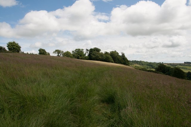
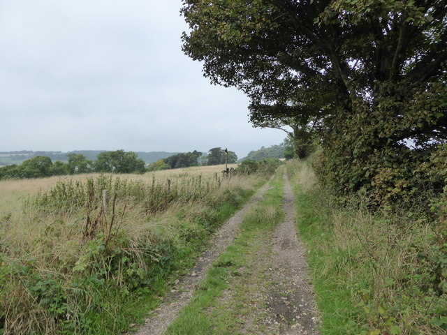
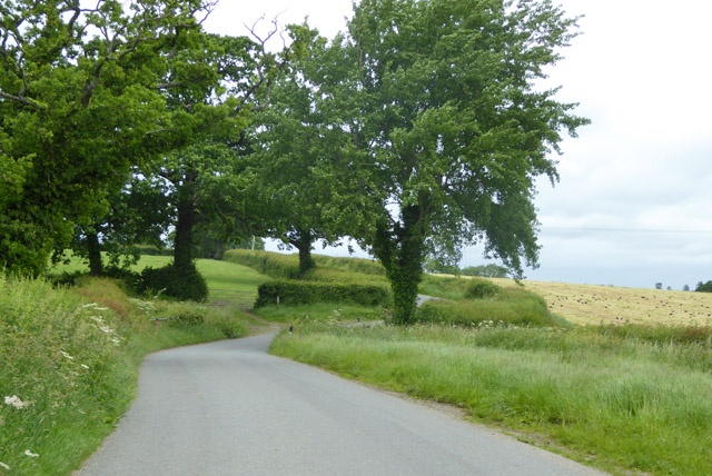
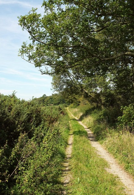
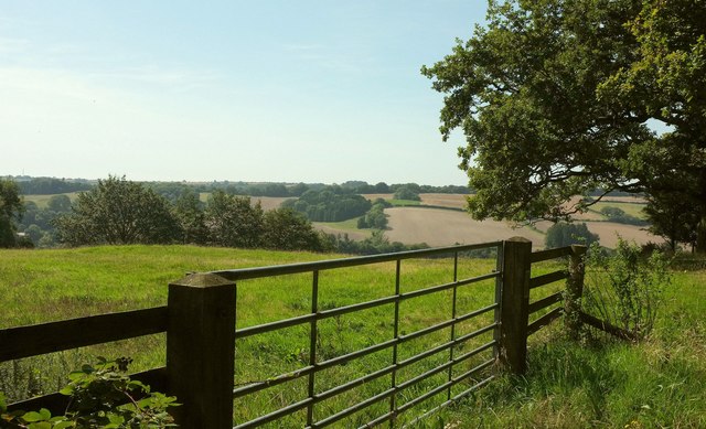
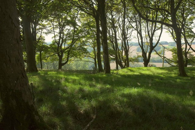
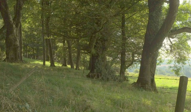
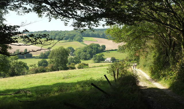
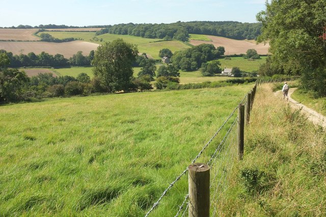
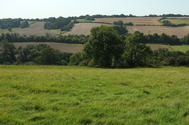
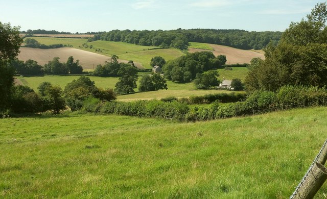
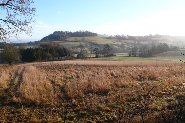
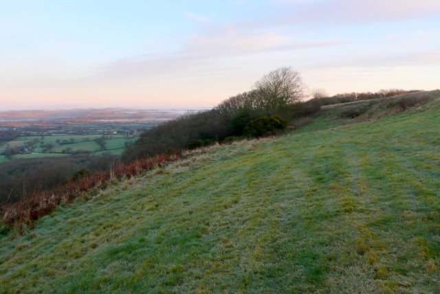
Gore Wood is a picturesque forest located in the county of Dorset in South West England. Spanning over an area of approximately 150 acres, this woodland boasts a diverse range of flora and fauna, making it a popular destination for nature enthusiasts and hikers alike.

The forest is predominantly composed of various species of broadleaf trees such as oak, beech, and ash, which create a dense canopy that filters sunlight and provides a cool, shaded environment. The forest floor is covered in a thick layer of leaf litter, creating a rich habitat for a multitude of plants and small animals.

Gore Wood is home to a wide variety of wildlife, including several species of birds, mammals, and insects. Birdwatchers can spot common woodland birds such as the great spotted woodpecker, tawny owl, and various species of tits and finches. Mammals such as deer, foxes, and badgers can also be found roaming the forest, while the buzzing sound of bees and butterflies fluttering among the wildflowers adds to the vibrant ecosystem.

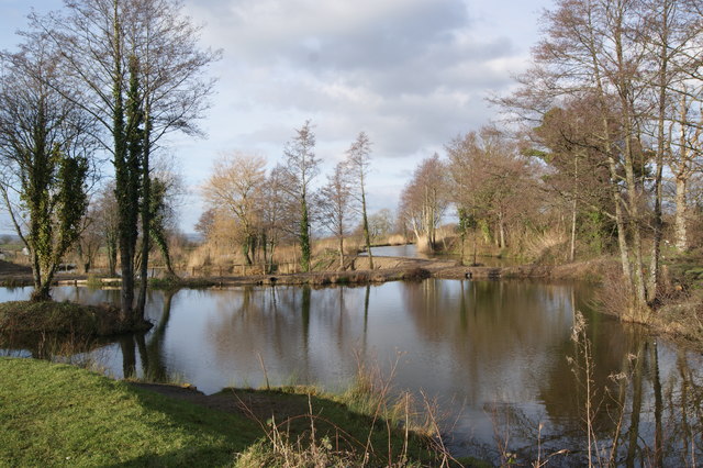
The woodland offers a network of well-maintained footpaths and trails, allowing visitors to explore its natural beauty at their own pace. These paths wind through the forest, leading to tranquil clearings and idyllic ponds where visitors can stop and enjoy the peaceful surroundings.

Gore Wood, Dorset, provides a serene and enchanting escape for those seeking a connection with nature. Its lush vegetation, diverse wildlife, and well-marked trails make it a must-visit destination for anyone looking to immerse themselves in the beauty of the English countryside.

If you have any feedback on the listing, please let us know in the comments section below.

Gore Wood Images

Images are sourced within 2km of 50.857465/-2.4841623 or Grid Reference ST6606. Thanks to Geograph Open Source API. All images are credited.

Benchmark on Remedy House, near Hermitage Ordnance Survey benchmark, described on database at <span class="nowrap"><a title="http://www.bench-marks.org.uk/bm71318" rel="nofollow ugc noopener" href="http://www.bench-marks.org.uk/bm71318">Link</a><img style="margin-left:2px;" alt="External link" title="External link - shift click to open in new window" src="https://s1.geograph.org.uk/img/external.png" width="10" height="10"/></span>. See also <a href="https://www.geograph.org.uk/photo/4723466">ST6405 : Remedy House gate, near Hermitage</a>.
Benchmark on Remedy House, near Hermitage
Ordnance Survey benchmark, described on database at LinkExternal link. See also ST6405 : Remedy House gate, near Hermitage.
Remedy House gate, near Hermitage There is an Ordnance Survey benchmark on the right-hand side of the gable end of this house. See <a href="https://www.geograph.org.uk/photo/4723461">ST6405 : Benchmark on Remedy House, near Hermitage</a>
Ordnance Survey benchmark, described on database at <span class="nowrap"><a title="http://www.bench-marks.org.uk/bm71318" rel="nofollow ugc noopener" href="http://www.bench-marks.org.uk/bm71318">Link</a><img style="margin-left:2px;" alt="External link" title="External link - shift click to open in new window" src="https://s1.geograph.org.uk/img/external.png" width="10" height="10"/></span>.
Remedy House gate, near Hermitage
There is an Ordnance Survey benchmark on the right-hand side of the gable end of this house. See ST6405 : Benchmark on Remedy House, near Hermitage Ordnance Survey benchmark, described on database at LinkExternal link.
Fishing lakes at Revels
St Lawrence's Catholic Church, Middlemarsh There is an Ordnance Survey benchmark on this building, see <a title="https://www.geograph.org.uk/photo/4547331" href="https://www.geograph.org.uk/photo/4547331">Link</a>.
St Lawrence's Catholic Church, Middlemarsh
There is an Ordnance Survey benchmark on this building, see Link.
Little Minterne Hill
Byway on Little Minterne Hill
Hermitage Lane Heading towards Hermitage.
Hermitage Lane
Heading towards Hermitage.
Lane north from Hermitage A field cut for silage on the right has attracted a great many rooks.
Lane north from Hermitage
A field cut for silage on the right has attracted a great many rooks.
Field by the Hardy Way The Way runs along the ridgetop public access route beyond the hedge on the right. This field is crossed by bridleway S31 1. The mast is in woodland on Dogbury Hill.
Field by the Hardy Way
The Way runs along the ridgetop public access route beyond the hedge on the right. This field is crossed by bridleway S31 1. The mast is in woodland on Dogbury Hill.
Hardy Way Running along a ridgetop public access route towards Dogbury Hill.
Hardy Way
Running along a ridgetop public access route towards Dogbury Hill.
Field and gate, Dogbury Hill Where the Hardy Way enters Dogbury Plantation, with a glimpsed of the Cerne valley near Minterne Magna.
Field and gate, Dogbury Hill
Where the Hardy Way enters Dogbury Plantation, with a glimpsed of the Cerne valley near Minterne Magna.
Dogbury Plantation Seen from the Hardy Way, with the Cerne valley in the background.
Dogbury Plantation
Seen from the Hardy Way, with the Cerne valley in the background.
Hardy Way in Dogbury Plantation Climbing a route with public access. <a href="https://www.geograph.org.uk/photo/5521392">ST6605 : Dogbury Plantation</a> looks right from this stretch of the track.
Hardy Way in Dogbury Plantation
Climbing a route with public access. ST6605 : Dogbury Plantation looks right from this stretch of the track.
Dogbury Plantation Looking right from where <a href="https://www.geograph.org.uk/photo/5521405">ST6605 : Hardy Way in Dogbury Plantation</a> was taken.
Dogbury Plantation
Looking right from where ST6605 : Hardy Way in Dogbury Plantation was taken.
Approaching Dogbury Gate The Hardy Way drops down a route with public access into the Cerne valley. The building right of centre with the bellcote is the former Minterne Magna School <span class="nowrap"><a title="https://www.historicengland.org.uk/listing/the-list/list-entry/1118816" rel="nofollow ugc noopener" href="https://www.historicengland.org.uk/listing/the-list/list-entry/1118816">Link</a><img style="margin-left:2px;" alt="External link" title="External link - shift click to open in new window" src="https://s1.geograph.org.uk/img/external.png" width="10" height="10"/></span> . The wood across the valley is Minterne Seat Coppice.
Approaching Dogbury Gate
The Hardy Way drops down a route with public access into the Cerne valley. The building right of centre with the bellcote is the former Minterne Magna School LinkExternal link . The wood across the valley is Minterne Seat Coppice.
Cerne valley near Dogbury Gate The Hardy Way descends a route with public access into the Cerne valley. Right of centre is the school house also seen in <a href="https://www.geograph.org.uk/photo/5521426">ST6505 : Approaching Dogbury Gate</a>  <span class="nowrap"><a title="https://www.historicengland.org.uk/listing/the-list/list-entry/1118816" rel="nofollow ugc noopener" href="https://www.historicengland.org.uk/listing/the-list/list-entry/1118816">Link</a><img style="margin-left:2px;" alt="External link" title="External link - shift click to open in new window" src="https://s1.geograph.org.uk/img/external.png" width="10" height="10"/></span> . Again, the wood across the valley is Minterne Seat Coppice.
Cerne valley near Dogbury Gate
The Hardy Way descends a route with public access into the Cerne valley. Right of centre is the school house also seen in ST6505 : Approaching Dogbury Gate LinkExternal link . Again, the wood across the valley is Minterne Seat Coppice.
Cerne valley near Dogbury Gate Looking left from where <a href="https://www.geograph.org.uk/photo/5521524">ST6505 : Cerne valley near Dogbury Gate</a> was taken. The further line of trees, along the A52 Sandy Lane, and the land beyond, is in <a href="https://www.geograph.org.uk/gridref/ST6504">ST6504</a>
Cerne valley near Dogbury Gate
Looking left from where ST6505 : Cerne valley near Dogbury Gate was taken. The further line of trees, along the A52 Sandy Lane, and the land beyond, is in ST6504
Cerne valley near Dogbury Gate From the Hardy Way descending the track shown in <a href="https://www.geograph.org.uk/photo/5521524">ST6505 : Cerne valley near Dogbury Gate</a>, again with the school house and its bellcote  <span class="nowrap"><a title="https://www.historicengland.org.uk/listing/the-list/list-entry/1118816" rel="nofollow ugc noopener" href="https://www.historicengland.org.uk/listing/the-list/list-entry/1118816">Link</a><img style="margin-left:2px;" alt="External link" title="External link - shift click to open in new window" src="https://s1.geograph.org.uk/img/external.png" width="10" height="10"/></span> right of centre, and Lane Cottages in the centre.
Cerne valley near Dogbury Gate
From the Hardy Way descending the track shown in ST6505 : Cerne valley near Dogbury Gate, again with the school house and its bellcote LinkExternal link right of centre, and Lane Cottages in the centre.
Show me another place!

Gore Wood is located at Grid Ref: ST6606 (Lat: 50.857465, Lng: -2.4841623)

Unitary Authority: Dorset

Police Authority: Dorset

What 3 Words

///major.chipper.detective. Near Yetminster, Dorset

Related Wikis

Hermitage, Dorset

Hermitage is a small village and civil parish in the county of Dorset in southern England. It is situated in the Blackmore Vale under the scarp of the...

Dogbury Hill

At 248 metres (814 ft), Dogbury Hill is one of the highest hills in the county of Dorset, England. It is the site of a prehistoric hill fort. == Location... ==

Cosmore

Cosmore is a small village in Dorset, situated just off the main A352 Sherborne-Dorchester road. It sits at the foot of Dogbury Hill, one of Dorset's...

Telegraph Hill, Dorset

Telegraph Hill (267 metres, 876 feet high) is a hill about 1 mile northwest of Minterne Magna and about 10 miles north of Dorchester in the county of Dorset...

River Cerne

The River Cerne is a ten mile long river in Dorset, England, which rises in the Chalk hills of the Dorset Downs at Minterne Magna, between High Stoy and...

Minterne Magna

Minterne Magna is a village and civil parish in Dorset, England, situated midway between Dorchester and Sherborne. In the 2011 census the parish had a...

Glanvilles Wootton

Glanvilles Wootton, or Wootton Glanville, is a village and civil parish in the county of Dorset in southern England. It is situated in the Blackmore Vale...

Cerne, Totcombe and Modbury Hundred

Cerne, Totcombe and Modbury Hundred was a hundred in the county of Dorset, England. Some of its tithings and parishes were exclaves which indicates that...

Related Videos

Minterne House & Gardens. Autumn Colors, Dorset, UK 25/10/2020

2020 has been a strange and quite depressing year with COVID19. Usually I visit different countries, at least 2 European countries ...

St Mary's Church, Glanvilles Wootton, Dorset, England

Filmed November, 2021. Music: Vaughan Williams - The Lark Ascending Benedictines Of Mary, Queen of Apostles - Christus Rex.

Minterne House Wedding | James & Ella | Devon Wedding Films

This was the wedding of James and Ella shot at Minterne House, Dorset. All filmed solo with 2 x Sony A7iii's and a Sony A6500.

Liam + Caroline ~ The Vow ~ Minterne House Minterne Magna Dorset Wedding Highlights Film Videography

Liam + Caroline ~ The Vow ~ Minterne House Minterne Magna Dorset Wedding Highlights Film ~ Fire Dove Films Ltd / Dorset, ...

Nearby Amenities

Located within 500m of 50.857465,-2.4841623
The data included in this document is from www.openstreetmap.org. The data is made available under ODbL.

Have you been to Gore Wood?

Leave your review of Gore Wood below (or comments, questions and feedback).