Coombe Brook Valley

Wood, Forest in Gloucestershire

England

Coombe Brook Valley

Greenbank Cemetery Greenbank Cemetery taken from Greenbank View, Bristol
Greenbank Cemetery Credit: Kate Lambert

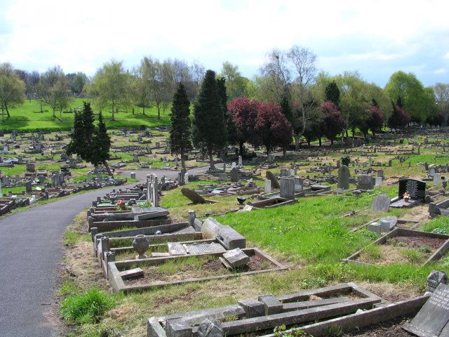
Coombe Brook Valley is a picturesque woodland area located in Gloucestershire, England. This serene valley is nestled amidst the rolling hills and lush greenery of the Cotswolds, offering visitors a tranquil escape from the hustle and bustle of urban life.

The valley is primarily composed of dense forests, featuring a diverse range of tree species such as oak, beech, and ash. These towering trees create a dense canopy that provides shade and shelter for a variety of wildlife, including birds, deer, and foxes. Additionally, the forest floor is adorned with an array of wildflowers and ferns, adding to the valley's natural beauty.

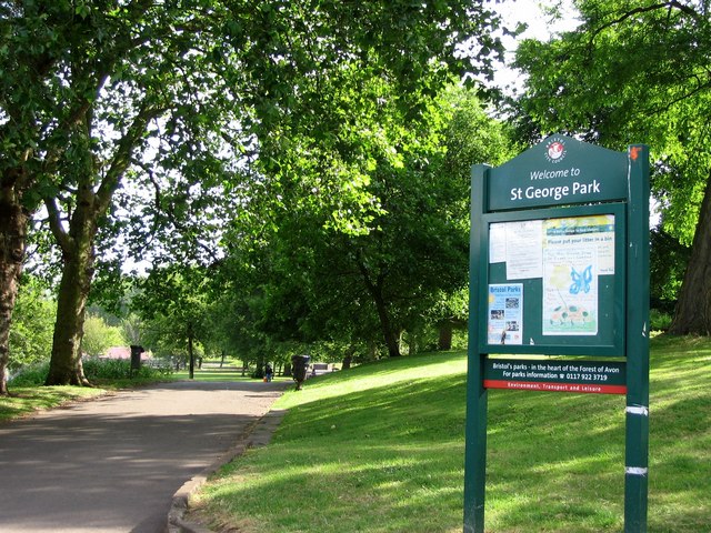
Traversing through Coombe Brook Valley, one can explore a network of well-maintained footpaths and trails. These paths wind their way through the woodland, leading visitors to enchanting sights such as babbling brooks, hidden waterfalls, and peaceful ponds. The babbling brook that runs through the valley, after which it is named, adds to the valley's charm and serves as a habitat for aquatic creatures.

Nature enthusiasts can indulge in activities such as hiking, birdwatching, and photography, immersing themselves in the tranquility of this idyllic setting. The valley is also a popular spot for picnickers and families looking to spend quality time amidst nature.

Coombe Brook Valley, with its rich biodiversity and serene ambience, offers a delightful escape for those seeking a peaceful retreat in the heart of Gloucestershire's natural beauty.

If you have any feedback on the listing, please let us know in the comments section below.

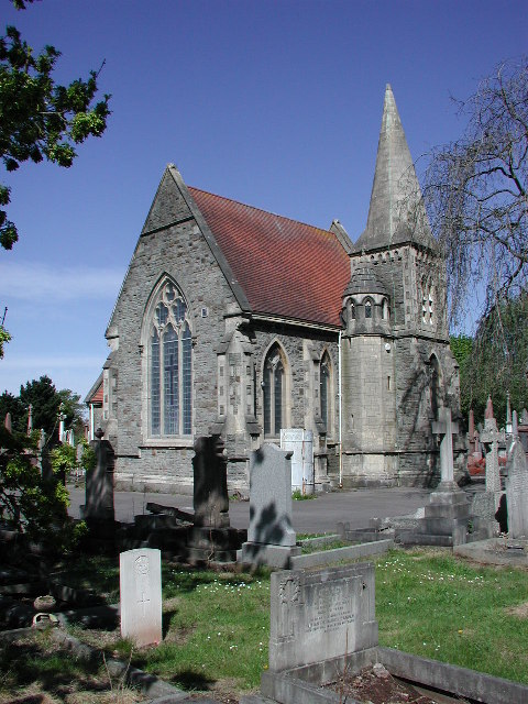
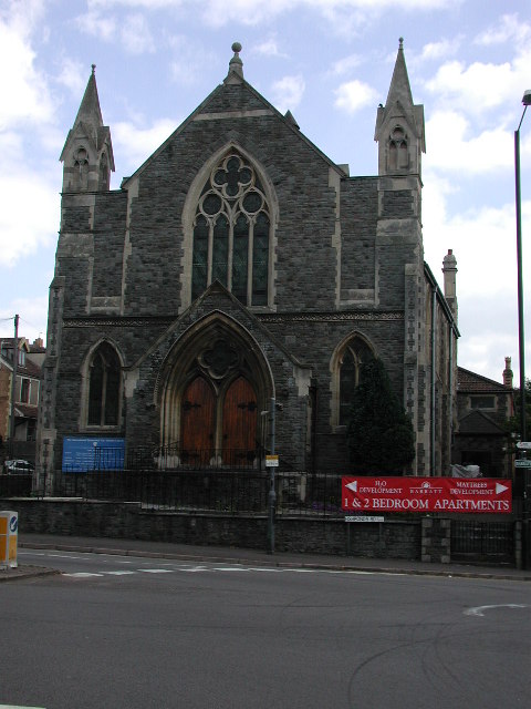
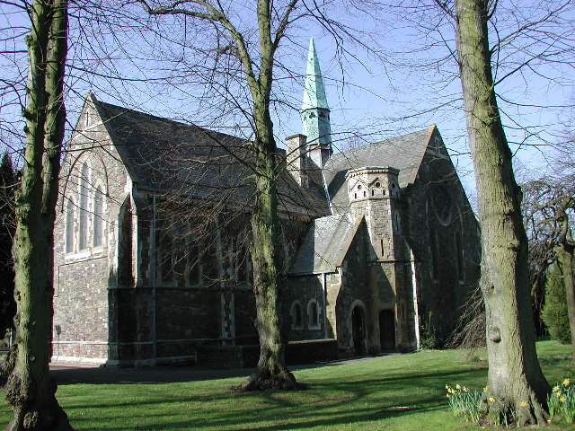
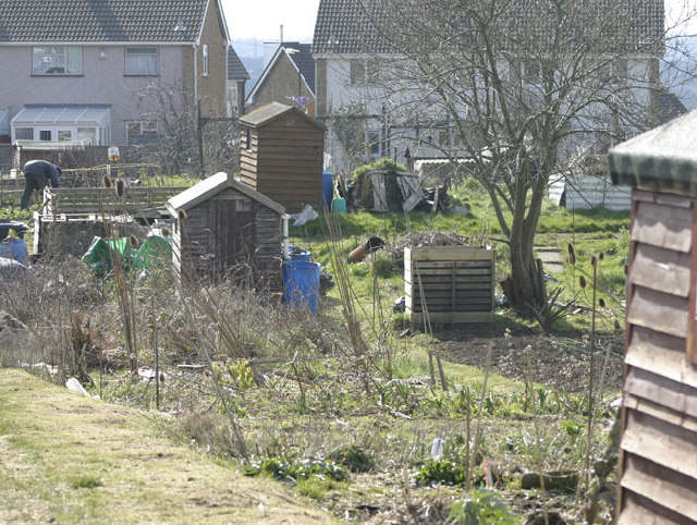
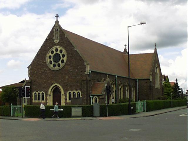
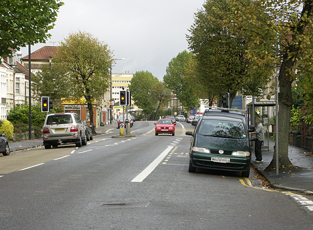
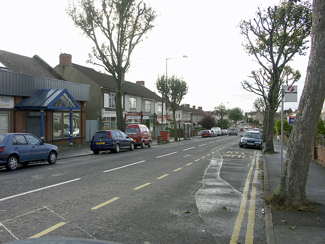
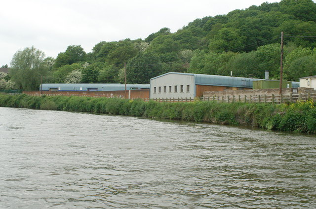
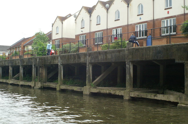
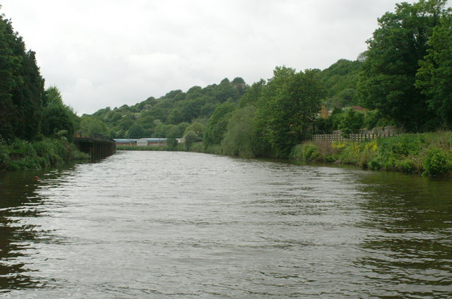
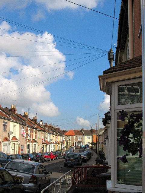
Coombe Brook Valley Images

Images are sourced within 2km of 51.47107/-2.5326004 or Grid Reference ST6374. Thanks to Geograph Open Source API. All images are credited.

Greenbank Cemetery Greenbank Cemetery taken from Greenbank View, Bristol
Greenbank Cemetery
Greenbank Cemetery taken from Greenbank View, Bristol
Bristol St George: Avonview Cemetery Chapel This chapel is no longer used for services but instead houses the equipment store of the gardeners.
Bristol St George: Avonview Cemetery Chapel
This chapel is no longer used for services but instead houses the equipment store of the gardeners.
BRISTOL Eastville Park Methodist Church Originally built as a United Free Methodist Chapel, it is now a Pentecostal church. More history on <span class="nowrap"><a title="http://www.churchcrawler.pwp.blueyonder.co.uk/bristol3/ufrmeth.htm" rel="nofollow ugc noopener" href="http://www.churchcrawler.pwp.blueyonder.co.uk/bristol3/ufrmeth.htm">Link</a><img style="margin-left:2px;" alt="External link" title="External link - shift click to open in new window" src="https://s1.geograph.org.uk/img/external.png" width="10" height="10"/></span>
BRISTOL Eastville Park Methodist Church
Originally built as a United Free Methodist Chapel, it is now a Pentecostal church. More history on LinkExternal link
Bristol Glenside Hospital Church Now in the grounds of the Glenside Campus of the University of the West of England (UWE) the former Stapleton Asylum Church (later Bristol Mental Hospital, and before its closure Glenside Hospital) is a picturesque Victorian Gothic structure and is now in use as the museum with artefacts from the former hospital. It is open on Weds and Sat mornings, free admission.
Bristol Glenside Hospital Church
Now in the grounds of the Glenside Campus of the University of the West of England (UWE) the former Stapleton Asylum Church (later Bristol Mental Hospital, and before its closure Glenside Hospital) is a picturesque Victorian Gothic structure and is now in use as the museum with artefacts from the former hospital. It is open on Weds and Sat mornings, free admission.
The Allotments, Nicholas Lane, Bristol The allotments, looking south towards the rear of the houses on Nibblets Hill taken from near the allotment shop.
The Allotments, Nicholas Lane, Bristol
The allotments, looking south towards the rear of the houses on Nibblets Hill taken from near the allotment shop.
Fishponds, Bristol, St Joseph's Catholic Church <span class="nowrap"><a title="http://www.churchcrawler.pwp.blueyonder.co.uk/bristol2/fishjose.htm" rel="nofollow ugc noopener" href="http://www.churchcrawler.pwp.blueyonder.co.uk/bristol2/fishjose.htm">Link</a><img style="margin-left:2px;" alt="External link" title="External link - shift click to open in new window" src="https://s1.geograph.org.uk/img/external.png" width="10" height="10"/></span>
Fishponds, Bristol, St Joseph's Catholic Church
Fishponds, Bristol, Baptist Church
Fishponds Road, Ridgeway, looking WNW In the part of Bristol called Ridgeway, on the A432 (Fishponds Road), looking WNW. The junction with the B4048 is next to the tall cream coloured building visible above the traffic island. The turning immediately on the right (at bottom of picture) is into Alcove Road at its western-most end.
Fishponds Road, Ridgeway, looking WNW
In the part of Bristol called Ridgeway, on the A432 (Fishponds Road), looking WNW. The junction with the B4048 is next to the tall cream coloured building visible above the traffic island. The turning immediately on the right (at bottom of picture) is into Alcove Road at its western-most end.
On Speedwell Road, Two Mile Hill, looking west On Speedwell Road just by its junction with Charlton Road, looking west towards the roundabout-junction
with Whiteway Road. Speedwell Methodist Church is hidden beyond the houses on the left.
On Speedwell Road, Two Mile Hill, looking west
On Speedwell Road just by its junction with Charlton Road, looking west towards the roundabout-junction with Whiteway Road. Speedwell Methodist Church is hidden beyond the houses on the left.
Regent Street Kingswood, looking east past the clock In Regent Street (on the A420) in Kingswood. Looking east past Kingswood's
elegant clock tower while standing on the opposite side of the road from
the King's Chase Shopping Centre. The right-turn in the foreground is into
Moravian Road.
Regent Street Kingswood, looking east past the clock
In Regent Street (on the A420) in Kingswood. Looking east past Kingswood's elegant clock tower while standing on the opposite side of the road from the King's Chase Shopping Centre. The right-turn in the foreground is into Moravian Road.
The Wackum Inn, Whitehall Road Looking approximately west from Brook Road. The mini roundabout leads east onto Speedwell Road and west onto Whitehall Road.
The Wackum Inn, Whitehall Road
Looking approximately west from Brook Road. The mini roundabout leads east onto Speedwell Road and west onto Whitehall Road.
Stapleton Parish Church Bristol The church is prominently positioned at the top of the hill from the M32 motorway junction
Stapleton Parish Church Bristol
The church is prominently positioned at the top of the hill from the M32 motorway junction
Speedwell Fire Station Speedwell Fire Station, Speedwell Road, Bristol is station number 11 of Avon Fire & Rescue Service
Speedwell Fire Station
Speedwell Fire Station, Speedwell Road, Bristol is station number 11 of Avon Fire & Rescue Service
Warehouses, Crew's Hole Warehouses on the north bank of the Avon opposite St Anne's
Warehouses, Crew's Hole
Warehouses on the north bank of the Avon opposite St Anne's
Waterside housing, St Anne's Park Housing backing onto former industrial wharf on south bank of the Avon, probably formerly part of St Anne's Board Mills.
Waterside housing, St Anne's Park
Housing backing onto former industrial wharf on south bank of the Avon, probably formerly part of St Anne's Board Mills.
River Avon north of St Anne's Park Looking downstream. Straight ahead on the left bank is the former St Anne's Board Mills quay.
River Avon north of St Anne's Park
Looking downstream. Straight ahead on the left bank is the former St Anne's Board Mills quay.
A typical Redfield Street Victorian terraces in Redfield / St George
A typical Redfield Street
Victorian terraces in Redfield / St George
Entrance to St. George Park St. George Park is a park on the eastern edge of the inner city in Bristol, England.
Entrance to St. George Park
St. George Park is a park on the eastern edge of the inner city in Bristol, England.
Show me another place!

Coombe Brook Valley is located at Grid Ref: ST6374 (Lat: 51.47107, Lng: -2.5326004)

Unitary Authority: Bristol

Police Authority: Avon and Somerset

What 3 Words

///loud.even.hurry. Near Kingswood, Gloucestershire

Related Wikis

Lodge Causeway

Lodge Causeway is an ancient passage through the former Royal Forest of Kingswood and now the main road between Fishponds and Kingswood in Bristol, England...

Bristol Brunel Academy

Bristol Brunel Academy is a mixed sex Secondary Academy, located in Speedwell in the ward of Hillfields, Bristol, England. The academy is named after Isambard...

Speedwell, Bristol

Speedwell is an area of east Bristol, Part of the Hillfields ward. It has a mixture of residential and industrial land. The 2014 population estimate of...
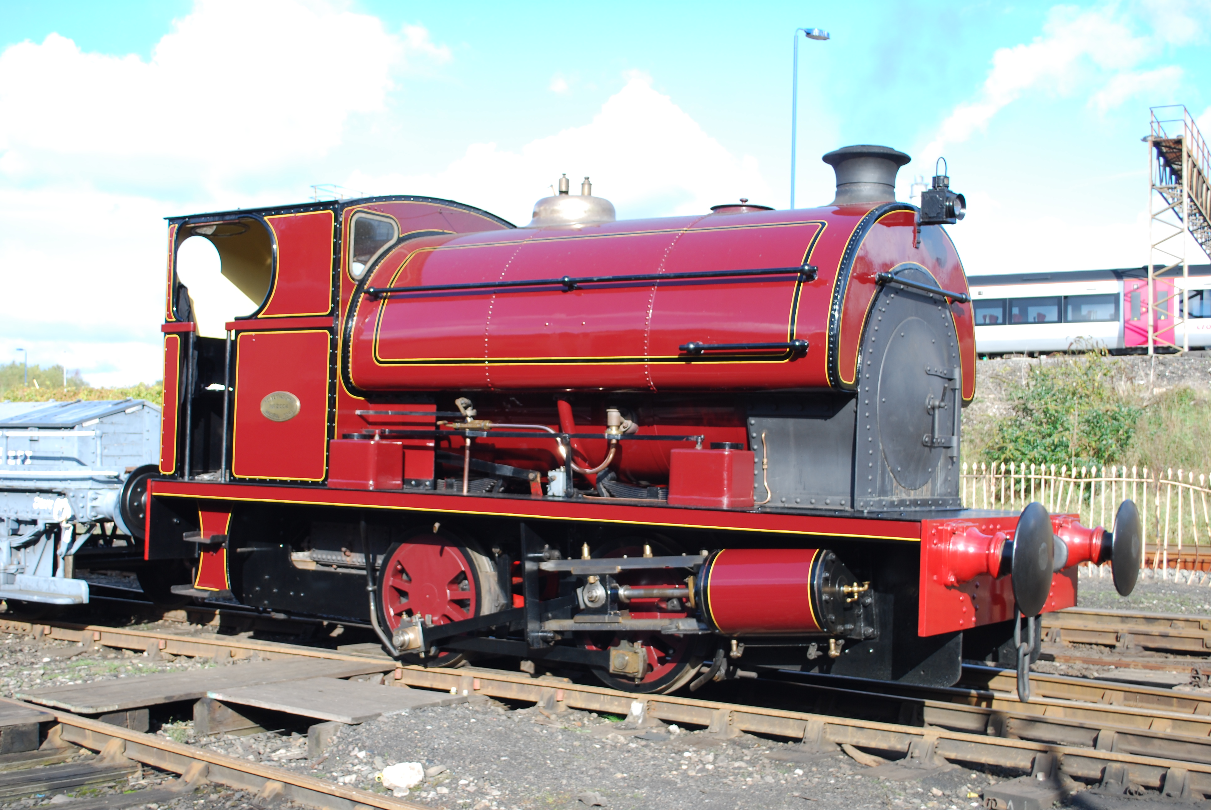
Peckett and Sons

Peckett and Sons was a locomotive manufacturer at the Atlas Locomotive Works on Deep Pit Road between Fishponds and St. George, Bristol, England. ��2...

Related Videos

இயற்கையுடன் ஓர் பயணம்#Best outoor Hiking @Bristol Conham RIver Park @akpayanangal 4K Ultra HD 👍

https://youtu.be/3kH62qo7MNY?si=z4mSFKbcLrOSzvDP Adventures #uk #bristol #tamil #travel #travel #hiking #hike #hikerlife ...

4* Holiday Inn Bristol Filton 400 Migrants Are Housed In A 211 Bed Hotel. Asking For Trouble

Thanks for watching the video. If you really enjoyed it then hit the LIKE button, COMMENT your suggestions, SHARE it with your ...

Relaxing Walk with Nature Sounds | Go on a walk with me

Hello lovelies, thanks for clicking this video. Watch this whenever you struggle to sleep or just want to be one with nature. Enjoy a ...

Nearby Amenities

Located within 500m of 51.47107,-2.5326004
Barrier: cycle_barrier
Lat/Long: 51.4724663/-2.5383431
Whitehall Rugby Club
Sport: rugby
Lat/Long: 51.4704977/-2.5373597
Turning Circle
Lat/Long: 51.4723445/-2.532323
Mini Roundabout
Direction: clockwise
Lat/Long: 51.4669385/-2.5310591
Turning Circle
Lat/Long: 51.4687022/-2.5306724
Place Of Worship
Mosque
Religion: muslim
Lat/Long: 51.4732621/-2.5308191
Post Box
Post Box Type: pillar
Ref: BS16 318
Royal Cypher: EIIR
Royal Cypher Wikidata: Q33102113
Lat/Long: 51.4713298/-2.5268784
Post Box
Post Box Type: pillar
Postal Code: BS16
Ref: BS16 209
Royal Cypher: GVIR
Royal Cypher Wikidata: Q33102169
Lat/Long: 51.4749858/-2.5315904
Barrier: block
Lat/Long: 51.4705963/-2.5376026
Bus Stop
Harewood Road
Bus: yes
Naptan AtcoCode: 0100BRA10507
Naptan Bearing: W
Naptan CommonName: Harewood Road
Naptan Crossing: Harewood Road
Naptan NaptanCode: bstmpmp
Naptan PlusbusZoneRef: BRSTLTM
Naptan Street: Speedwell Road
Naptan Verified: no
Public Transport: platform
Shelter: yes
Source: naptan_import
Lat/Long: 51.466576/-2.5325829
Bus Stop
Harewood Road
Bench: yes
Bin: yes
Mapillary: 157591109645112
Naptan AtcoCode: 0100BRA10508
Naptan Bearing: E
Naptan CommonName: Harewood Road
Naptan Crossing: Harewood Road
Naptan NaptanCode: bstmptj
Naptan PlusbusZoneRef: BRSTLTM
Naptan Street: Speedwell Road
Naptan Verified: no
Public Transport: platform
Shelter: no
Source: naptan_import
Survey Date: 2018-08-21
Lat/Long: 51.4668589/-2.5316504
Bus Stop
Mayfield Park
Naptan AtcoCode: 0100BRA10533
Naptan Bearing: N
Naptan CommonName: Mayfield Park
Naptan Crossing: Mayfield Park South
Naptan NaptanCode: bstmtga
Naptan PlusbusZoneRef: BRSTLTM
Naptan Street: Berkeley Road
Naptan Verified: no
Source: naptan_import
Lat/Long: 51.4712321/-2.5269788
Bus Stop
Mayfield Park
Naptan AtcoCode: 0100BRA10534
Naptan Bearing: SW
Naptan CommonName: Mayfield Park
Naptan Crossing: Argyle Road
Naptan NaptanCode: bstmtdp
Naptan PlusbusZoneRef: BRSTLTM
Naptan Street: Whitefield Road
Naptan Verified: no
Shelter: no
Source: naptan_import
Lat/Long: 51.4703289/-2.5278754
Bus Stop
Duncombe Lane
Bench: no
Bin: no
Mapillary: 512838576557888
Naptan AtcoCode: 0100BRA10535
Naptan Bearing: N
Naptan CommonName: Duncombe Lane
Naptan Crossing: Duncombe Lane
Naptan NaptanCode: bstmtap
Naptan PlusbusZoneRef: BRSTLTM
Naptan Street: Whitefield Road
Naptan Verified: no
Public Transport: platform
Shelter: no
Source: naptan_import
Survey Date: 2018-08-21
Lat/Long: 51.469947/-2.5287799
Bus Stop
Duncombe Lane
Naptan AtcoCode: 0100BRA10536
Naptan Bearing: W
Naptan CommonName: Duncombe Lane
Naptan Crossing: Duncombe Lane
Naptan NaptanCode: bstmpwp
Naptan PlusbusZoneRef: BRSTLTM
Naptan Street: Whitefield Road
Naptan Verified: no
Source: naptan_import
Lat/Long: 51.4694664/-2.5297083
Bus Stop
Whitefield Avenue
Bench: no
Bin: no
Mapillary: 511412089905844
Naptan AtcoCode: 0100BRA10537
Naptan Bearing: SW
Naptan CommonName: Whitefield Avenue
Naptan Crossing: Whitefield Avenue
Naptan NaptanCode: bstmpjp
Naptan PlusbusZoneRef: BRSTLTM
Naptan Street: Whitefield Road
Naptan Verified: no
Public Transport: platform
Shelter: no
Source: naptan_import
Survey Date: 2018-08-21
Lat/Long: 51.4685516/-2.533153
Bus Stop
Whitefield Avenue
Bench: no
Bin: no
Mapillary: 420063655875810
Naptan AtcoCode: 0100BRA10538
Naptan Bearing: NE
Naptan CommonName: Whitefield Avenue
Naptan Crossing: Whitefield Avenue
Naptan NaptanCode: bstmpgp
Naptan PlusbusZoneRef: BRSTLTM
Naptan Street: Whitefield Road
Naptan Verified: no
Public Transport: platform
Shelter: no
Source: naptan_import
Survey Date: 2018-08-21
Lat/Long: 51.4683233/-2.5339133
Bus Stop
Mendip View Avenue
Naptan AtcoCode: 0100BRA10868
Naptan Bearing: N
Naptan CommonName: Mendip View Avenue
Naptan Crossing: Mendip View Avenue
Naptan Indicator: Adj
Naptan Landmark: Chester Park School
Naptan NaptanCode: bstmpwj
Naptan PlusbusZoneRef: BRSTLTM
Naptan Street: Lodge Causeway
Naptan Verified: no
Source: naptan_import
Lat/Long: 51.474472/-2.5303278
Bus Stop
Mendip View Avenue
Naptan AtcoCode: 0100BRA10869
Naptan Bearing: N
Naptan CommonName: Mendip View Avenue
Naptan Crossing: Mendip View Avenue
Naptan Indicator: Opp
Naptan Landmark: Chester Park School
Naptan NaptanCode: bstmpwg
Naptan PlusbusZoneRef: BRSTLTM
Naptan Street: Lodge Causeway
Naptan Verified: no
Source: naptan_import
Lat/Long: 51.4746865/-2.5306327
Traffic Signals
Crossing: traffic_signals
Crossing Ref: pelican
Lat/Long: 51.474779/-2.5309342
Fixme: does this continue west?
Lat/Long: 51.4741895/-2.5347893
Pub
The Greyhound
Addr City: Bristol
Addr Housenumber: 80-82
Addr Postcode: BS16 3JP
Addr Street: Lodge Causeway
Fhrs Id: 312051
Lat/Long: 51.4755075/-2.53302
Barrier: cycle_barrier
Lat/Long: 51.4721903/-2.5335096
Access: no
Barrier: cycle_barrier
Bicycle: yes
Foot: yes
Material: steel
Wheelchair: yes
Lat/Long: 51.4724073/-2.5343012
Barrier: bollard
Lat/Long: 51.4681264/-2.5378982
Barrier: cycle_barrier
Lat/Long: 51.4701695/-2.5358798
Barrier: cycle_barrier
Lat/Long: 51.4693281/-2.528212
Barrier: cycle_barrier
Lat/Long: 51.4704334/-2.5262862
Barrier: bollard
Lat/Long: 51.4698226/-2.531602
Barrier: bollard
Lat/Long: 51.4703929/-2.5310517
Post Box
Post Box Type: pillar
Ref: BS16 410
Royal Cypher: GR
Royal Cypher Wikidata: Q33102273
Lat/Long: 51.4732919/-2.5355051
Traffic Signals
Crossing: traffic_signals
Crossing Ref: puffin
Lat/Long: 51.472654/-2.5261608
Grit Bin
Lat/Long: 51.4728294/-2.5367372
Traffic Signals
Crossing: traffic_signals
Crossing Ref: puffin
Lat/Long: 51.4729083/-2.5262411
Bicycle Parking
Access: yes
Bicycle Parking: stands
Capacity: 4
Covered: no
Lat/Long: 51.4729482/-2.5265907
Telephone
Booth: KX100
Covered: booth
Mapillary: 154684259949007
Survey Date: 2019-06-23
Lat/Long: 51.4736572/-2.5343408
Power: substation
Lat/Long: 51.4677475/-2.5361259
Grit Bin
Lat/Long: 51.4681485/-2.5340673
Grit Bin
Lat/Long: 51.4689885/-2.5319396
Grit Bin
Lat/Long: 51.4694915/-2.5300855
Power: substation
Lat/Long: 51.4699702/-2.5288202
Waste Basket
Lat/Long: 51.4701113/-2.5280504
Entrance: main
Lat/Long: 51.4670077/-2.5334923
Entrance: yes
Lat/Long: 51.4670979/-2.533492
Entrance: yes
Lat/Long: 51.4669187/-2.5334925
Traffic Calming: island
Lat/Long: 51.4667296/-2.532119
Bristol Plumbing Supplies
Addr Street: Lodge Causeway
Shop: hardware
Lat/Long: 51.4752749/-2.5326081
Mr Clutch Autocentres
Addr Street: Lodge Causeway
Service Vehicle Brakes: yes
Service Vehicle Car Repair: yes
Service Vehicle Diagnostics: yes
Service Vehicle Inspection: yes
Shop: car_repair
Lat/Long: 51.4752991/-2.5330342
Westbourne Motoring Assistance
Shop: car_repair
Lat/Long: 51.4754285/-2.5337985
Travis Perkins
Addr Street: Ridgeway Road
Brand: Travis Perkins
Brand Wikidata: Q2450664
Brand Wikipedia: en:Travis Perkins
Shop: doityourself
Website: https://www.travisperkins.co.uk/branch-locator/0500
Lat/Long: 51.4747969/-2.5347553
A..J. Taylor Collision Repair Centre
Addr Street: Ridgeway Road
Shop: car_repair
Lat/Long: 51.4746537/-2.5338316
Barrier: cycle_barrier
Lat/Long: 51.4701159/-2.5346252
Barrier: cycle_barrier
Lat/Long: 51.4702747/-2.5367516
Barrier: cycle_barrier
Lat/Long: 51.4705898/-2.5387682
Traffic Calming: table
Lat/Long: 51.4744783/-2.5323492
Traffic Calming: table
Lat/Long: 51.4743886/-2.5325981
Traffic Calming: table
Lat/Long: 51.4738069/-2.5342286
Traffic Calming: table
Lat/Long: 51.4737229/-2.5344598
Traffic Calming: table
Lat/Long: 51.4740168/-2.5318466
Traffic Calming: table
Lat/Long: 51.4739428/-2.5316697
Bench
Lat/Long: 51.4718542/-2.5345333
Bench
Lat/Long: 51.4717661/-2.5346466
Bench
Lat/Long: 51.4723613/-2.5340945
Bench
Lat/Long: 51.4719619/-2.5385052
Bench
Lat/Long: 51.4716683/-2.538579
Bench
Lat/Long: 51.4714194/-2.5385362
Bench
Lat/Long: 51.4720018/-2.5347477
Bench
Lat/Long: 51.4720661/-2.5346245
Waste Basket
Waste: dog_excrement
Lat/Long: 51.4724068/-2.5342516
Waste Basket
Lat/Long: 51.4721677/-2.5335308
Access: yes
Leisure: pitch
Sport: rugby_union
Surface: grass
Lat/Long: 51.4717333/-2.5392196
Traffic Calming: table
Lat/Long: 51.4725486/-2.5309613
Traffic Calming: table
Lat/Long: 51.4727131/-2.5308208
Waste Basket
Waste: mixed
Lat/Long: 51.4723993/-2.5342301
Traffic Calming: table
Lat/Long: 51.4743601/-2.5323945
Traffic Calming: table
Lat/Long: 51.4736853/-2.5342822
Bench
Lat/Long: 51.4723105/-2.5384122
Waste Basket
Colour: black
Waste: litter
Lat/Long: 51.4707116/-2.5385982
Waste Basket
Colour: black
Waste: mixed
Lat/Long: 51.4724298/-2.5383307
Waste Basket
Waste: dog_excrement
Lat/Long: 51.4724336/-2.5383134
Power: substation
Lat/Long: 51.472681/-2.5363725
Traffic Calming: island
Lat/Long: 51.4680692/-2.5343749
Traffic Calming: island
Lat/Long: 51.4683155/-2.53378
Playground: structure
Lat/Long: 51.4719947/-2.5346429
Playground: structure
Lat/Long: 51.4696226/-2.5276347
Playground: structure
Lat/Long: 51.4695461/-2.5276795
Playground: structure
Lat/Long: 51.4696172/-2.527479
Playground: structure
Lat/Long: 51.4696434/-2.5273913
Playground: structure
Lat/Long: 51.4696963/-2.5276049
Playground: structure
Lat/Long: 51.4695182/-2.527428
Bench
Lat/Long: 51.469584/-2.5273821
Crossing
Lat/Long: 51.4733439/-2.5305762
Crossing
Lat/Long: 51.4735271/-2.5297568
Bicycle Parking
Access: yes
Bicycle Parking: stands
Capacity: 8
Covered: no
Lat/Long: 51.4728891/-2.5264335
Advertising: column
Visibility: street
Lat/Long: 51.472853/-2.5263313
The data included in this document is from www.openstreetmap.org. The data is made available under ODbL.

Have you been to Coombe Brook Valley?

Leave your review of Coombe Brook Valley below (or comments, questions and feedback).